Sarah's Atlantic Circle
| Winter Storm Strikes Cascais |
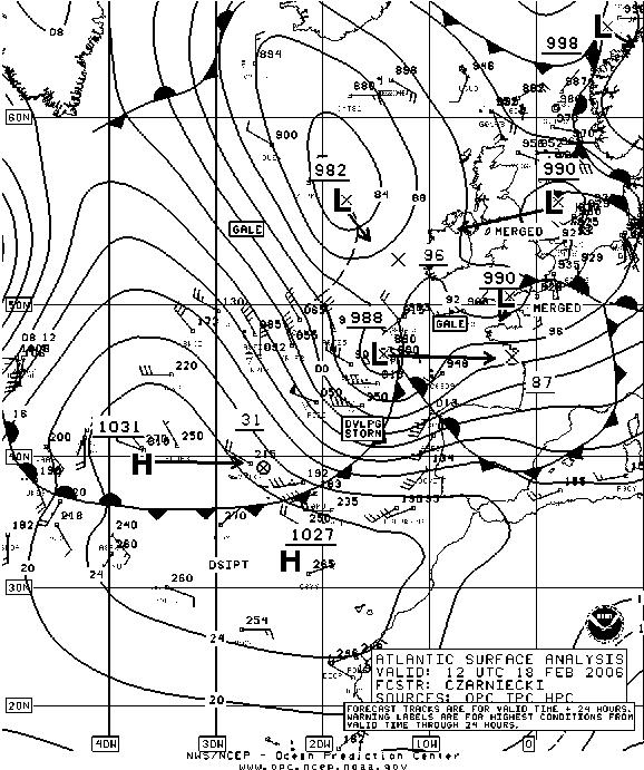
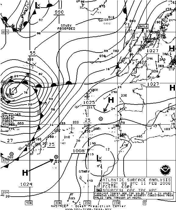 Around
the 11th of February, 2006 a severe storm was developing in the eastern
North Atlantic. The 0600Z NOAA surface analysis shows this developing
hurricane force storm. The storm was slowly moving to the NE and
deepening. This would not bring severe weather to the coast or Portugal and
Cascais, but it would bring very large seas. At the time of this chart we
were enjoying warm and calm conditions in the Cascais Marina. I used these
days to check sails and do other chores on Sarah that were made easy by the
pleasant weather. Around
the 11th of February, 2006 a severe storm was developing in the eastern
North Atlantic. The 0600Z NOAA surface analysis shows this developing
hurricane force storm. The storm was slowly moving to the NE and
deepening. This would not bring severe weather to the coast or Portugal and
Cascais, but it would bring very large seas. At the time of this chart we
were enjoying warm and calm conditions in the Cascais Marina. I used these
days to check sails and do other chores on Sarah that were made easy by the
pleasant weather. |
 A
few days later I went to the Nauticampo Expo at the
Parque da Nacoes on the east side of Lisbon with Chris & Dora of Morild
(my marina neighbors) and Martin (who was visiting from Sines). The
Nauticampo is a boat and camping show at the large convention center in the
Parque da Nacoes. At the show Dora got us an invite for a test sail of a
Catana 43 catamaran that was berthed in Cascais. A
few days later I went to the Nauticampo Expo at the
Parque da Nacoes on the east side of Lisbon with Chris & Dora of Morild
(my marina neighbors) and Martin (who was visiting from Sines). The
Nauticampo is a boat and camping show at the large convention center in the
Parque da Nacoes. At the show Dora got us an invite for a test sail of a
Catana 43 catamaran that was berthed in Cascais. |
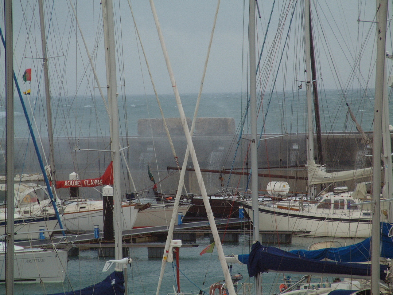
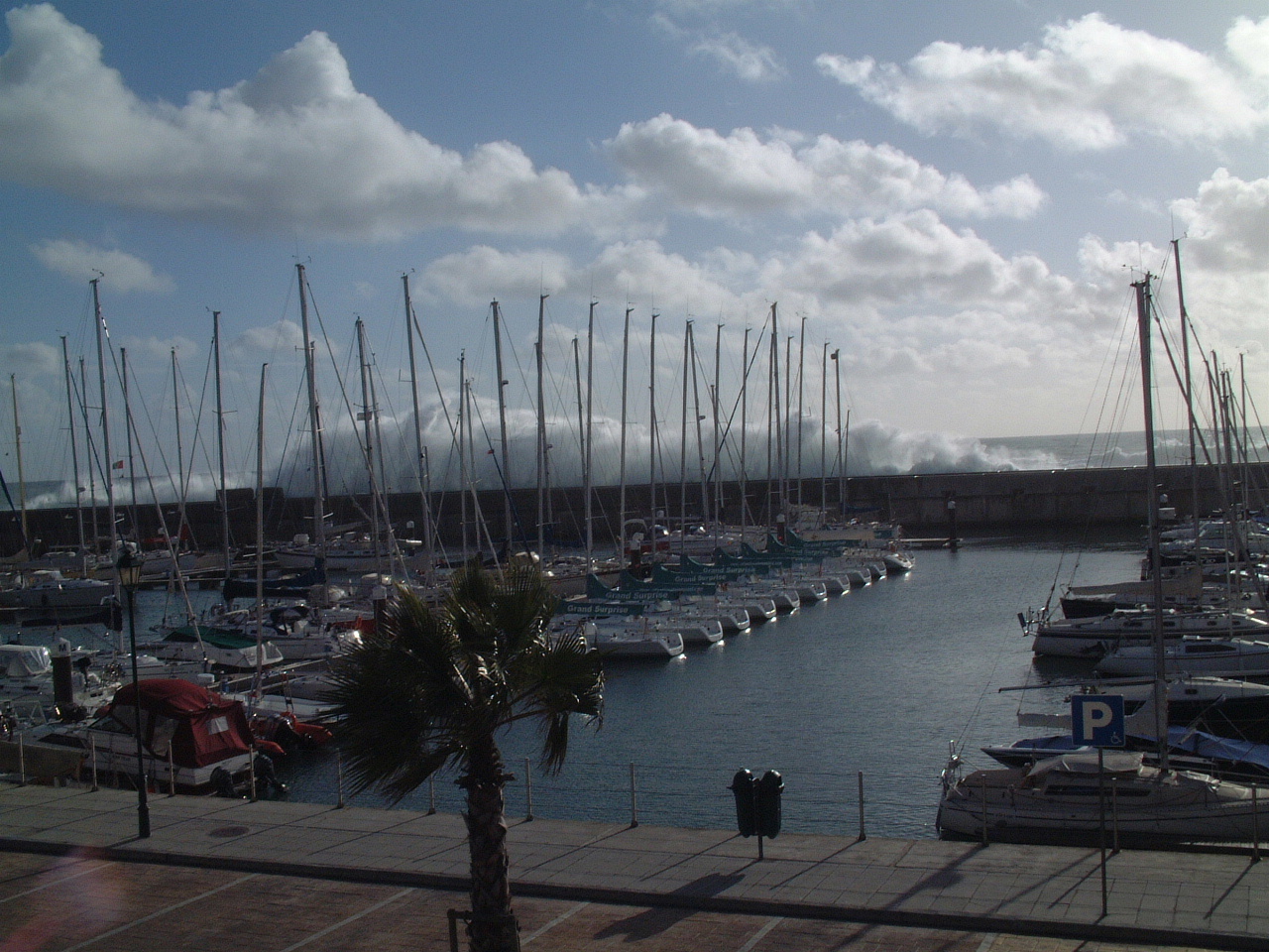
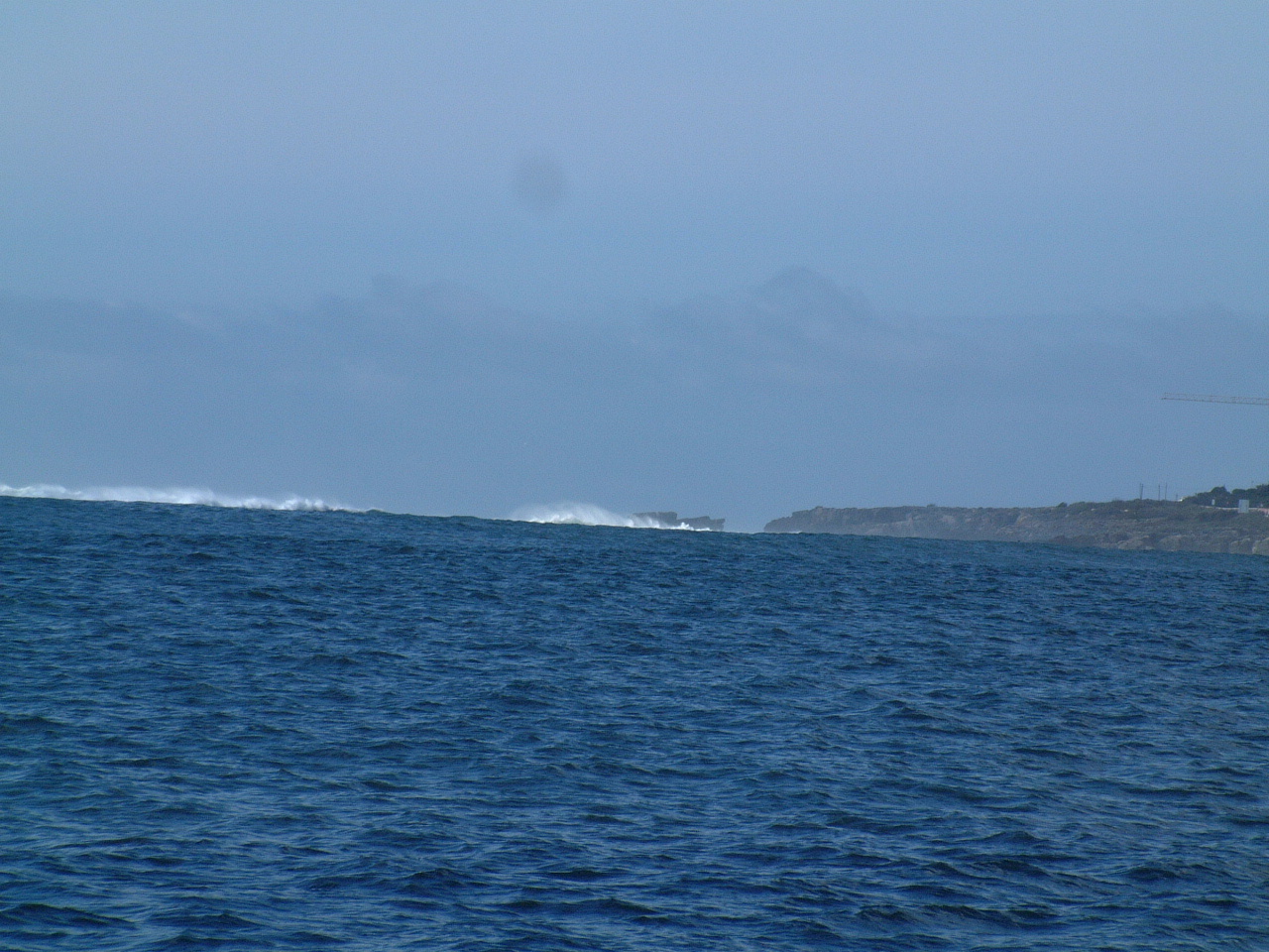 During
that test sail we could see the developing seas in the mouth of the Rio
Tejo. The picture on the left shows the breaking seas just outside off
Cascais. It is a little difficult to see in the thumbnail image on this
page, but if you click on the picture you can view it at full 1280 x 1280
resolution. During
that test sail we could see the developing seas in the mouth of the Rio
Tejo. The picture on the left shows the breaking seas just outside off
Cascais. It is a little difficult to see in the thumbnail image on this
page, but if you click on the picture you can view it at full 1280 x 1280
resolution. |
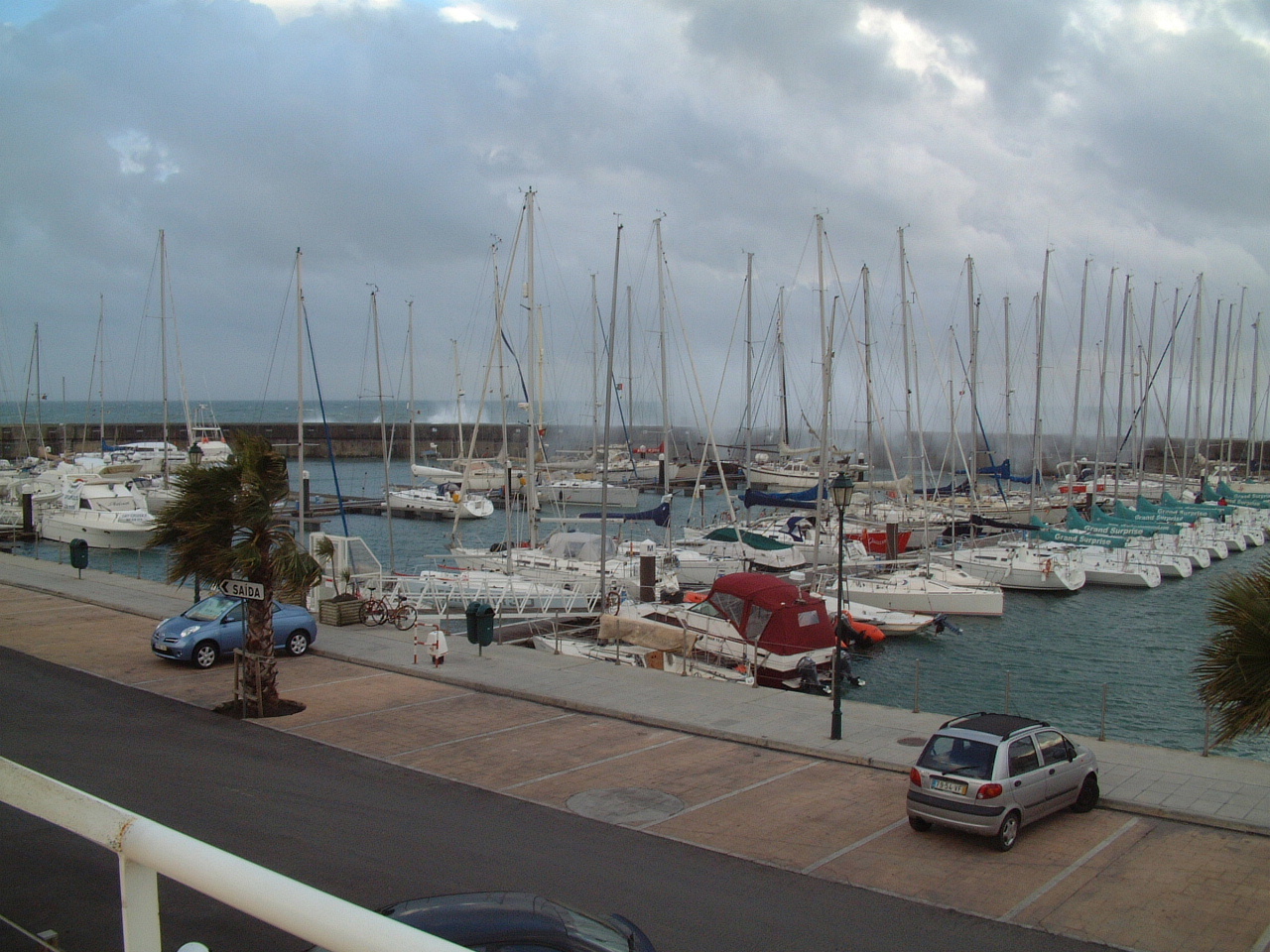
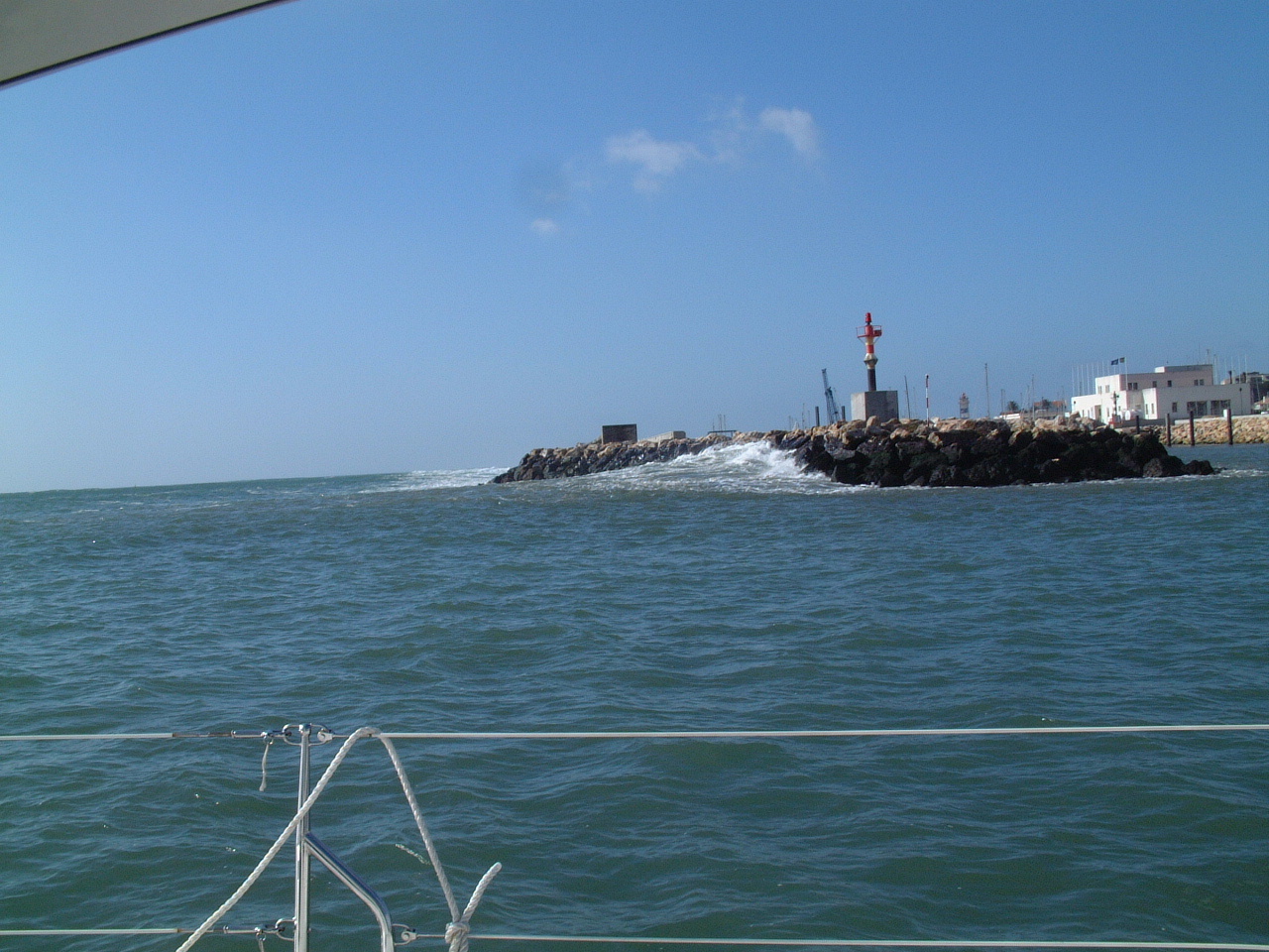 The
picture on the right shows the swell engulfing the new extension to the
breakwater at the entrance to the Cascais Marina. This extension was
completed over the winter to provide better protection for the Marina's
mega-yacht (length > 40 meters) pontoon. The
picture on the right shows the swell engulfing the new extension to the
breakwater at the entrance to the Cascais Marina. This extension was
completed over the winter to provide better protection for the Marina's
mega-yacht (length > 40 meters) pontoon. |
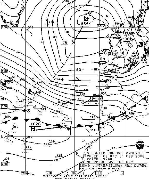 By
the February 17 the storm center was heading into the Norwegian Sea and had
deepened from 972 to 966 MB. The storm continued to bring strong (Force
7-8) winds to the coast of France and Iberia. The forecast was for
continued strong winds and building seas in the Cascais area as the trough
line moved into our area. By
the February 17 the storm center was heading into the Norwegian Sea and had
deepened from 972 to 966 MB. The storm continued to bring strong (Force
7-8) winds to the coast of France and Iberia. The forecast was for
continued strong winds and building seas in the Cascais area as the trough
line moved into our area. |
|
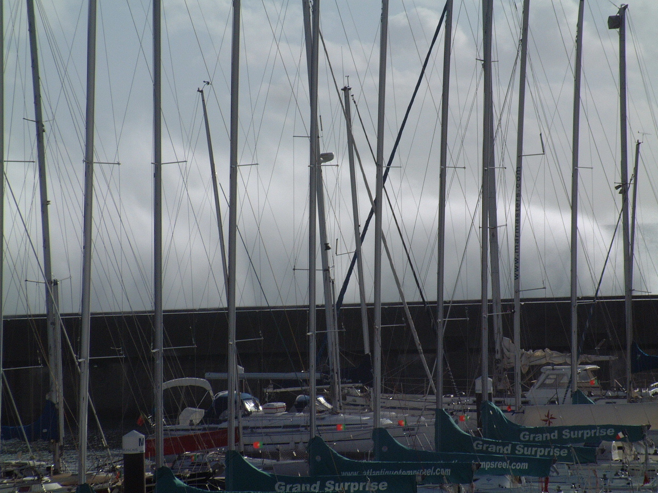
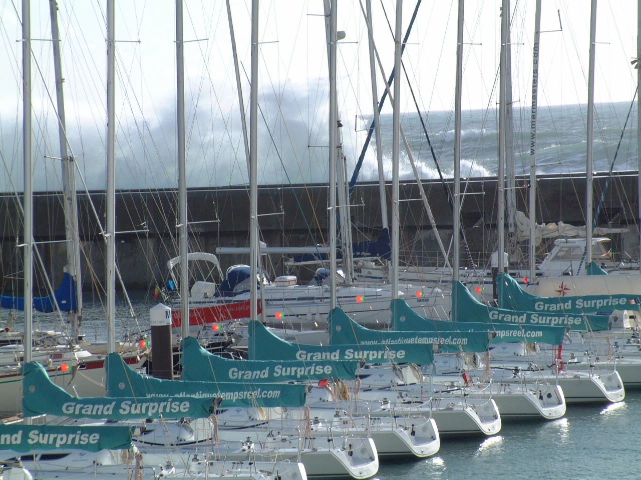
| By this time the seas were more than 4 meters
in height and breaking on the shoal just west of the marina breakwater.
However the seas had so much energy that they carried all the way to the
breakwater and then sent a wall of spray 5 - 10 meters above the top of the
breakwater. The pictures on the right were taken on Feb 17, 2006 at high
tide. Click on any of the pictures to view them at the full 1280 x 1280 resolution. |
 |
 |
|
 |
|
 |
|
 |
|
 |
|
 By
February 18 a secondary low had developed west of the Bay of Biscay and was
heading for the French coast pulling a frontal system along with it. The
strong pressure gradient around this low re-inforced the strong on-shore
winds we had been experiencing in Cascais. It also maintained the long
fetch that had allowed the seas to continue to grow for nearly a week.
By
February 18 a secondary low had developed west of the Bay of Biscay and was
heading for the French coast pulling a frontal system along with it. The
strong pressure gradient around this low re-inforced the strong on-shore
winds we had been experiencing in Cascais. It also maintained the long
fetch that had allowed the seas to continue to grow for nearly a week.