Sailing Topics
| Cruising the Abacos |
 I
had planned to sail Sarah as far down the Bahamas chain of islands
as possible before departing the Bahamas in early April. I
had planned to sail Sarah as far down the Bahamas chain of islands
as possible before departing the Bahamas in early April.Shortly before I planned to leave Marsh Harbor and head south my generator failed. I stayed at anchor in Marsh Harbor for over a month before finally getting the generator back in operation as described in the Genset Saga web page. Because I don't have any passive electrical generators (wind or solar) the generator is fairly important to me, which is the reason I stayed in Marsh Harbor until it was fixed. Although Marsh Harbor is not the prettiest harbor in the Bahamas, it is definitely not an unpleasant place to spend time. |
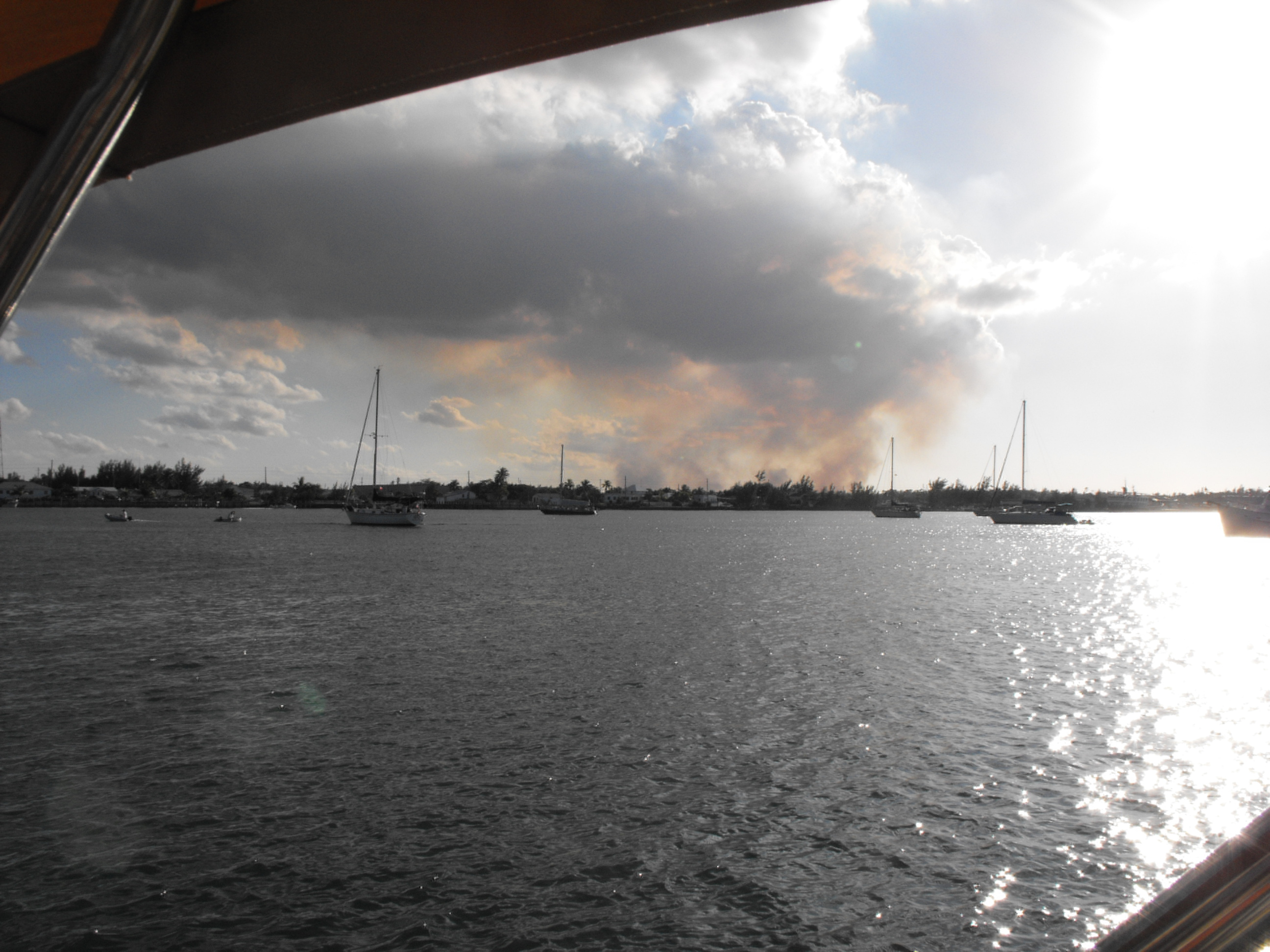 While
in Marsh Harbor there were several fires inland on Abaco Island.
Since the Bahamas have a very arid climate these brush fires are a
constant problem on the larger islands. I do not know if the
fires I saw where accidentally or intentional set. I expect
the Abaco fire department does set some of these fires to remove
much of the fuel for a more serious wild fire. While
in Marsh Harbor there were several fires inland on Abaco Island.
Since the Bahamas have a very arid climate these brush fires are a
constant problem on the larger islands. I do not know if the
fires I saw where accidentally or intentional set. I expect
the Abaco fire department does set some of these fires to remove
much of the fuel for a more serious wild fire.Finally after generator saga was over I decided to stay put in the Abacos for the rest of the winter rather than head south for the Exumas. Looking at the charts and reading the guides it was apparent to me that, single-handing, it would take me the better part of a month to get to George Town in the southern Exumas. That meant I would have to start my departure from the Bahamas within a week or two of arriving in the George Town. George Town was never a destination for me, but just a protected harbor from which I could wait for weather windows that would allow me to explore the more remote islands of the Bahamas. |
 I had no interest in going to George Town and just sit at anchor for
a few weeks and then depart. I could do that in Marsh Harbor.
I also had a few friends who were interested in joining me for a
short visit and next to Nassau and Freeport, Marsh Harbor is the
easiest city to travel to from the states.
I had no interest in going to George Town and just sit at anchor for
a few weeks and then depart. I could do that in Marsh Harbor.
I also had a few friends who were interested in joining me for a
short visit and next to Nassau and Freeport, Marsh Harbor is the
easiest city to travel to from the states.In the last week of February, Steve rejoined my on Sarah in Marsh Harbor. Steve had helped me get Sarah to Florida via the ICW the previous fall, but motoring down the ICW was never Steve's intention when he signed on to crew. Weather and time constraints caused us to do most of the trip on the ICW and forced Steve to depart before we reached the Bahamas. So I was glad Steve was able to take a week off and join me in the Abacos. His arrival also forced me to finally pull up the anchor and actually take Sarah sailing. |
| Hope Town, Elbow Cay |
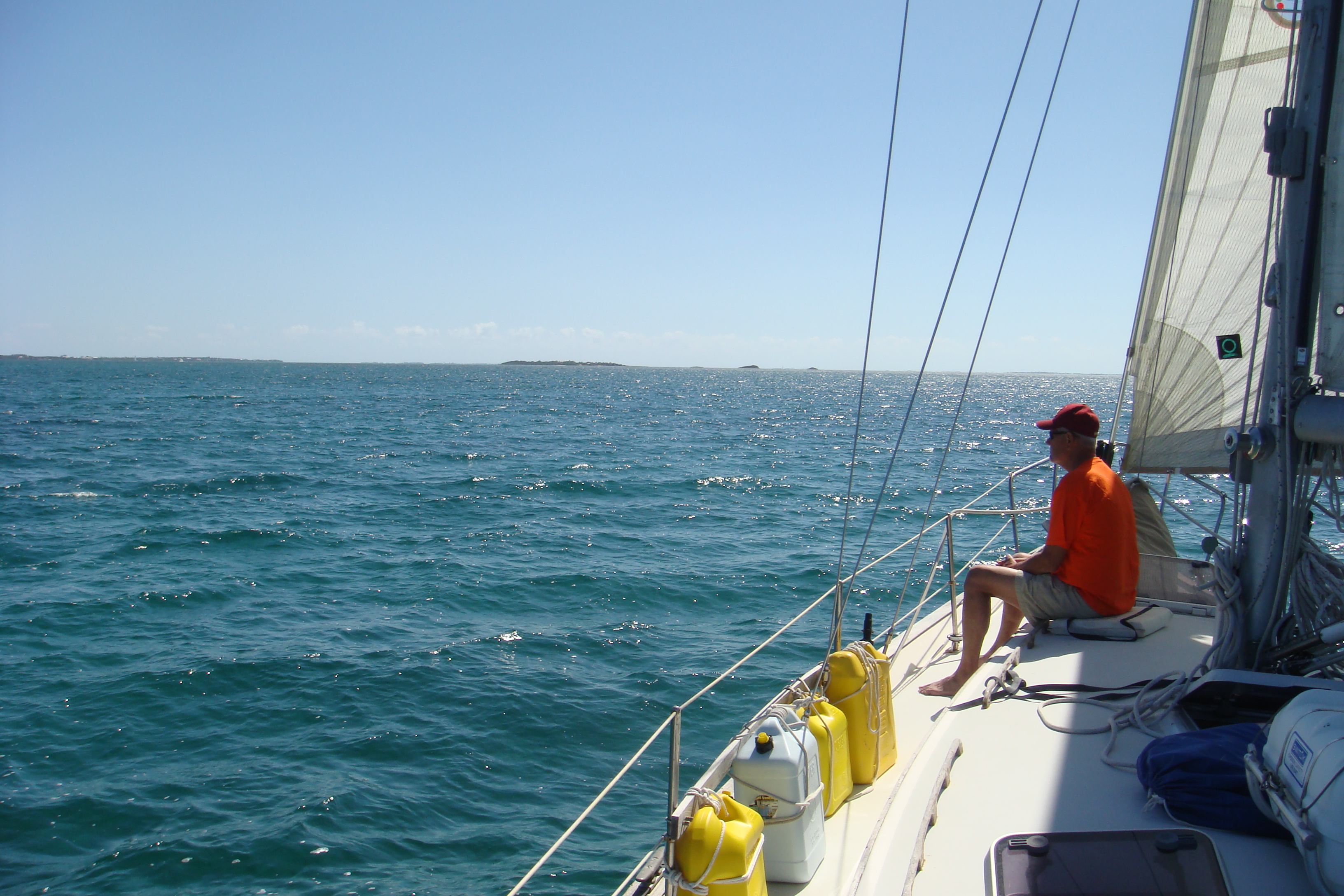
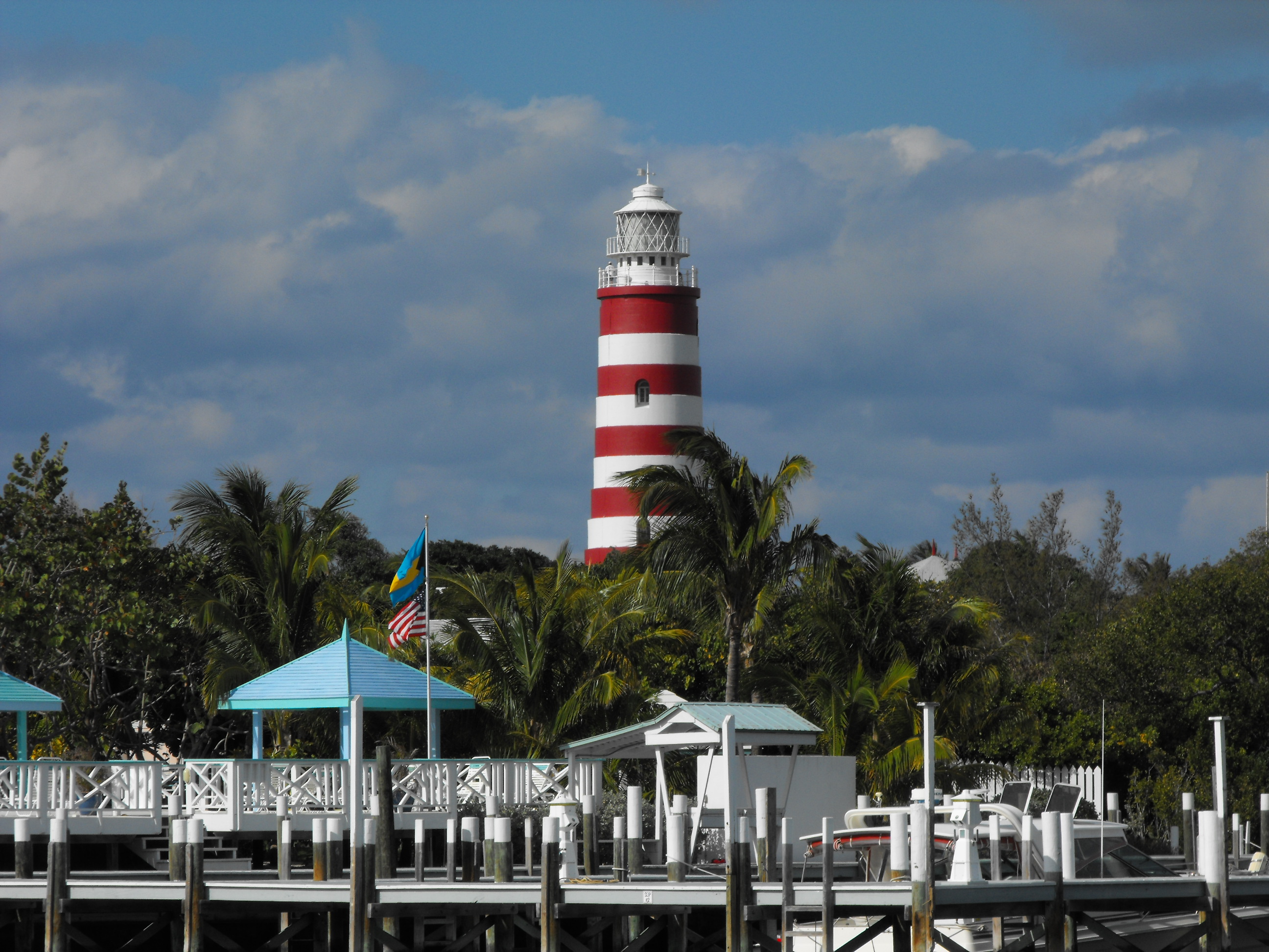 The
first day the wind was blowing a gentle 10-12 kts and we spent most
the afternoon on a day-sail up to Guana Cay and back down to
Hopetown on Elbow Cay. We took a mooring in Hopetown with a
nice view of the famous candy-striped lighthouse. The
first day the wind was blowing a gentle 10-12 kts and we spent most
the afternoon on a day-sail up to Guana Cay and back down to
Hopetown on Elbow Cay. We took a mooring in Hopetown with a
nice view of the famous candy-striped lighthouse. |
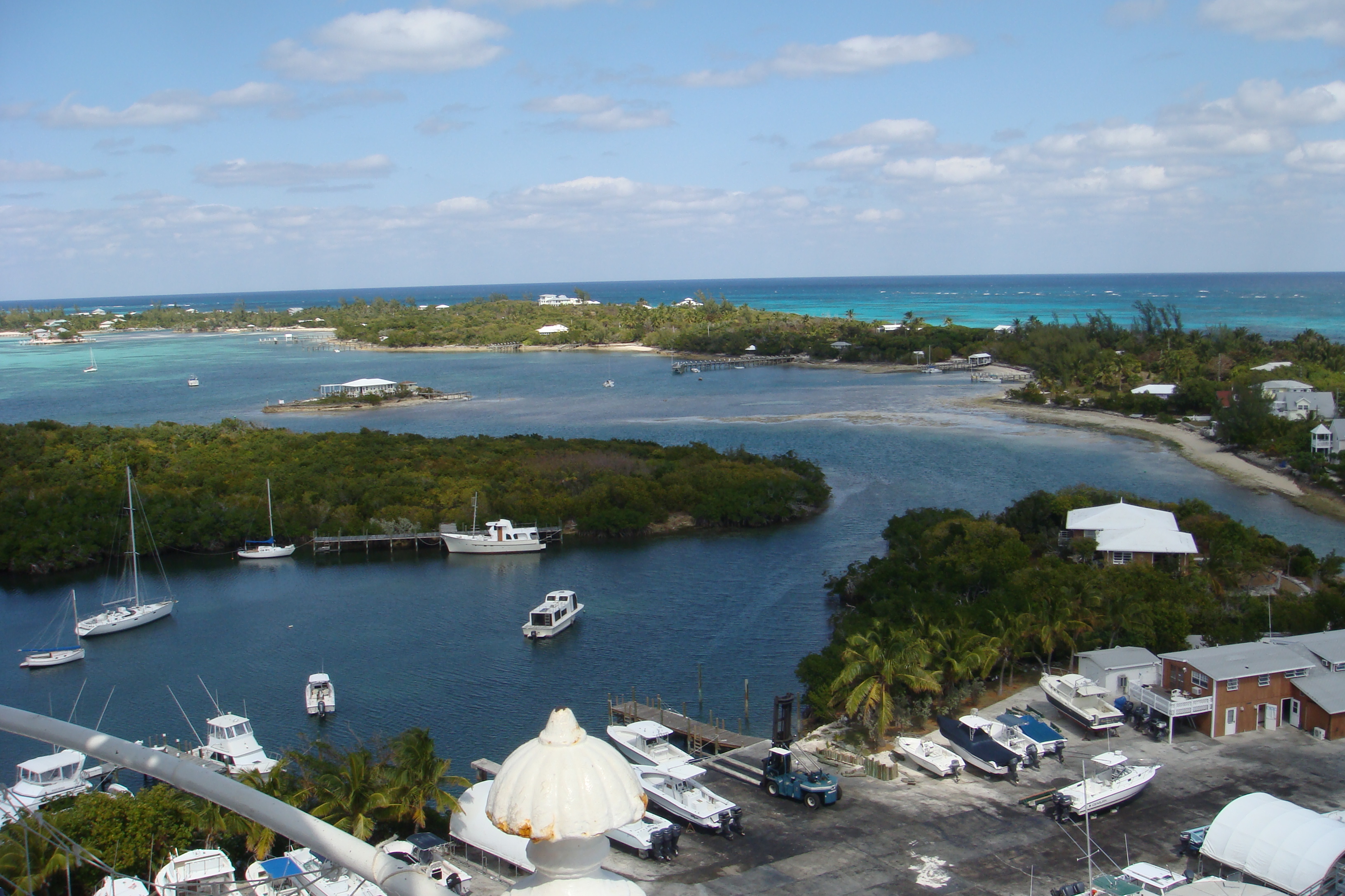
 The
next day we climbed to the top of the lighthouse and took a few
pictures of Hopetown and the harbor. The
next day we climbed to the top of the lighthouse and took a few
pictures of Hopetown and the harbor.Sarah is in the center of the picture on the left. |
 This
is the very narrow and shallow approach and entrance to the harbor. This
is the very narrow and shallow approach and entrance to the harbor. |
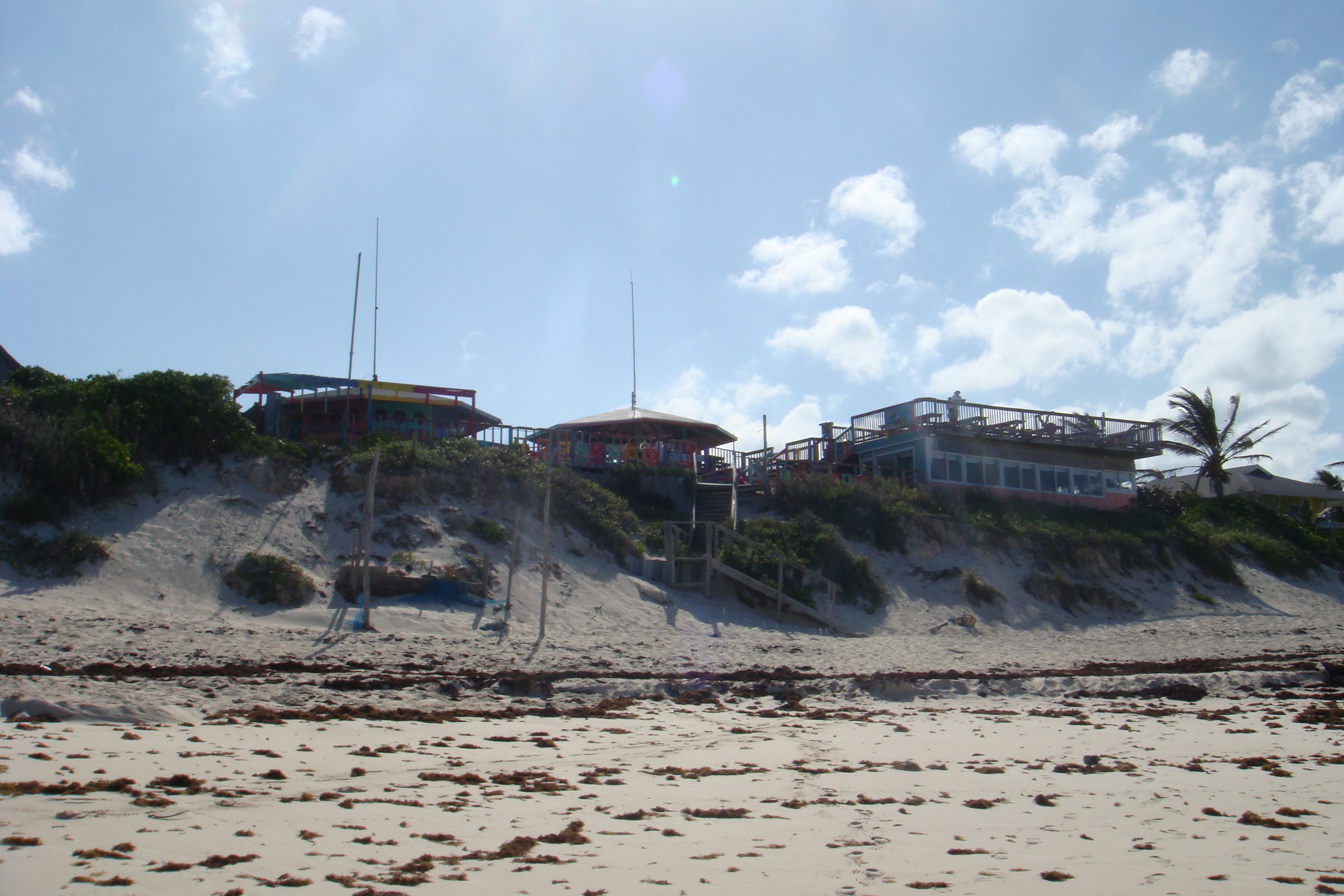
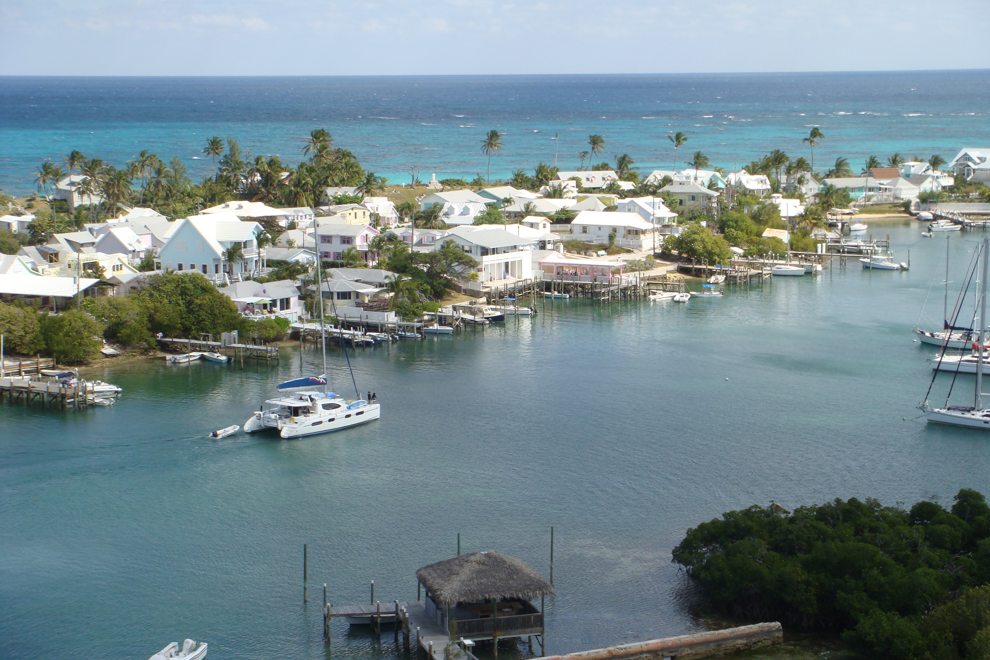 Hopetown
is definitely set up to capture as many tourist dollars as possible,
but it is also a very pleasant place to visit. Hopetown
is definitely set up to capture as many tourist dollars as possible,
but it is also a very pleasant place to visit. |
| Fishers Bay, Great Guana Cay |
 After
two nights in Hopetown we enjoyed a brief sail back up to Guana Cay
where we anchored in Fishers Bay. After
two nights in Hopetown we enjoyed a brief sail back up to Guana Cay
where we anchored in Fishers Bay.It was on this sail in 15-20kts of wind that I decided to put a reef in Sarah's mainsail. That action began the saga of the Strong Track Problem. |
 After
a night anchored in Fisher's Bay we took the dinghy into the harbor
on Guana Cay. After
a night anchored in Fisher's Bay we took the dinghy into the harbor
on Guana Cay. |
 Of
course we stopped for a beer at the (in)famous Nipper's Bar, Of
course we stopped for a beer at the (in)famous Nipper's Bar, |
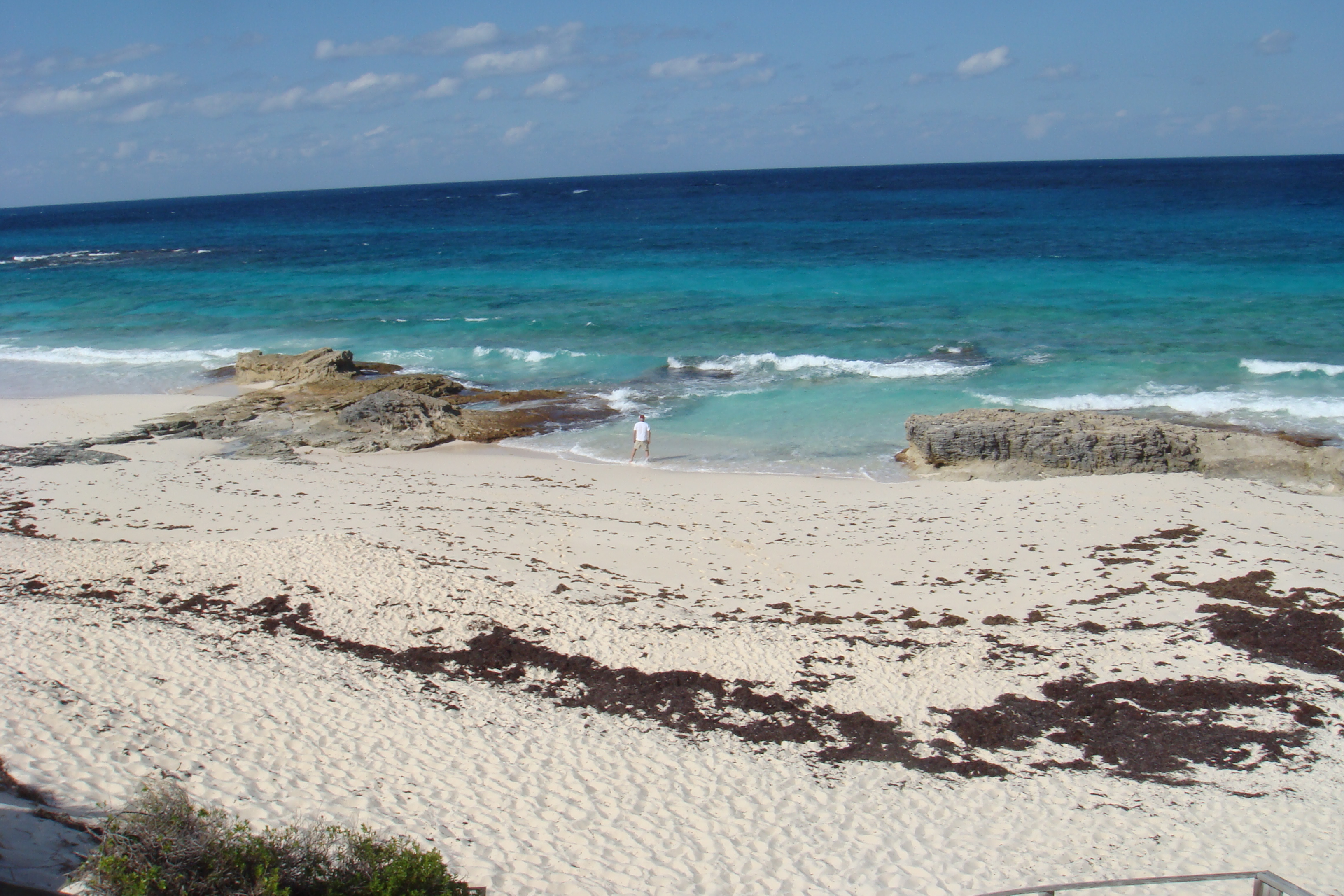 and
strolled on the Guana Cay beach. and
strolled on the Guana Cay beach. |
| Matt Lowes Cay |
 After
two nights anchored in Fisher's Bay we had another short sail back
toward Marsh Harbor. A front was expected to cross the Sea of
Abaco within 48 hours and I wanted to have Sarah securely at anchor
in Marsh Harbor well before the front arrived. After
two nights anchored in Fisher's Bay we had another short sail back
toward Marsh Harbor. A front was expected to cross the Sea of
Abaco within 48 hours and I wanted to have Sarah securely at anchor
in Marsh Harbor well before the front arrived.So we anchored Sarah in the small bay just west of Matt Lowes Cay, just outside of Marsh Harbor. |
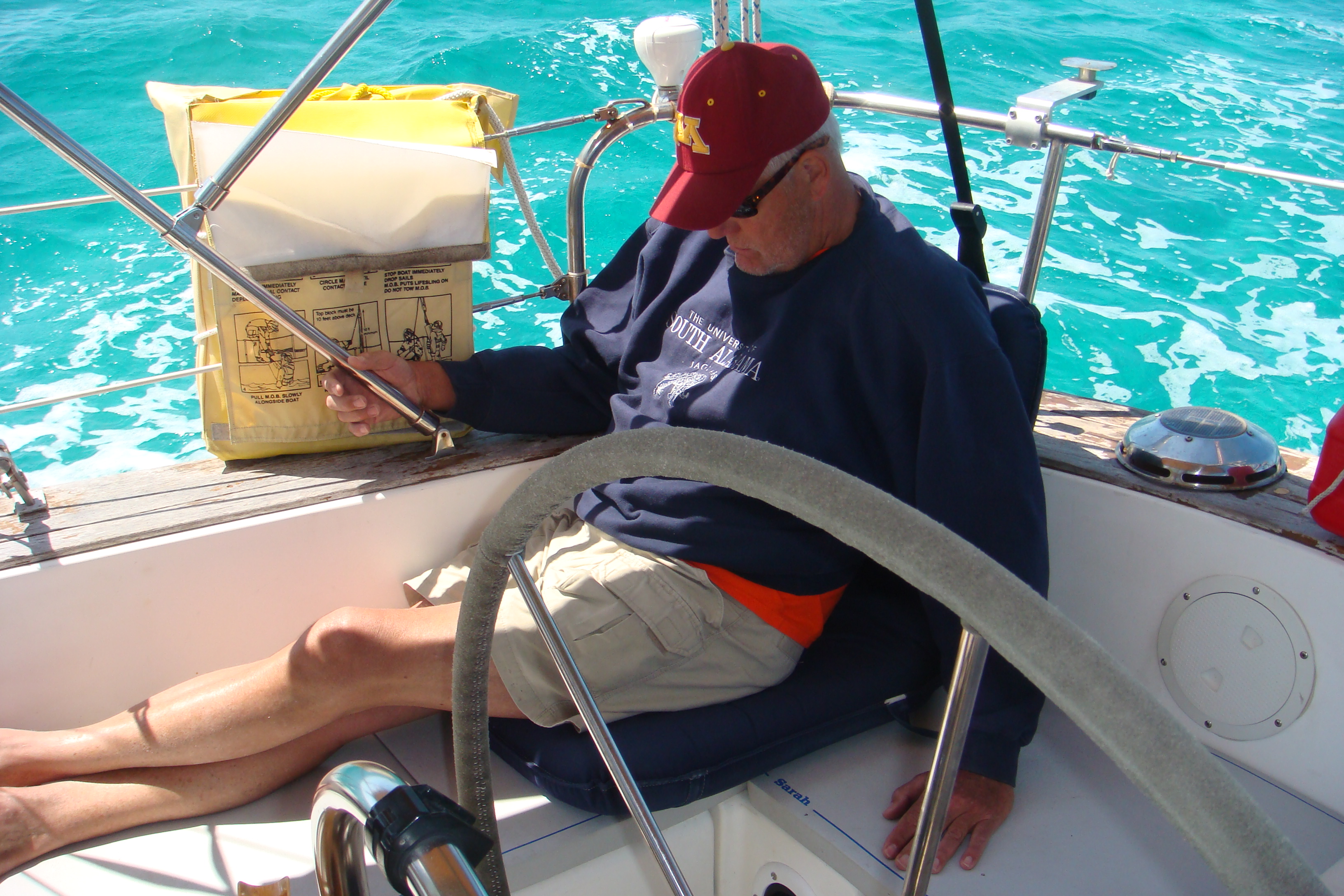 As
you can see, Steve was having great difficulty relaxing on this
trip. As
you can see, Steve was having great difficulty relaxing on this
trip.The next day we had a pleasant day sail in very light winds and eventually anchored Sarah back in Marsh Harbor. The front came through the following evening with a fair amount of rain and winds over 25 kts. Everything was clear the next day when Steve departed for the states and I started to work on the Strong Track Problem. |
| Returning to the USA |
| After nearly 4 months in the Abacos, most of which in Marsh
Harbor, it was time to leave and return to the states. My four
month Visa expired in the last week of April, and I had planned to
start working my way out of the Bahamas around April 1. However the continuing series of cold fronts reaching well down into the Bahamas delayed my departure. The high winds not only created rough seas in the Florida Strait, but also in the Whale Passage through which I planned to pass on my way out of the Abacos. Finally, around the middle of April the normal Spring/Summer weather pattern started to appear. Now the cold fronts were stopping in the SE US and then moving off to the NE. Easterly trade winds set in over the Northern Bahamas. These winds brought fair weather, but again very rough seas in the Whale Passage and the Florida Strait. Also, by this time, I could no longer expect to be able to depart Bahamian waters before my Visa expired. Although that probably would not be a big deal, so long as I remained at anchor, but it's not worth the risk of being caught. 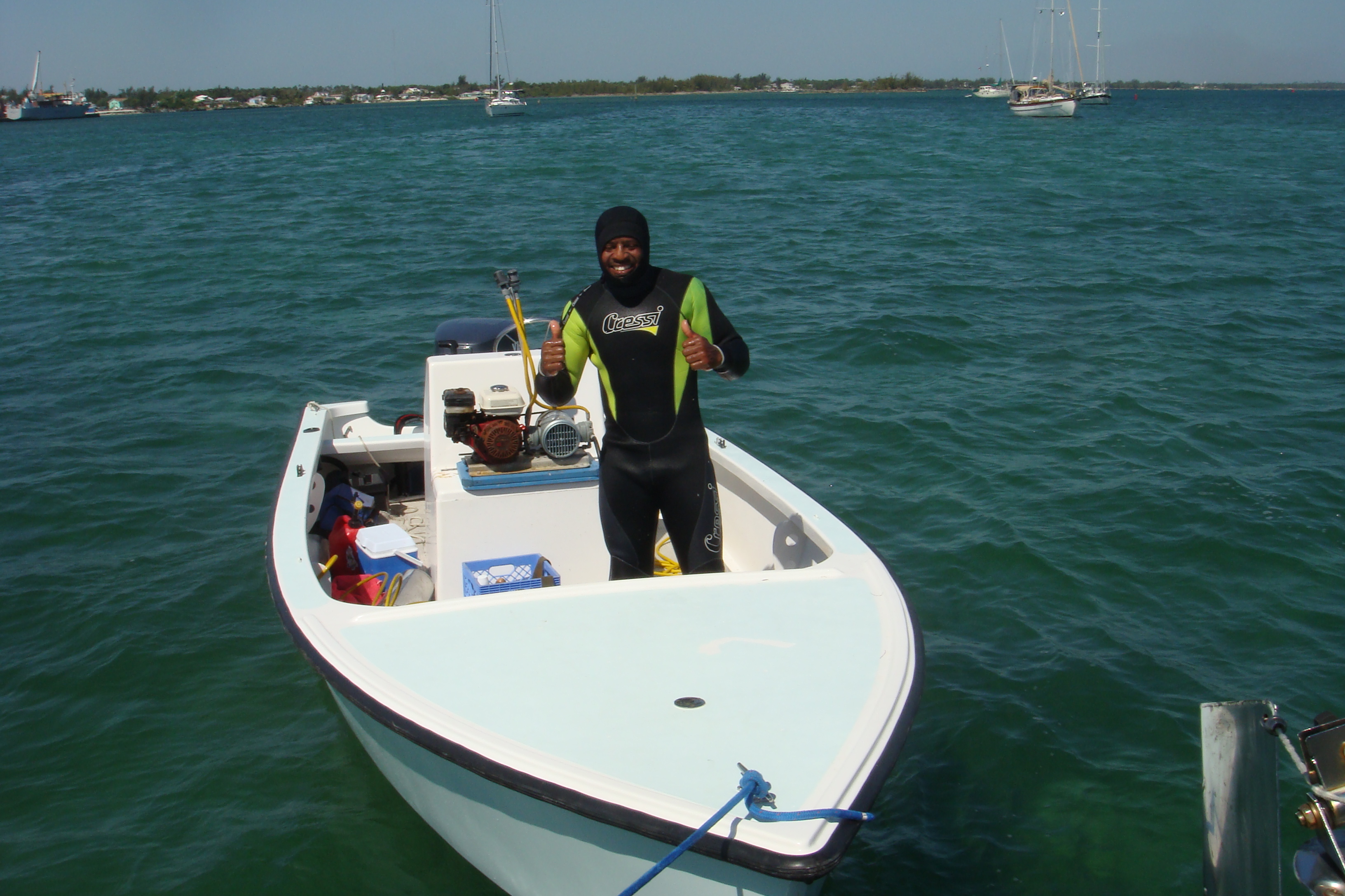 So
I needed to get my Visa extended by a month. Unfortunately
this meant I couldn't leave Marsh Harbor until the Visa extension
was approved and I couldn't get the Visa extension until the last
working day before the expiration date. So I sat at anchor in
Marsh Harbor for an extra week, watching great departure weather,
until it was time for my Visa extension. That happened with no
trouble, I just had to visit the Immigration office in the Port of
Marsh Harbor. So
I needed to get my Visa extended by a month. Unfortunately
this meant I couldn't leave Marsh Harbor until the Visa extension
was approved and I couldn't get the Visa extension until the last
working day before the expiration date. So I sat at anchor in
Marsh Harbor for an extra week, watching great departure weather,
until it was time for my Visa extension. That happened with no
trouble, I just had to visit the Immigration office in the Port of
Marsh Harbor.The Day after my Visa extension was approved I hired Brown Tip, a local diver and blues singer (picture on right) to clean Sarah's bottom and scrape the propeller. Now all was ready, including the weather, for my departure. |
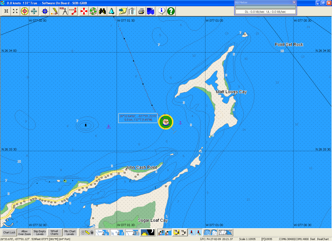
 On
May 1 I pulled up Sarah's anchor for the first time in over a month,
topped off the fuel tank, and then departed Marsh Harbor for the
final time in 2009. The winds were very light, so I had no
expectations of a sail, and decided to motor as far as I could that
day. On
May 1 I pulled up Sarah's anchor for the first time in over a month,
topped off the fuel tank, and then departed Marsh Harbor for the
final time in 2009. The winds were very light, so I had no
expectations of a sail, and decided to motor as far as I could that
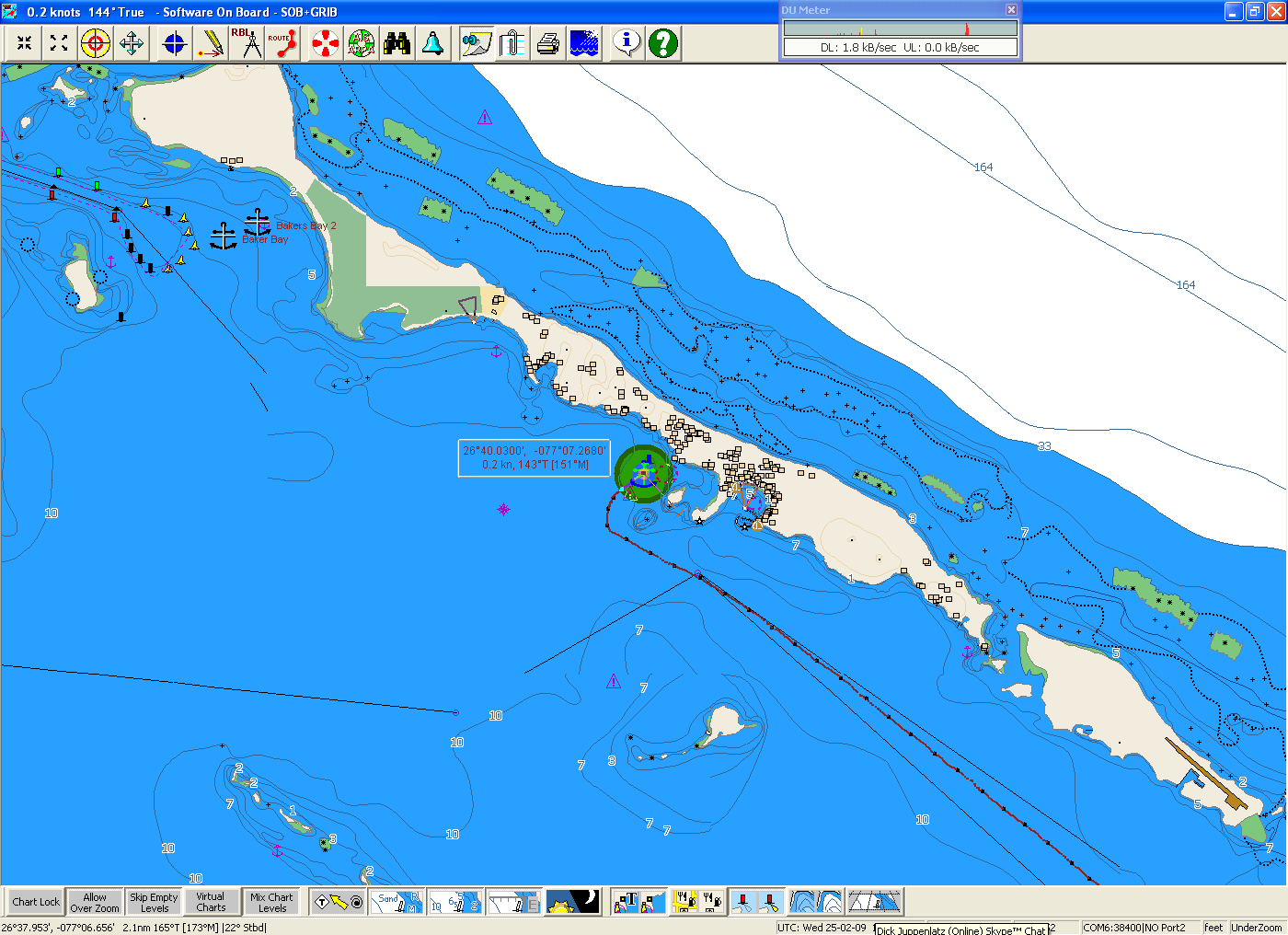
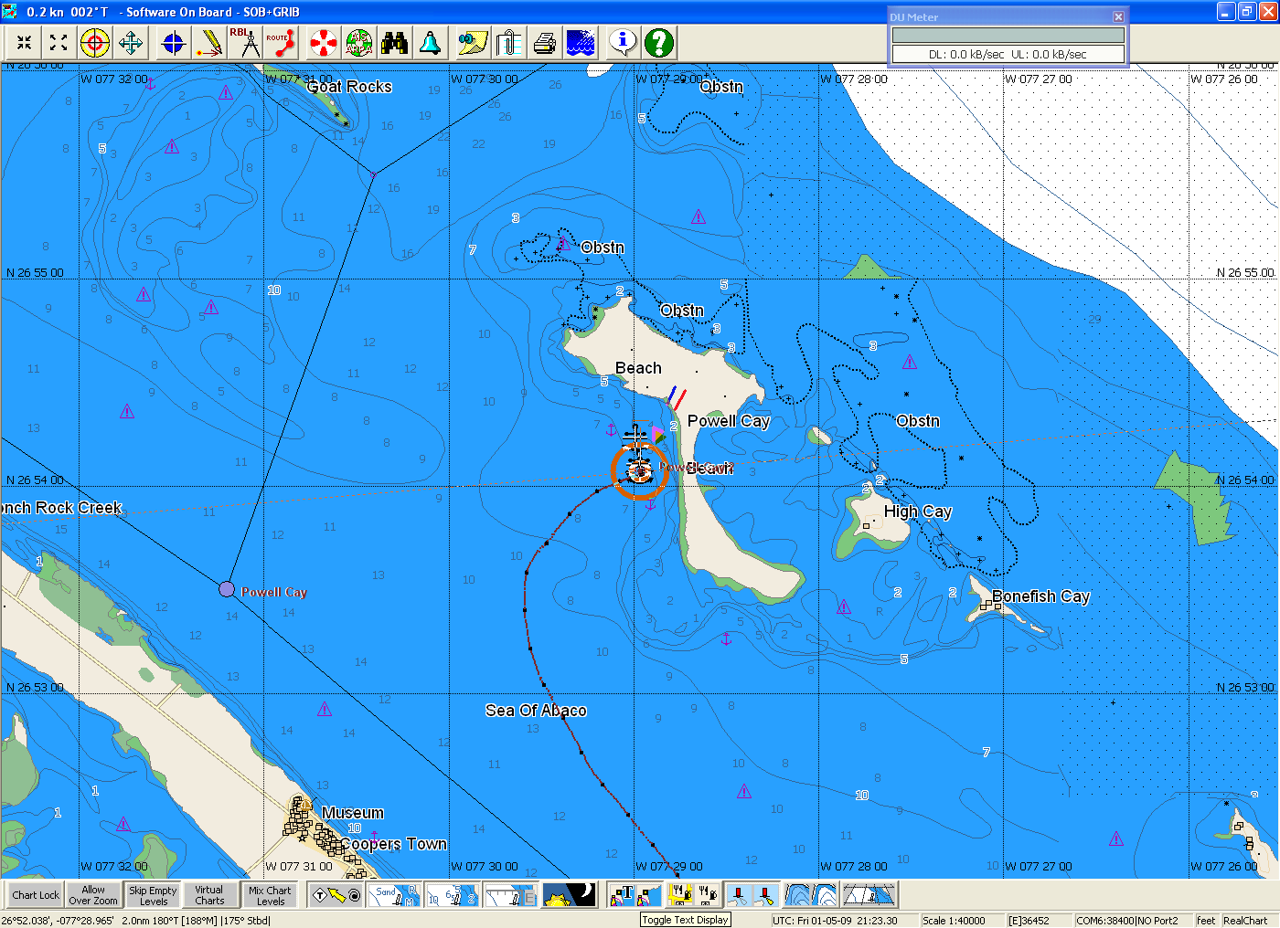
day.By noon I was through the Whale. I had thought to stop at Green Turtle Cay, as several other cruisers I'd met over the winter were there. When I was off Green Turtle I could see dozens of boats anchored off the island. I guessed if there were that many boats anchored in the Sea of Abaco, the anchorages in the sounds would be even more crowded. I learned later that was not the case, but it was still only 13:00 and I really didn't want to stop that early. So I kept motoring until about 15:00 and then dropped anchor once more off Powell Cay (screen capture on left) |
 The
day after I anchored in Powell Cay, I moved Sarah to a berth at the
marina in Spanish Cay. This is where I checked into the
Bahamas back in December. The
day after I anchored in Powell Cay, I moved Sarah to a berth at the
marina in Spanish Cay. This is where I checked into the
Bahamas back in December.I stayed two nights at the marina, using shore power to run the frig and the battery charger to keep the batteries up. I also used this time for several small maintenance tasks, including tightening the belt on the engine-driven refrigeration compressor. On May 4 I departed Spanish Cay for Great Sale Cay on the Little Bahama Bank. Once again, little or no wind and I motored the 45 nm to Great Sale. From Great Sale Cay I was 150nm from Port Canaveral, FL my intended Port of Entry back into the states. |
 I
tried to get as much sleep as possible that night, knowing I would
be pulling an all-nighter on the trip from Great Sale Cay to Port
Canaveral. I wanted to sleep until well after nine in the
morning, but by eight it was clear I wasn't going to get any more
sleep. I
tried to get as much sleep as possible that night, knowing I would
be pulling an all-nighter on the trip from Great Sale Cay to Port
Canaveral. I wanted to sleep until well after nine in the
morning, but by eight it was clear I wasn't going to get any more
sleep.Around 11:30 I pulled up the anchor and started motoring across the Little Bahama Bank toward the Mantanilla Shoal, where I would depart the Bank and The Bahamas. I moved off the Little Bahama Bank into the Florida Strait around 19:30 that evening. |
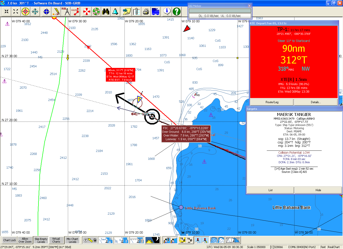 Almost
immediately I encountered shipping as shown in the screen capture on
the right. There were three vessels crossing my course in the
first 10 nm into the strait. Almost
immediately I encountered shipping as shown in the screen capture on
the right. There were three vessels crossing my course in the
first 10 nm into the strait.You may notice that Sarah's heading (arrow) shown in the screen captures above and on the right is well south of the route (red line) that is displayed on the chart. Once again I would be crossing the Gulf Stream and I needed to adjust my course for the strong current that would push me to the north. In this case the current will be pushing me toward my destination, rather than away from it. I once again used an average current of 2 kts to the north for the period I would be in the Gulf Stream. I super-imposed my route on Jenifer Clark's Gulf Stream Analysis to determine the total distance I would travel while in the stream was about 60 nm, or about 10 hours at 6 kts. |
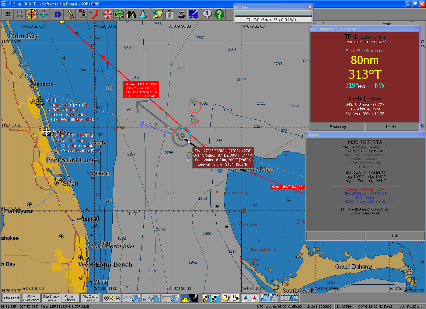 From
that I calculated that the Gulf Stream would push Sarah to north
about 20 nm miles on this passage. Therefore rather than set
Sarah's course to that of the planned route I set it to a point 20nm
south of the intersection of the route and the western wall of the
Gulf Stream. That point shows up on the screen capture on the
left as a small red dot labeled, "GS Wall". That is the point
toward which I set Sarah's heading once I was off the Little Bahama
Bank, and the current pushed Sarah to the north such that when we
reached the western wall we on the course planned route. From
that I calculated that the Gulf Stream would push Sarah to north
about 20 nm miles on this passage. Therefore rather than set
Sarah's course to that of the planned route I set it to a point 20nm
south of the intersection of the route and the western wall of the
Gulf Stream. That point shows up on the screen capture on the
left as a small red dot labeled, "GS Wall". That is the point
toward which I set Sarah's heading once I was off the Little Bahama
Bank, and the current pushed Sarah to the north such that when we
reached the western wall we on the course planned route. By the time of this screen capture (showing another crossing vessel) Sarah was already in the Gulf Stream and the heading (thin blue arrow) is already pointed north of the GS Wall waypoint. |
| Below are some graphs I created using PastTracks data generated
by the SOB chart plotting software on my navigation PC and
my PastTracks Excel Add-In application.
You can slightly enlarge each of these graphs by double clicking on
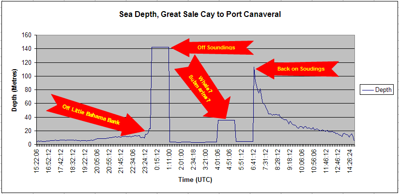
them. The first graph is of the sea depth recorded by my depth sounder on the passage. The graph clearly shows when Sarah moved off the Little Bahama Bank into the Florida Strait, and then when the sea depth exceeded the range of my depth sounder. On the right side of the graph the point where the sea floor was once again within the range of my depth sounder. Between these two points is a period when the depth sounder recorded a depth of around 35 Meters. This was likely just some turbulence below the boat or some other false return. Of course it could have been a whale or a submarine or a school of Tuna. I'll never know. |
 |
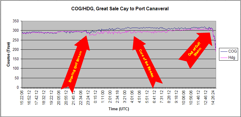
| The next graph is a plot of Course over Ground (COG - blue line) from the GPS and the boat's Heading (Hdg - magenta line) from the Autopilot. While on the Little Bahama Bank and then on approach to Port Canaveral the COG and Hdg were very nearly identical. During the Gulf Stream crossing the COG was 10 - 15 degrees more northerly than the Hdg. |
 |
| The last graph shows Speed Over Ground (SOG - blue line) from
the GPS and Boat Speed (Spd - magenta line) from the knot meter.
During the Gulf Stream crossing the SOG was several knots faster
than the knot meter. When I first departed Great Sale Cay, the
knot meter was out of calibration and showing a knot higher than the
SOG from the GPS. I recalibrated the knot meter while on the
Little Bahama Bank so I could measure the additional speed provided
by the Gulf Stream. This graph also shows that I encountered a counter current of about 1/2 kt for the last half of the trip on the Little Bahama Bank. |
 |
By dawn the next morning I was approaching Port Canaveral. I
entered the marked off-shore channel around 8:30 AM and called the
Customs & Border Patrol office to check-in with Homeland Security.
As expected they recorded all of the information, but told me I must
report in person to their office in the Port so that my paper work
can be validated. If I'd used the Local Boater Option (LBO) before
departing that visit would not be necessary. The LBO applies to
entry in only a few ports in fewer states and when I left Solomons, MD for The
Bahamas last fall I really didn't intend to re-entry the USA in Florida, so I decided not to bother. I was advised during my check in that no food,
fresh or frozen could be brought into Florida from the Bahamas.
I sort of expected something like that and dumped all fresh vegetables, fruit and
dairy products at sea before entering the Port. I also had a
leg of lamb, port tenderloins and a sealed package of Bacon in my
freezer. I really didn't want to dump those fairly expensive
meats into the sea, especially since they were still in their
original vacuum-sealed packaging. These meats were likely shipped
to the Bahamas from Florida in the first place. So I held onto
those items. I was advised during my check in that no food,
fresh or frozen could be brought into Florida from the Bahamas.
I sort of expected something like that and dumped all fresh vegetables, fruit and
dairy products at sea before entering the Port. I also had a
leg of lamb, port tenderloins and a sealed package of Bacon in my
freezer. I really didn't want to dump those fairly expensive
meats into the sea, especially since they were still in their
original vacuum-sealed packaging. These meats were likely shipped
to the Bahamas from Florida in the first place. So I held onto
those items.When I tied to the dock at Cape Marina (screen capture on right), I was met by two agents from the C&BP agriculture section. They were very courteous, but insisted that those meats were not admissible and must be incinerated. I wasn't going to get into a pissing contest with Homeland Security over $40 of meat, so I turned the items over to the agents. On the positive side, my onboard garbage also was not admissible because it included the packaging for some of the items. So the agents took my garbage as well, relieving me of a trip to the dumpster. So not all bureaucratic rules are hateful - just 99.999% of them. In talking to several other cruisers who returned to the states from Bahamas in the same time frame as myself I discovered that no one had their on-board food supplies confiscated, including fresh vegetables and meats produced in the Bahamas. It appears I chose the wrong port of entry. It is also possible I just arrived on the wrong day. This might have be Training Day for the Port Canaveral CBP. If I was realy cynical I might believe the CBP was having a picnic that weekend and they needed a few more items for the grill. Actually I am more than a little cynical and I truly believe that is the most likely scenario. While berthed at the Cape Marina I observed another Space Shuttle launch, this one during daylight. Click HERE to view a short video of the launch. One good thing that happened during my stay in Port Canaveral is that I made contact with MarinePro in Cocoa, FL. They are the central Florida reps for both Yanmar and Northern Lights. They determined the final failure on my Genset Saga was indeed the brushes and used my set of brushes to put the generator back in operation. They are definitely the Go-To guys in central east coast of Florida. |
| Well, now I'm back in the states - where do I go from here. I have a vague plan to return to the Chesapeake Bay for a portion of the summer. I'm also thinking of wintering in North Carolina or parts south of there. Check back here in a few weeks and the plans may have solidified. Or maybe not. |