Sailing Topics
| Heading North in 2012 | |
| In June, 2012 after my
second winter at the Ortega Yacht Club Marina I was ready to
head North once again. My original plan for the summer
was a sail to Maine and then a return to Florida and the Bahamas
in the Fall via the Chesapeake Bay. That plan fell through
when the crew for the trip had to pull out and I could not find
a substitue. So it was back to the Chesapeake Bay for the
summer. Descriptions and pictures of the legs of the voyage north can be accessed by the links on the right. |
Oretega River to
Mouth of St. John St. John River to Charleston, SC Charleston, SC to Southport, NC Southport, NC to New River, NC New River NC to Beaufort, NC Beaufort, NC to Belhaven, NC Belhaven, NC to Pungo River Anchorage Pungo River Anchorage to Coinjock, NC Coinjock, NC to Willoughby Bay, VA Willoughby Bay, VA to Great Wicomico River, VA Great Wicomicao River, VA to Cuckold Creek, MD |
| Ortega River to Mouth of St. John | |
I had initially planned to depart Ortega around June 1, but T.S. Beryl and over a week of thunderstorms that followed Beryl delayed my departure until June 16. |
|
 Fuller Warren (I-95) Bridge |
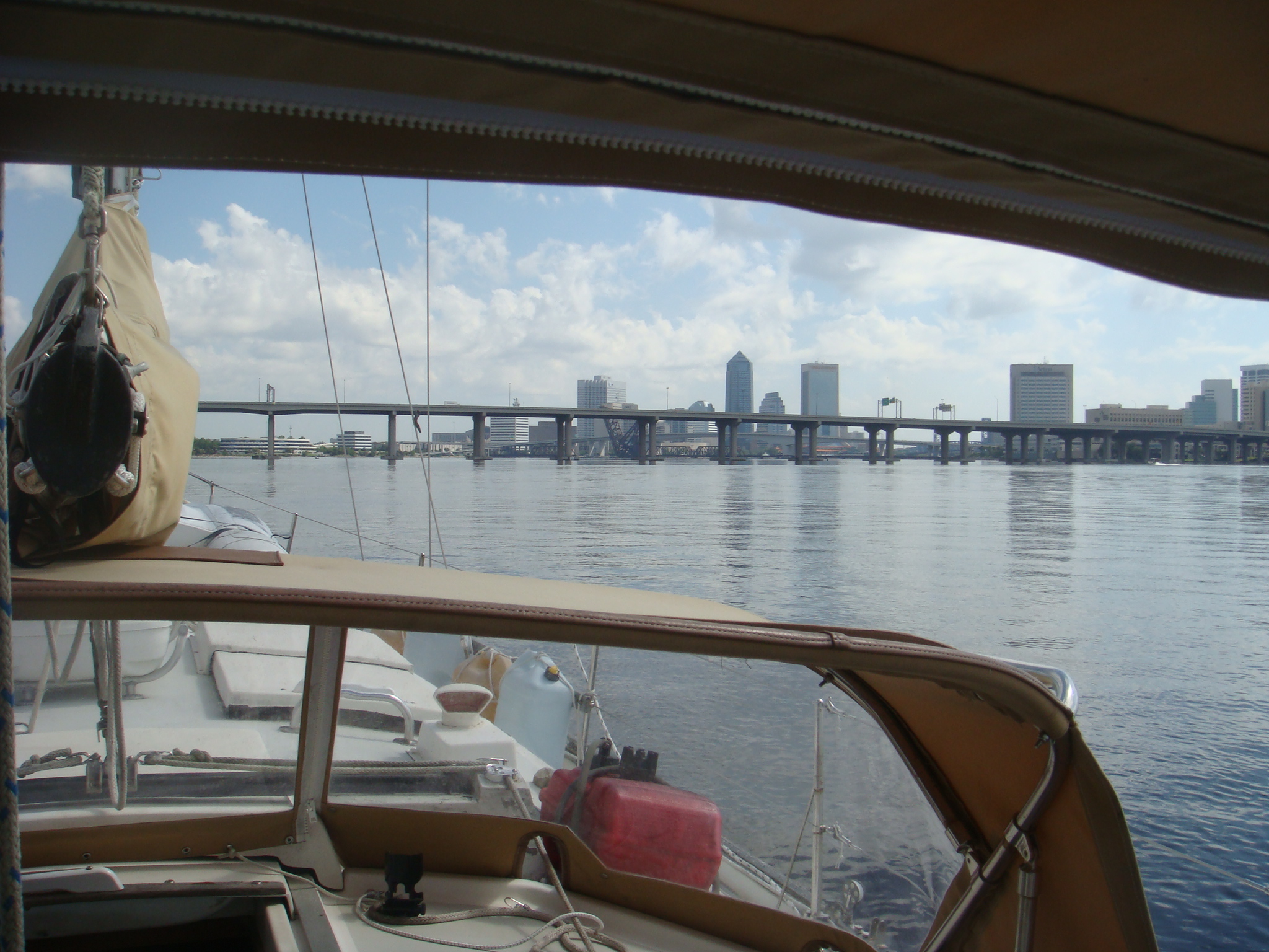
Jacksonville is well-known for the number of bridges over
the St. John River. Most now are fixed bridges and are
not a navigation issue for yachts. On the left is the Fuller Warren Bridge which carries I-95 across the St. John. This is a relatively new bridge. |
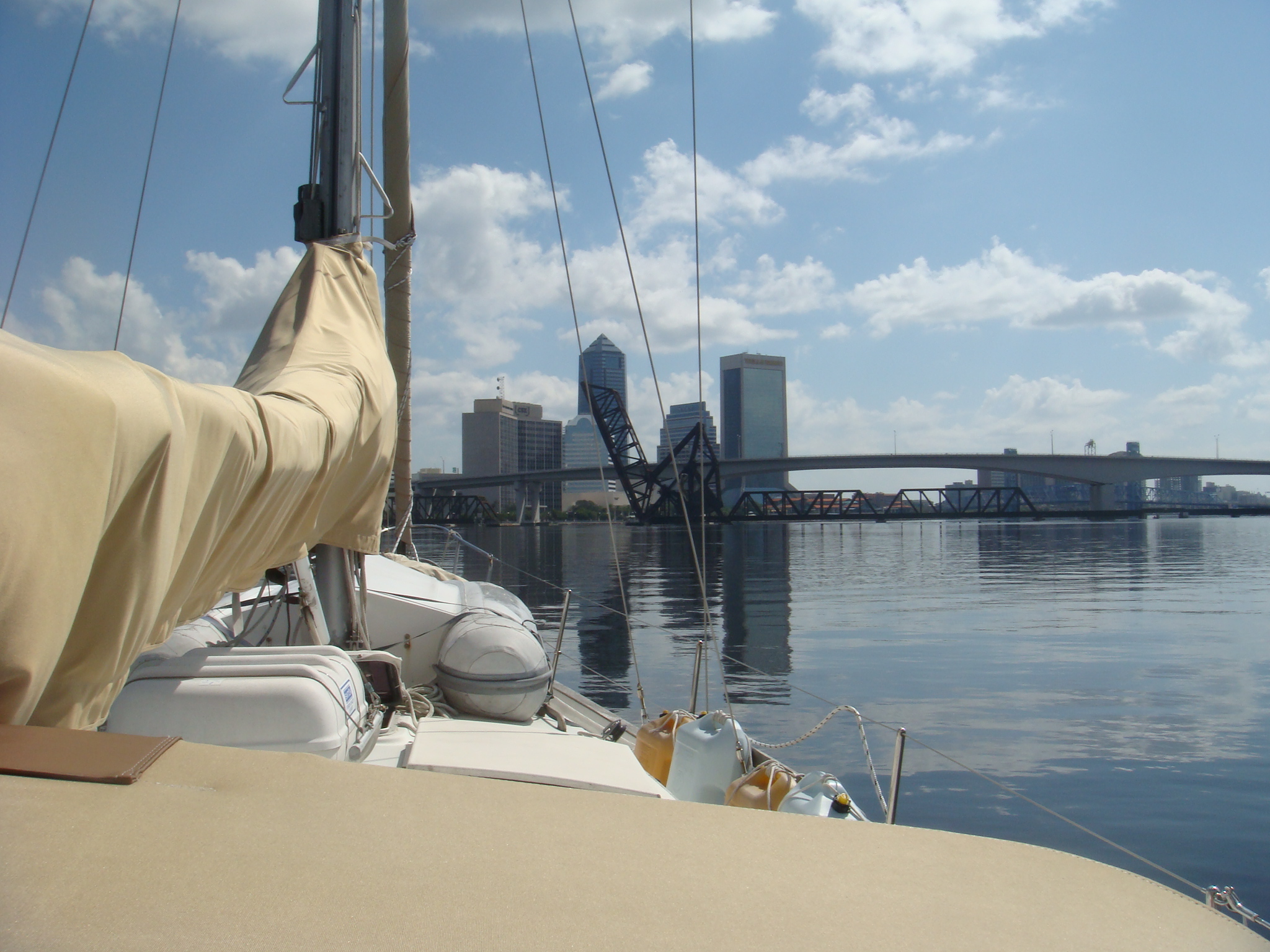
| Just south of the Fuller Warren Bridge is the Florida East
Coast RR bridge. This is a Bascule bridge that is normally
open except for train traffic. This has also been a
problem bridge as it has required several periods of intensive
maintenance which restricted its openning. When I was
headed South for Ortega in the Fall of 2011 this bridge was
restricted to a single openning around noon from Sunday through
Wednesday. I arrived on a Friday so it was not an
issue for my arriving in Ortega. When I was ready to head
back down the St. John the restrictions on openning had been
lifted. Just beyond the FECRR Bridge is the fixed Acosta Bride. |
 FECRR Bridge and Acosta Bridge |
 Main Street Bridge |
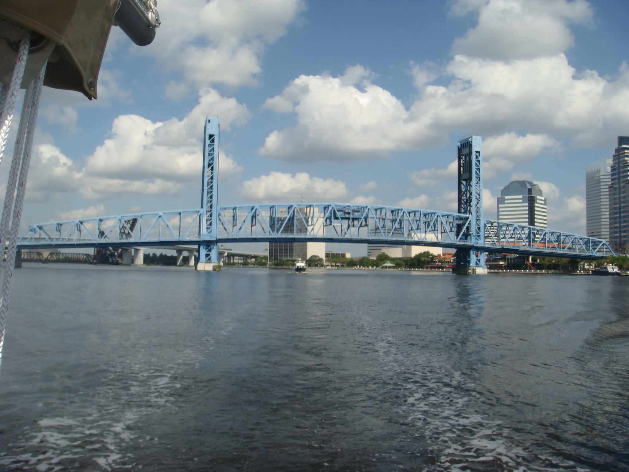
On the left is the Main Street Lift Bridge, the only other
openning bridge between Ortega and the mouth of the river.
This bridge opens on demand except during rush hours.
This bridge has a history of problems that can delay or prevent opennings for boats. It can also be slow to open as the procedure requires posting safety guards at the traffic stop positions rather than relying on just the gates. |
| Below the Main Stree Bridge is the fixed Hart Bridge.
Over the winter of 2010/2011 I remember a report on the news
that this bridge has been condemned, however it is still in use
in 2012. I don't believe there is any funding for a
replacement. Apparently the condemnation does not imply the bridge is ready to fall down, just that it will require major repairs over the coming years that would make replacement a more economical solution. |
 Hart Bridge |
 Rogue Channel Marker |
One of the risks of concentrating on taking pictures of
bridges is that I can lose track of where the channel markers
are located. This rogue channel marker nearly collided with Sarah as I was approaching the Hart Bridge. I thought my bow wake had pushed the marker away such that there was no contact. However I did just graze the marker. Several days later I removed the tell-tale red marks on Sarah's hull with Acetone. |
| After the Hart is the Mathews Bridge. This is another aging fixed bridge that is going under extensive repaires. |
 Mathews Bridge |
 I-295 Bridge |
This final bridge before the mouth of the St. John is the I-295 bridge a new and very modern designed suspension bridge. |
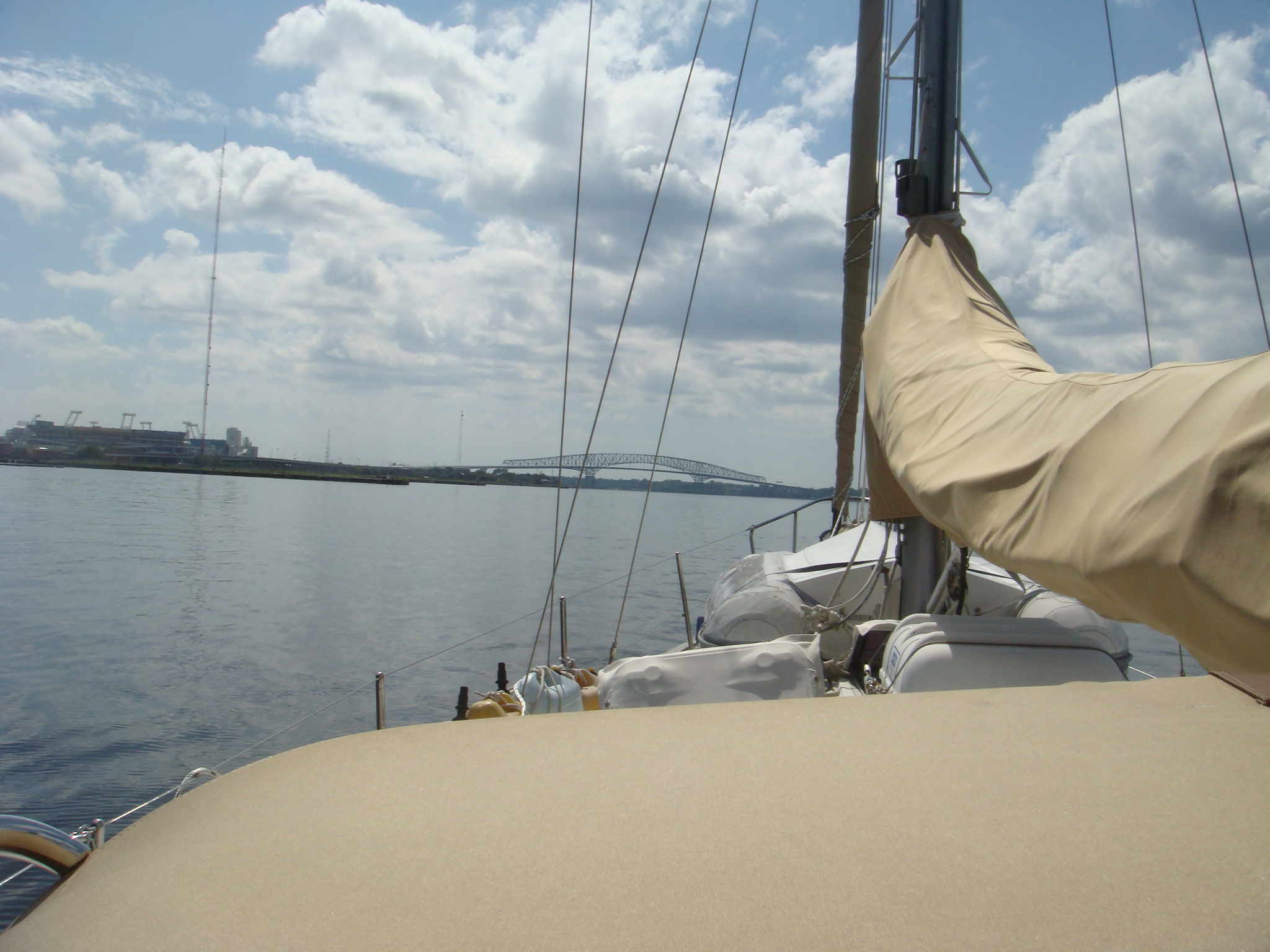
| My plan was to sail off-shore from the mouth of the St. John to Charleston, about 170 nm. This would be more than 24 hours so I anchored Sarah near the mouth of the St. John in a wide spot in the AICW waiting for a mid-morning departure the next day. |
 Anchorage Off AICW Near Mayport |
| St. John to Charleston | |
| I left the anchorage the next morning a little after 0900
and motored past the Naval Station at Mayport and out the mouth
of the St. John. There was a live-fire exercise going on
that morning between the St. John and St. Mary Inlets, so I had
to go well off-shore before turning North toward Charleston. I had been waiting in Ortega for several weeks for the thunderstorms and strong NE winds to abate. Now when I was underway there were very light winds from the NW. Not enough wind to get me to Charleston by the next afternoon so the engine remained on. |
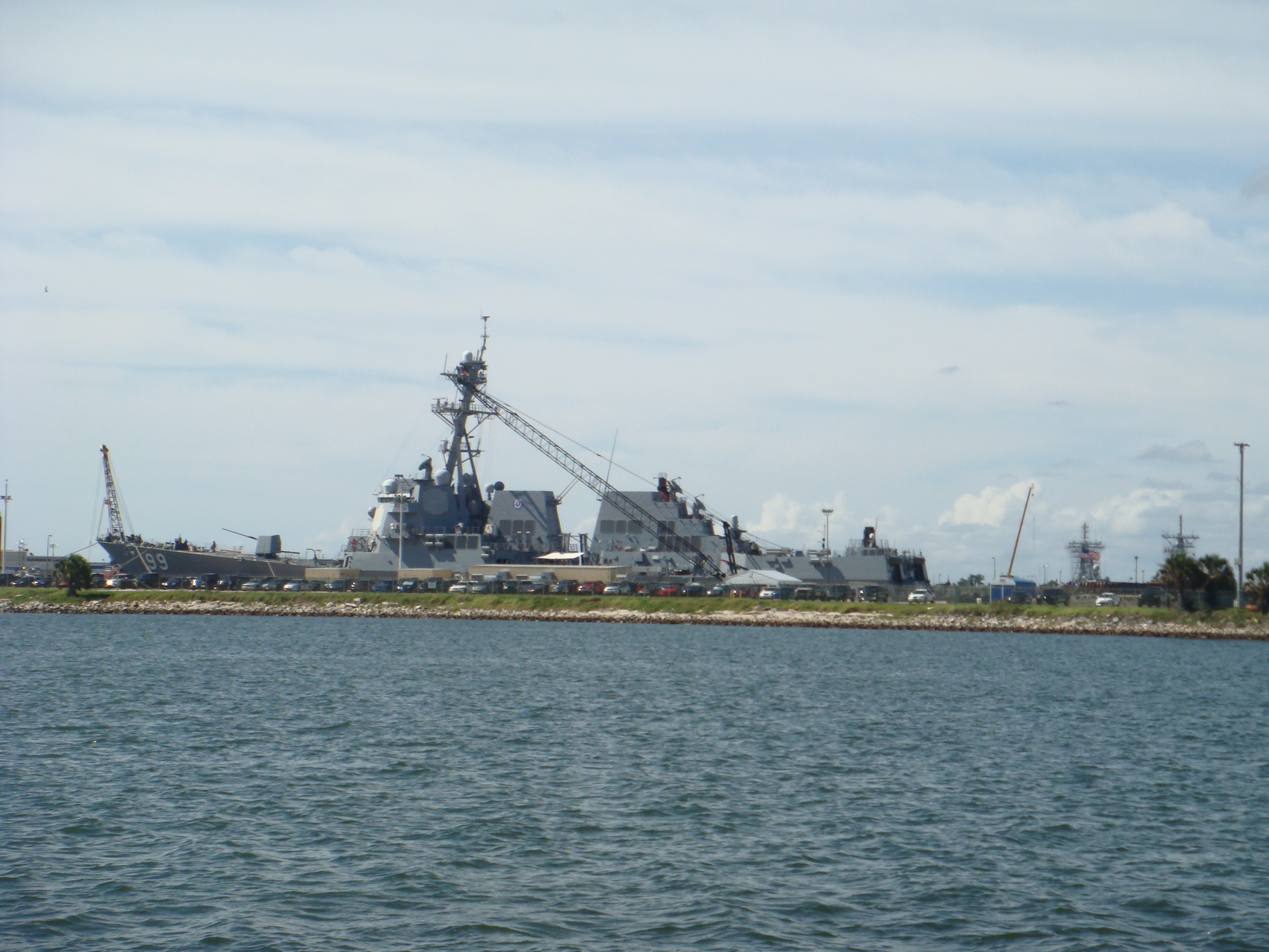 Mayport Naval Station |
 Berthed at Charleston Maritime Center |
I arrived in Charleston a little after noon the next day.
I called the Charleston Maritime Center and secured a
berth for the next two nights. I needed a couple of nights' rest after the all-nighter, and my insurance policy requires it. I also wanted to take advantage of the Harris-Teeter that is a few blocks from the marina. I thought I would go out to a restaurant at least one of the nights I was in Charleston, but I was too tired and ate on-board both nights. |
| Charleston to Southport, NC | |
| On June 22, after two restful nights at the Maritime Center
I departed for Cape Fear and Southport, NC. There was a 10-12 kt. breeze out of the S when I cleared the Charleston breakwaters and I was able to sail for the first time on this trip. |
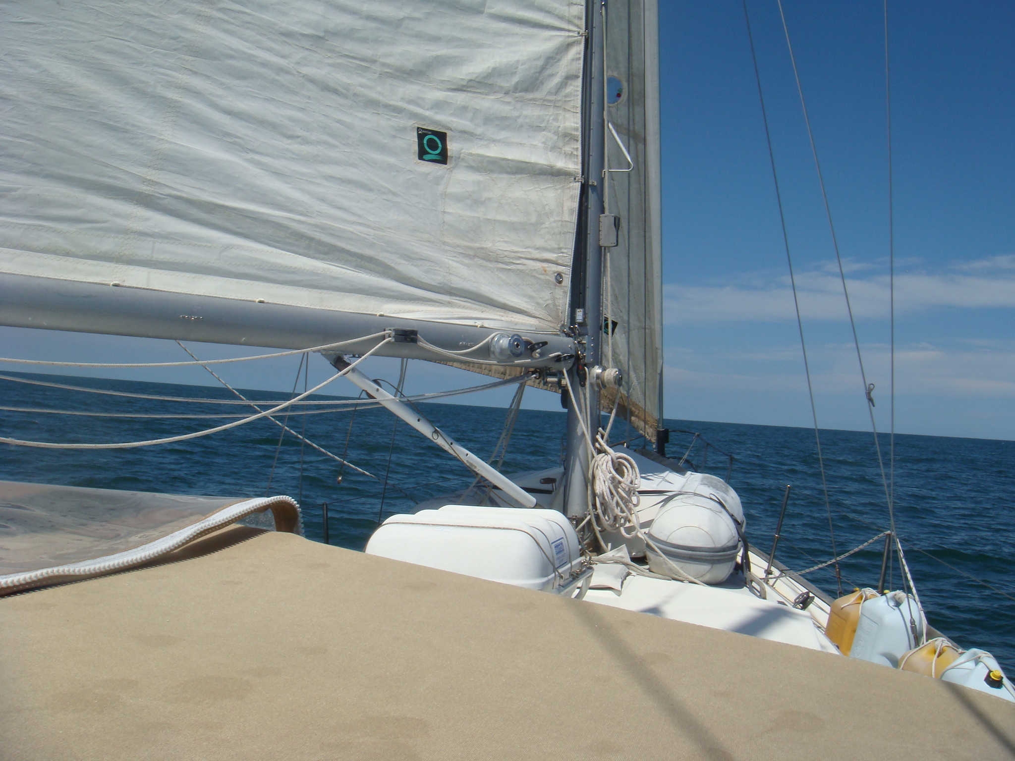 Under Sail, Headed for Cape Fear |
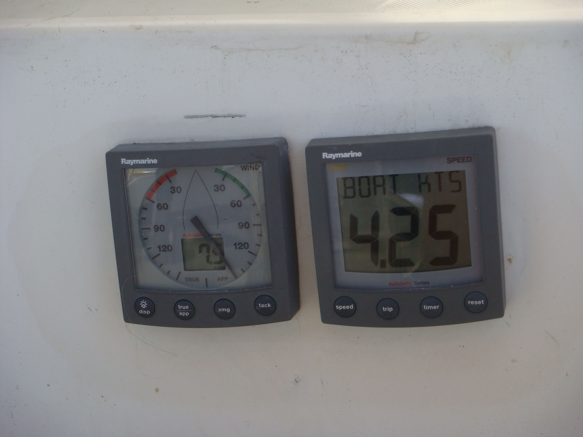 Running Down Wind at Less Than 5 Kts |
The wind speed was not over-whelming, but I was able to
maintain a speed of 4-5 kts. on a broad reach. I sailed until just after sunset. By then the wind shifted to the SSE making this a dead down wind run. In the light air my speed barely made 4 kts., but also in the SE swell Sarah was rolling a good bit and it was hard to keep the sails filled. I could have tacked down wind, but that would have extended this leg by as much as a half day. Finally I started the engine, furled the sails and motored the rest of the way to Southport. |
| I arrived at the Southport Marina a little before noon. As soon as I registered with the marina I crashed for about 4 hours. I was much more tired than I expected after a relaxing 24 hour run. I planned to spend only two nights at the Marina before going off-shore once again to Beaufort, NC. Unfortunately Tropical Storm Debby in the Gulf of Mexico played havoc with the winds off NC for the next several days. |
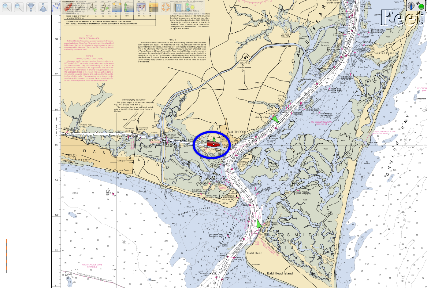 Berthed at Southport Marina |
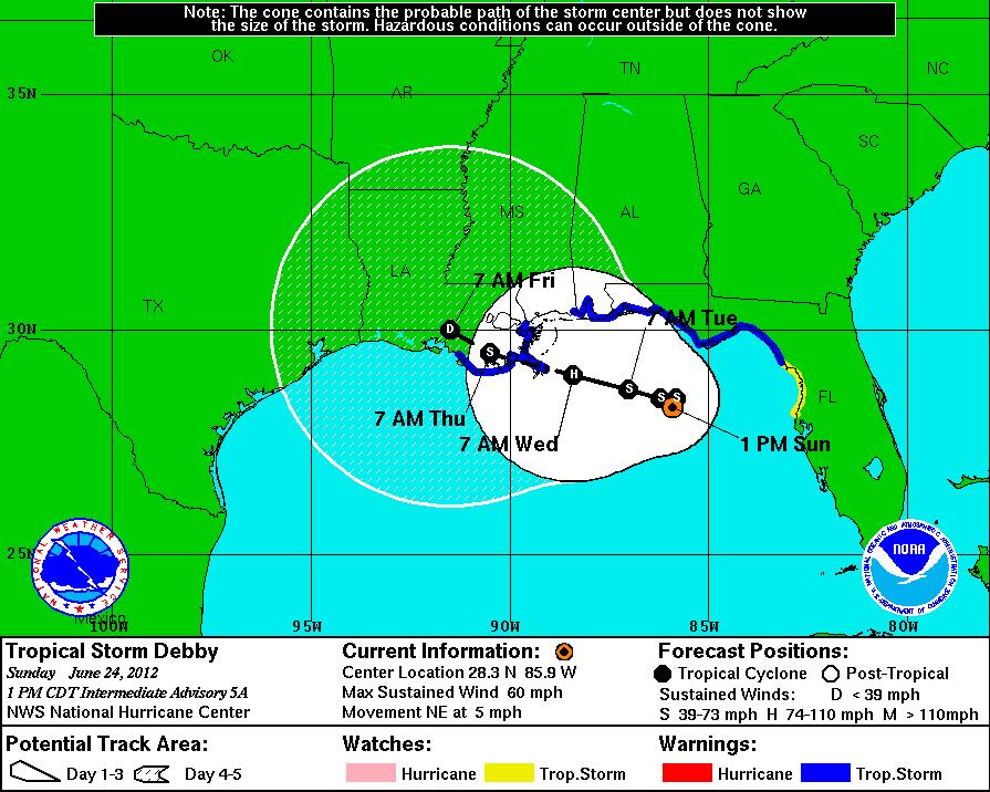 Debby Forecast Track on June 24, 2012 Courtesy of NOAA |
On the left is the forecast track for Debby on June 24, the day
after I arrived in Southport. Debby was expected to drift
slowly to the west and come ashore near New Orleans. I still needed another day in port to get more rest, but if this forecast held I should have fair weather, if not favorable winds for the trip from Cape Fear to Beaufort the next day. |
| On the right is the forecast track on June 25. Now
Debby was forecast to drift north into the Florida panhandle. By this time the winds off the Mid-Atlantic coast were out of the east, but were forecast to shift to the SW the next day. I decided to remain in Southport until that wind shift ocurred. At least I had plenty of time to get the red marks from the St. John channel marker off Sarah's hull. |
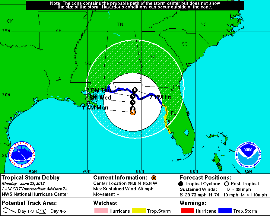 Debby Forecast Track on June 25, 2012 Courtesy of NOAA |
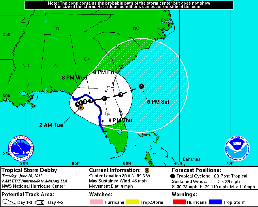 Debby Forecast Track on June 26,2012 Courtesy of NOAA |
By June 26 the forecast track called for Debby to cross northern
Florida into the Atlantic. Now the off-shore winds were strong out of the NE. I was definitely staying one more day in Southport. |
| By June 27 the forecast track had finally held true and
Debby was in the Atlantic and heading NE. The off-shore
winds were still out of the East and the seas were running over
4 feet. One more night in Southport. By the morning of June 28 Debby was well off-shore and the winds had died down significantly and started to shift to the South. However I expected the seas to still be rough and sloppy. I gave up on the off-shore trip to Beaufort and headed up the AICW. |
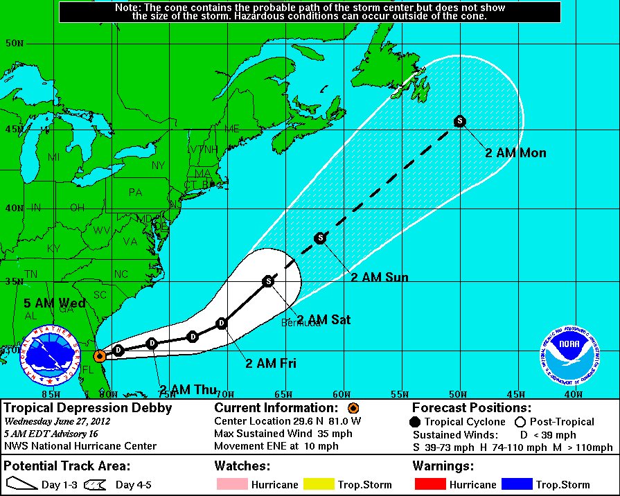 Debby Forecast Track on June 27, 2012 Courtesy of NOAA |
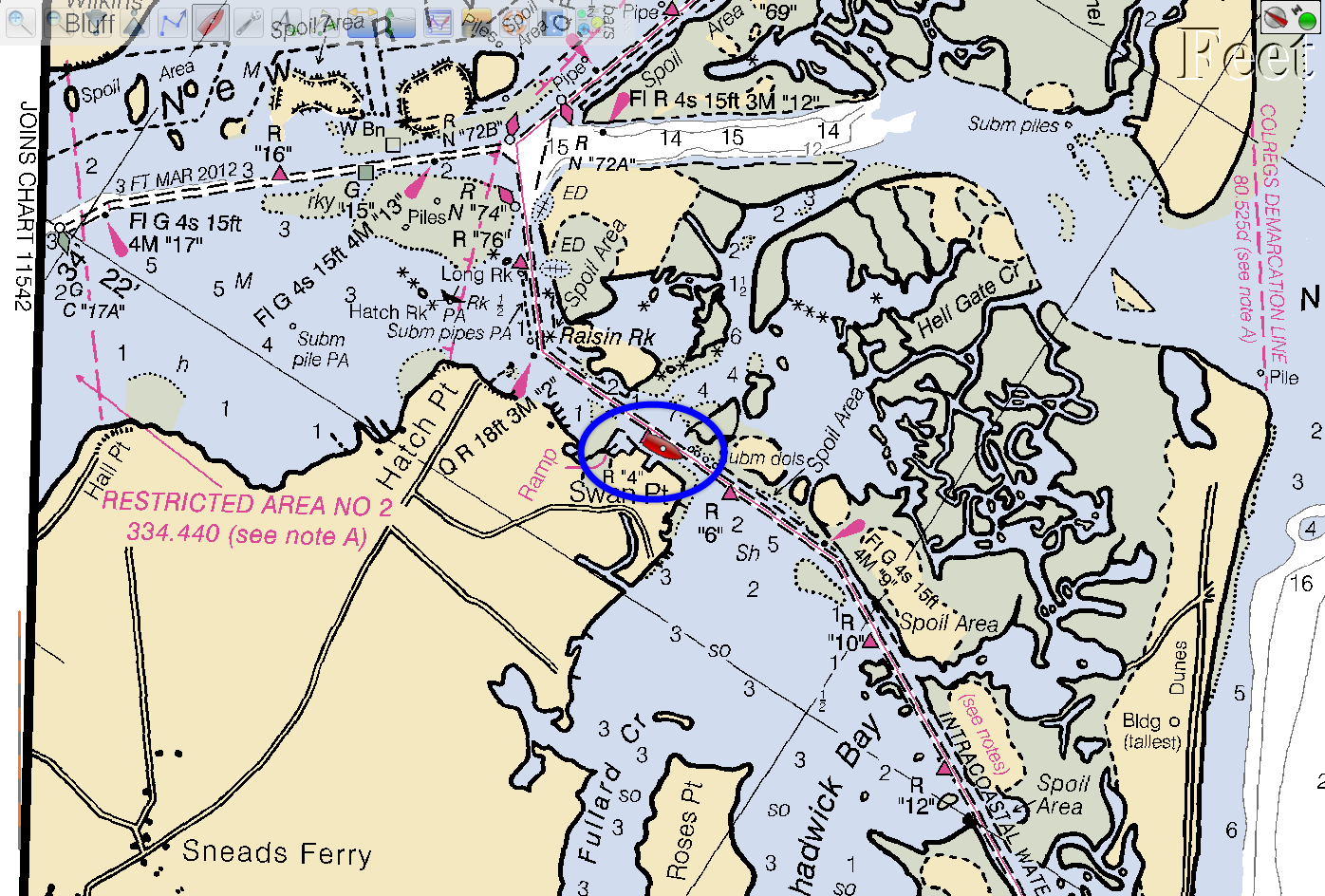
| Southport to New River, NC | |
| I planned to stop at the fuel dock on the way
out of the Southport Marina and top off the fuel tank. I
quickly checked the fuel gauge (without my eyeglasses) and read
it as 1/3 of a tank left. That was over 25 gallons, more
than enough to get me to Beaufort, and I headed out of the
marina without stopping at the fuel dock. I should have re-checked the fuel gauge. That reading should not have made sense. The last time I had added fuel to the tank was last December in Fernandina Beach on the way to Ortega. Since that fuel up I'd gone up and down the St. John, motored to Charleston and motored half of the way to Southport. Sure enough, 6 miles south of Wrightsville Beach the engine shut down. Even then I was not thinking out of fuel. I checked the fuel filter. It looked OK, but I changed it anyway and topped off the Racor bowl with fuel. The engine started, but then shut down in a minute or so. Finally I checked the fuel gauge and it was on the big "E". By this time I had drifted out of the channel and nearly aground so I set the anchor and called Tow Boat/US to get towed to the nearest fuel dock. Thank god I have unlimited towing insurance so this was only going to be an personal embarrassment and not a financial disaster. Within an hour I was at a fuel dock in Wrightsville Beach and topped off the tank with 75 gallons of diesel. Now I know how much of the 80 gallon tank is really available. The remaining 5 gallons is below the fuel pickup. It took a few minutes to work all of the air out of the fuel lines and get the engine running reliably. By the time I was ready to depart the fuel dock it was nearly 1:00 PM. I caught the 1:00 openning of the Wrightsville Beach bridge and headed north in company with a 40' catamaran, "Escape Velocity". We had both left Southport that morning and intended to anchor near Surf City. As we approached the channel into Surf City, Escape Velocity turn into the channel but quickly backed out. I thought there must be something wrong as they draw less than Sarah. I turned into the channel and immediately ran aground. Clearly this channel is silting in and the small anchorage off the channel probably no longer exists. |
|
| Both boats headed up the AICW trying to find another place
to stop for the night. The only marinas we could reach
before dark were already closed and not answering their
telephones. Marce, on Escape Velocity, found a reference in
her waterway guide that the New River Marina allowed vessels to
tie to their fuel dock after hours. That was our best
chance. As the sun was going down we were able to tie both boats to the fuel dock. I joined Jack and Marce on Escape Velocity for dinner. After dinner I attempted to help them (unsucessfully) with problems they were having with their chart plotter. |
 Tied to the Fuel Dock at the New River Marina |
| New River to Beaufort, NC | |
| The next day we would have to cross one of the
perssistent problem areas in this section of the AICW, where the
Brown's Inlet crosses the AICW within the USMC Camp Lejeune.
Both boats wanted to stay at the New River Marina fuel dock as
long as possible so we would be transiting this problem area on
a rising tide. The marina was very accommodating, but by
8:30 AM they insisted we move. We slowly made our way
around the New River Inlet and down to the Onslow Beach bridge,
which is operated by the Marine Corps. We finally
approached the area (which is described in detail on Claiborne
Young's website -
Cruisers.net)
around 10:30 AM, about 1 hour after low tide at the New River
Inlet. There are two temporary floating channel markers around
the shoal, and carefully following those markers I did not see
any depths below 6.5'. Several cruisers have reported
hitting the bottom or running aground at this point at other
than low tide. Some of that can probably be explained by
cruisers not paying strict attention to the buoyage, but also
the wind direction can have a major effect on the tides.
This day we had a southerly wind, which was probably pushing
water into the New River and Brown's Inlets and raising the depth of the low
tide. |
|
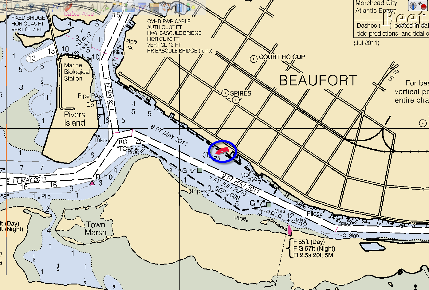 Sarah Berthed at Beaufort Docks |
In any case both boats were happy to get through that section of
the AICW, and we were finally able to power up heading for the
Beaufort area. Escape Velocity decided to anchor out and entered Peltier Creek in Morehead City. I headed for the Beaufort Docks marina. |
| Beaufort to Belhaven, NC | |
| After 2 nights at the Beaufort Docks (and
topping off the fuel tank once more) I headed up the next to
last section of the AICW before the Chesapeake Bay. I had
thought to anchor in Cedar Creek and then go to the head of the
Pungo River the next day. I arrived off Cedar Creek around
10:30 AM and decided it was too early to stop and pushed on
toward the Pungo. Not long after I entered the Neuse River I started to regret not stopping. It was turning into a very hot day, and if I were anchored in Cedar Creek I could go swimming and cool off. As I was nearing the Pamlico River on Goose Creek, a strong thunderstorm passed over bringing 40 kt winds and horizontal rain. Briefly that storm made for difficult navigation as I couldn't see into the rain, but it passed within 5 minutes and it had the effect of that swim in Cedar Creek. I had a refreshing shower and the air was a bit cooler. I had been making good time and I should be anchored (and swimming) in the Pungo River by 6:00 PM. Then, as I neared Belhaven, NC, I could hear thunder off to the NW. I turned on my radar and saw strong returns from the rain in that direction. As the clouds moved closer I could see strong shear lines in the clouds, meaning violent changes in wind velocity. This was not going to be a refreshing shower, it was going to be an ass-kicking. Suddenly I was hit with winds over 50 kts, with gusts going over 70. Visibility was near zero in heavy horizontal rain. I struggle to keep Sarah in the channel and not be driven ashore. I expected this violent storm to blow over in 15 or 20 minutes, but 45 minutes later it was just as strong. By that time I had reached the bend in the channel that headed East toward the head of the Pungo River. Here the channel was much wider and I was going down wind. I could briefly engage the autopilot and rest a bit. About this time a young couple in a 26' power boat started to follow me. When I reached the next bend in the Pungo River I turned back to the West. The next section of the channel was very narrow and I didn't trust my ability to keep Sarah in the channel if I got hit by another 70 kt gust. Sure enough as I headed back to the West another blast of over 50 kts hit us. As I once more approached the West end of the channel and the wind dropped to below 30 kts., the small power boat came along side and shouted, "Where is Belhaven?". Now I knew why they were following me, they thought I might know where I was. I pointed in the direction of the Belhaven breakwater and they took off. I decided to make one more attempt to get to the anchorage at the head of the Pungo and turned once more to East. |
|
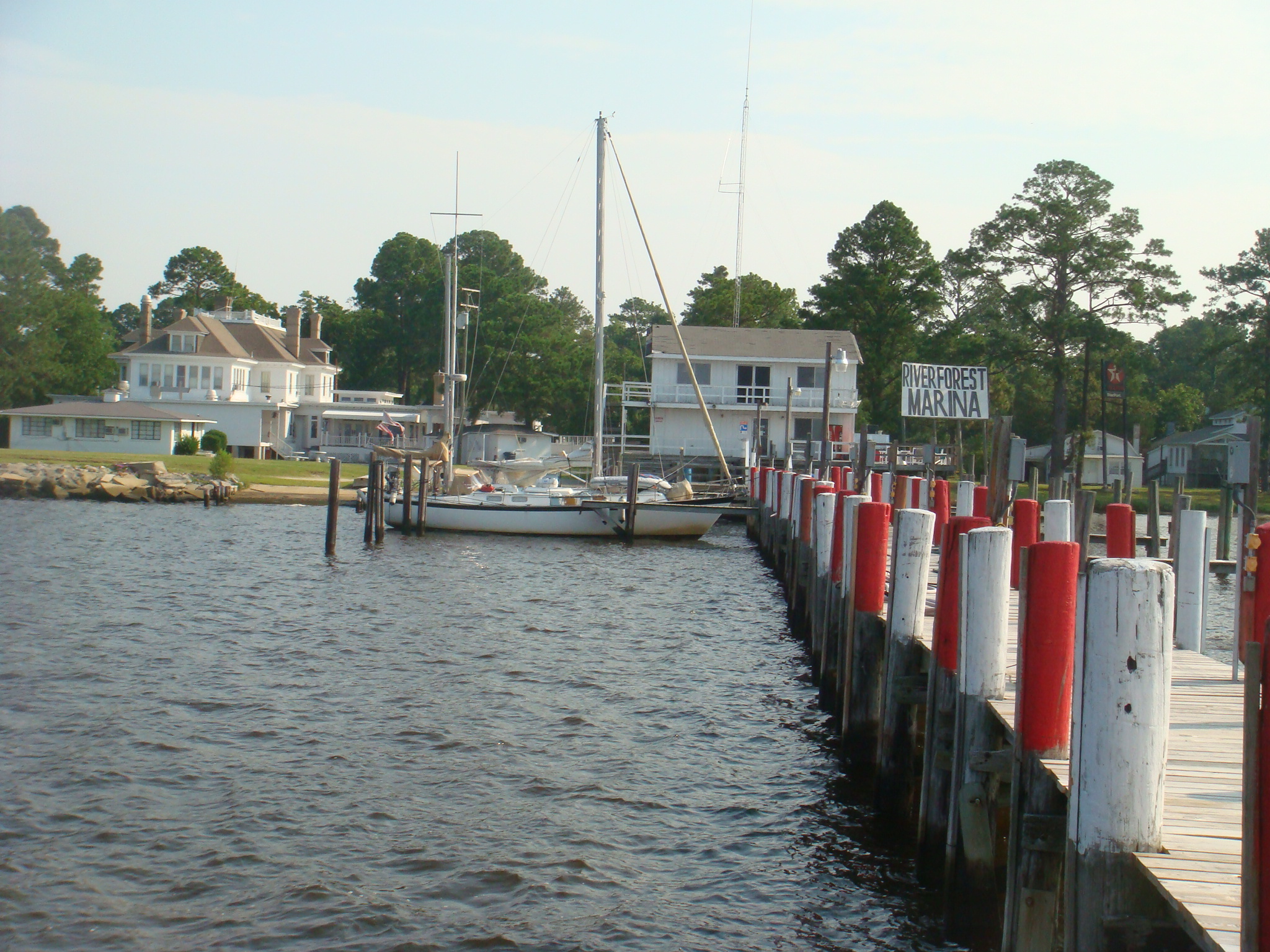
 Sarah Berthed at the River Forest Marina |
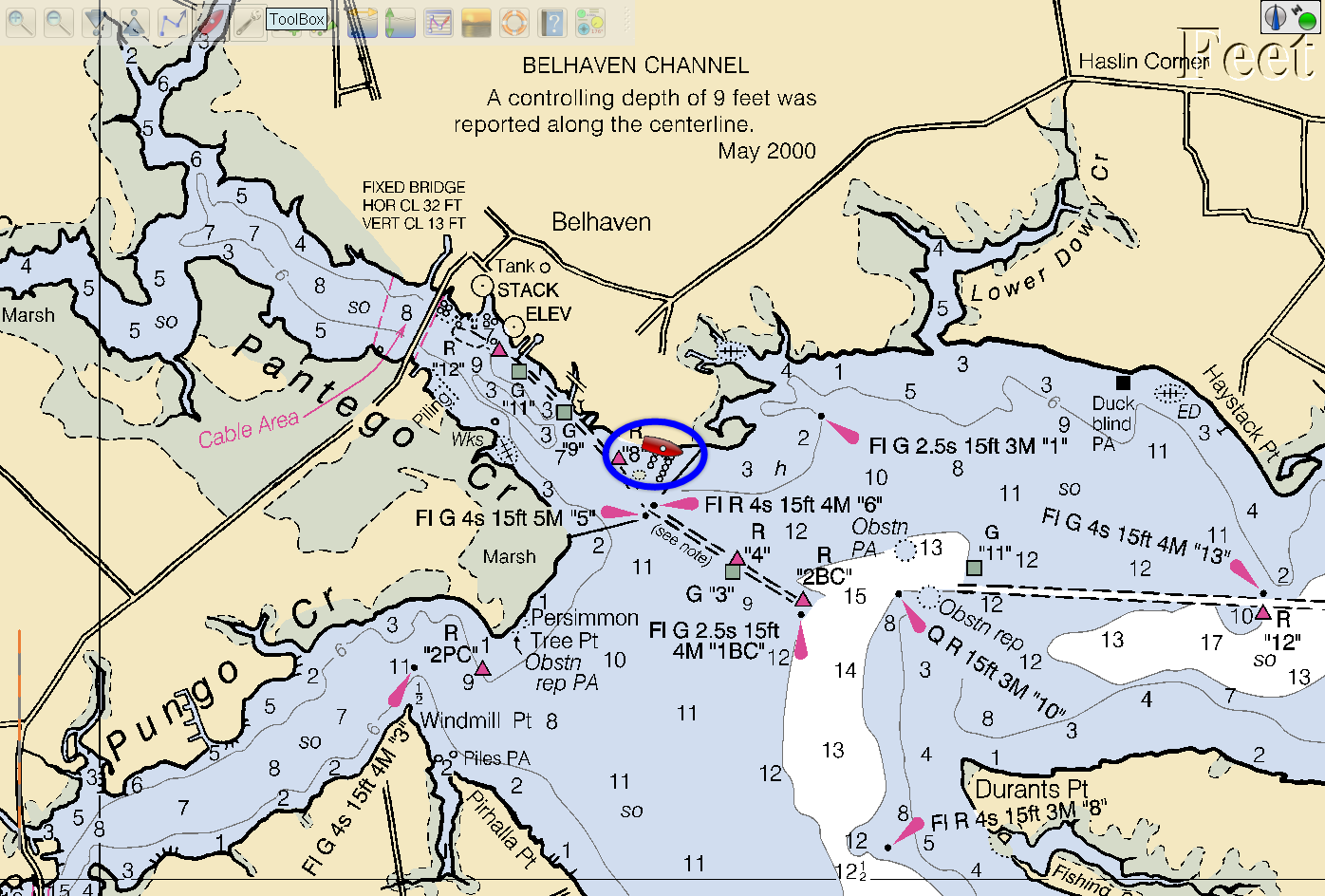
Once again this storm intensified, and it was getting dark.
I gave up and headed for the harbor at Belhaven. I called the River Forest Marina in Belhaven for a berth and assistance with lines. At first I could not make contact with the marina. I did not know there was an area-wide power outage and their main radio was out. As I got closer to the breakwater they were able to make contact with a hand-held radio, and they guided me to a berth at the marina. |
| It took a little while to get Sarah secured in the berth as
the wind was still blowing over 30 kts, and the rain was still
coming down hard. With an area-wide power outage and this being past closing time for the marina, I was very appreciative that the owner and staff had remained at the marina to assist me. I'm sure they wanted to get home and deal with whatever problems might be there. |
 River Forest Marina, Belhaven, NC |
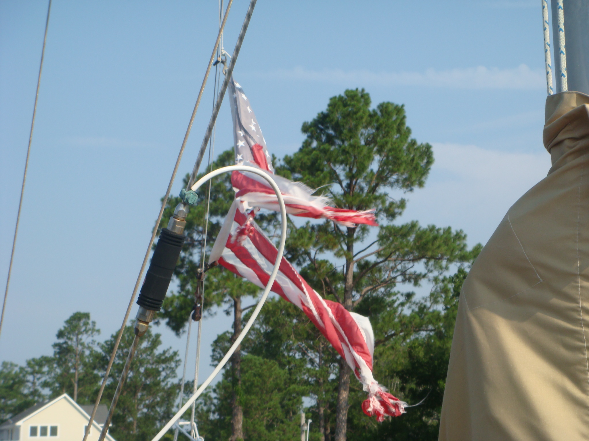 Destroyed Ensign |
The next morning I had a chance to assess any damage to
Sarah from the storm. As you see from the picture on the
left, my flag ensign was toast. Tropical Storm Beryl
started a tear, but this was the coup de grace. I had a spare ensign, and Sarah was quickly back in flag-shape. |
| The second piece of damage was the hatch over the shower
stall. No that is not a very clear piece of acrylic in the
hatch. It is a missing pane. I found the pane,
undamaged, in the shower stall. I'm not sure how it got
down into the stall when it came loose during the storm, but I'm
glad it didn't go flying off into the dark. I temporarily re-secured the pane in the frame with sealant. I will probably replace the entire hatch before next winter. |
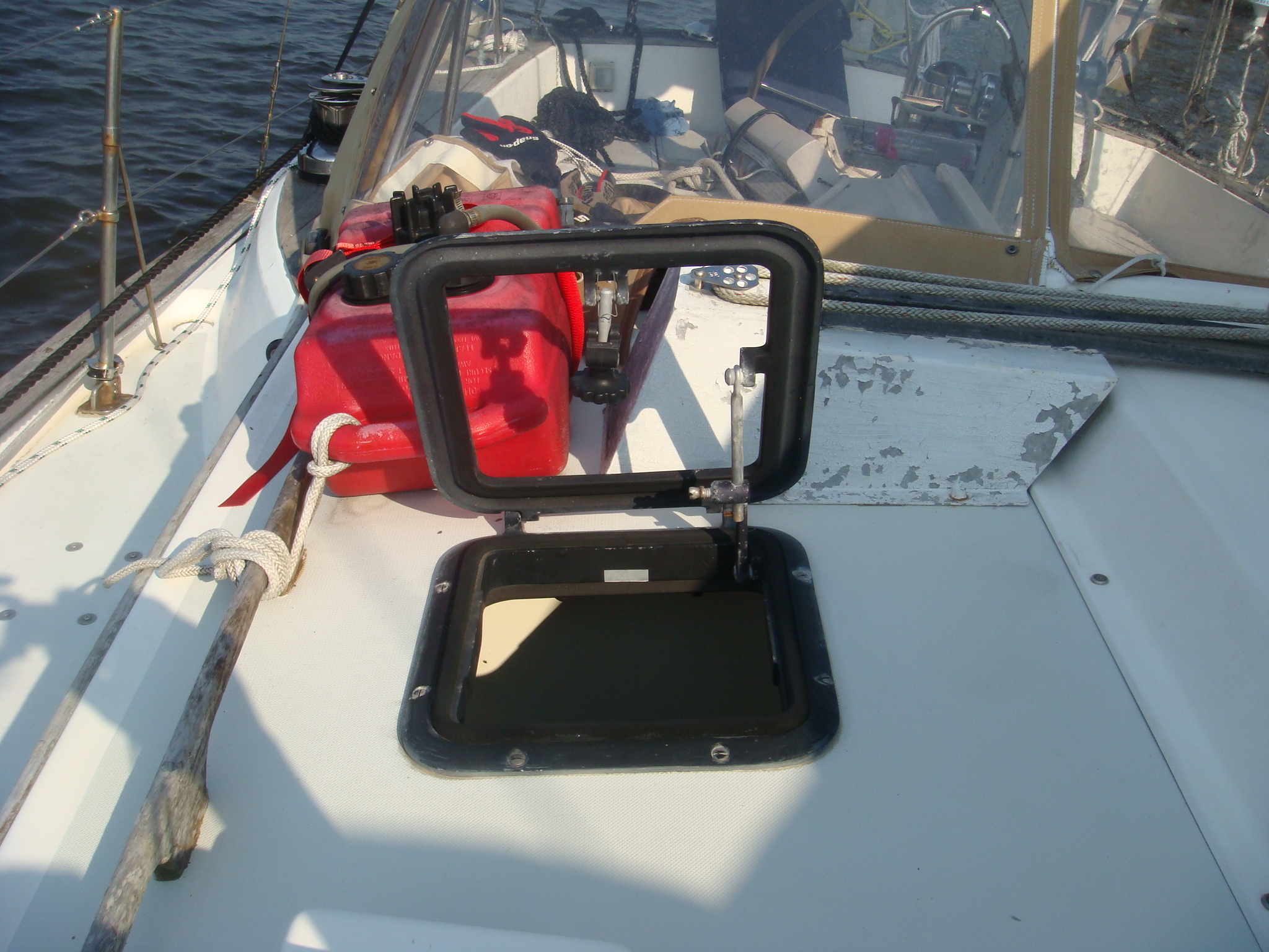 Pane Blown Out of Hatch Over Shower Stall |
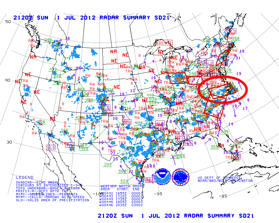 NOAA Radar Summary for July 1, 2012 at 2120Z Courtesy of NOAA |
After I completed this trip North, and had been berthed off the
Chesapeake Bay for a few days, I went to the NOAA archive site (http://nomads.ncdc.noaa.gov/ncep/NCEP)
and looked up the surface analysis and radar charts for the
approximate time I encountered this storm. On the left is the US Radar Summary for 2120Z or 5:17 PM local time (click on the chart to view at full resolution). I circled the area of NC that shows the strong radar returns for this storm. Severe thunderstorm warnings were up most of Eastern North Carolina. The USCG was broadcasting storm warnings, but they were for the storm I encountered earlier. This storm just blew up out of nowhere. |
| On the right is the 2100Z (5:00 PM local time) suface
analysis of the Mid-Atlantic Coast. I have circled the
area of the storm. This chart shows a low pressure trough line from central Georgia to just north of Cape Hatteras. There is weak low pressure system on this trough line West of New Bern, NC. This trough line and the low pressure system must have provided just enough of an atmospheric instability to kick off this severe thunderstorm. |
 2100Z Surface Analysis Courtesy of NOAA |
| Belhaven to Head of Pungo River | |
| I spent two nights in Belhaven resting from the storm
and fixing the minor problems it produced. Then I had a
short trip to the head of the Pungo River, where I anchored for
the night. I enjoyed a cooling swim in the anchorage, but had to hang onto the boarding ladder as there was a strong (1 kt.) current running. |
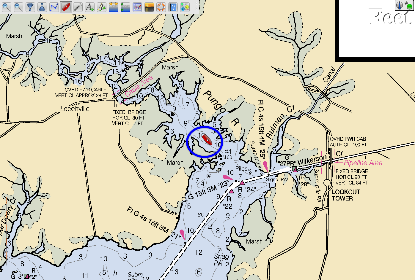 Anchored in the Pungo River |
| Pungo River to Coinjock, NC | |
| The next day I headed down the Pungo-Alligator Canal to the
Alligator River. The storm had cooled things off for a
day, but now the heat was back. I had planned to go to Elizabeth City and then the Dismal Swamp Canal, but when I entered the Albemarle Sound the temperature was over 90 F. I decided to head to Coinjock where I could get shore power and run my air conditioner. I got to Coinjock around 5:00 PM and quickly connected the shore power and turned on the AC. I spent the next hour sitting in front of the AC blower trying to cool off enough to take a shower and eat dinner. |
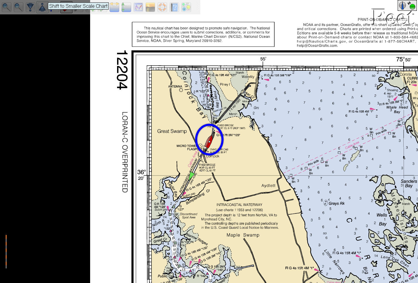 Berthed at Coinjock Marina |
| Coinjock to Willoughby Bay | |
| By choosing Coinjock over Elizabeth City I committed my self to running the gauntlet of bridge opennings (none on demand) on the Virginia Cut. | |
| Things went fairly well and I arrived at the Gilmerton Bridge in
Chesapeake, VA about 10 minutes before its scheduled openning.
There is almost always a complication at the Gilmerton, and
today was not an exception. A tug with a large barge and
limited maneuverability (termed a "Red Flag") was approaching
the bridge from the other side. So the openning was
delayed for about 20 minutes as the tug got the barge lined up
to pass through the bridge. Once the tug had cleared the
bridge the other boats waiting were able to pass through the
bridge and head into Norfolk Harbor. |
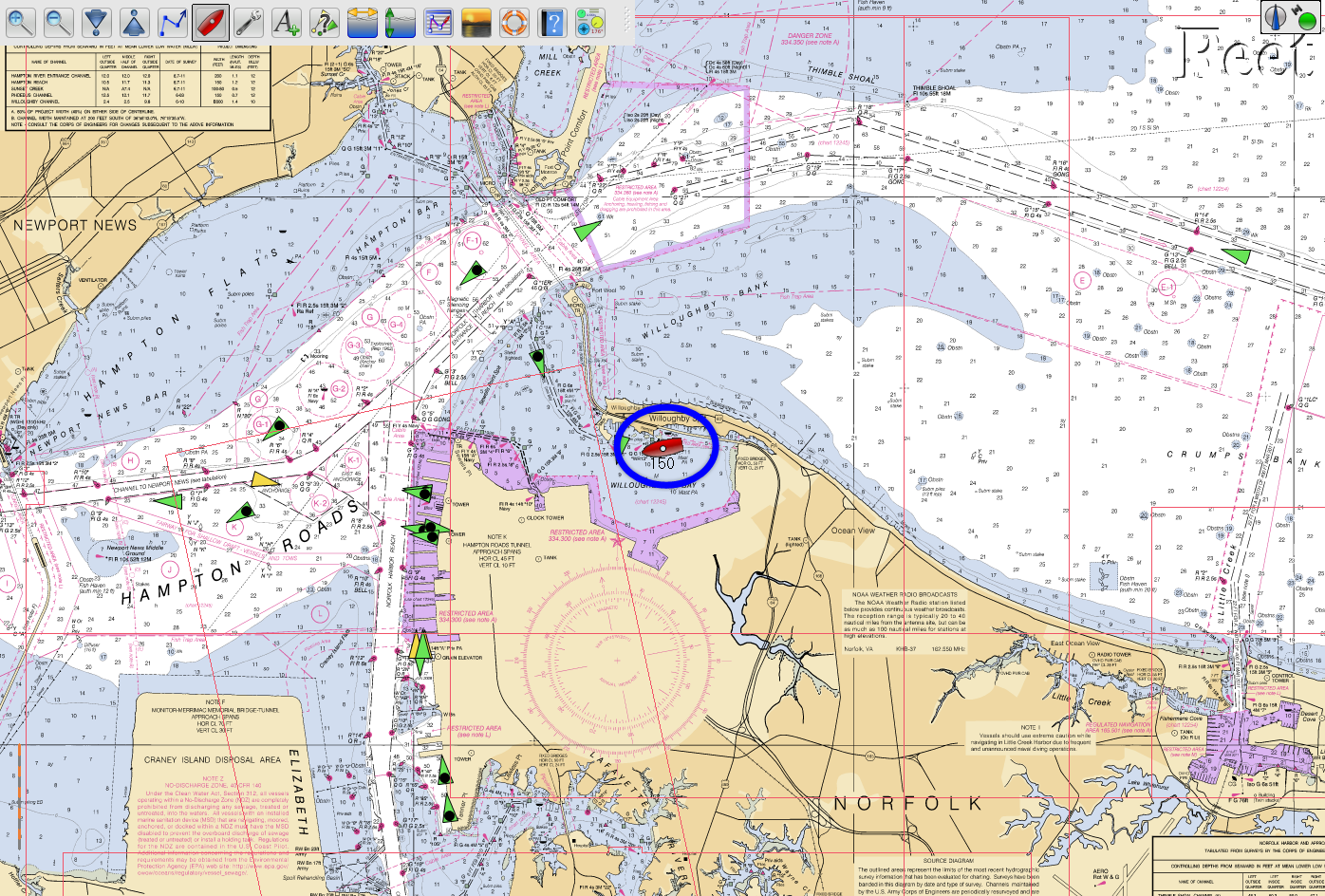 Anchored in Willoughby Bay |
| I motored to my usual anchorage in Willoughby Bay. I even risked a swim in this harbor water as it was another 95 F day. | |
| Willoughby Bay to the Great Wicomico River | |
| Now I was no longer on the AICW. I was not restricted
to a narrow channel and had no bridges with which to be
concerned. Maybe I could do some real sailing. There had been a pleasant breeze from the West overnight, and I hope it would make for a sailing day. It did seem that way at first, but by the time I had crossed the Thimble Shoals and started north up the Bay, the wind had died. I motored to the Great Wicomico River and anchored in the cove behind Sandy Pt. Now there was a light breeze out of the East, and I had a pleasant night at anchor and a equally pleasant view of the Chesapeake from the anchorage. |
 Anchored in the Great Wicomico River |
 Looking Past Sandy Pt. to the Chesapeake Bay From the Great Wicomico River |
|
| Great Wicomico River to Cuckold Creek | |
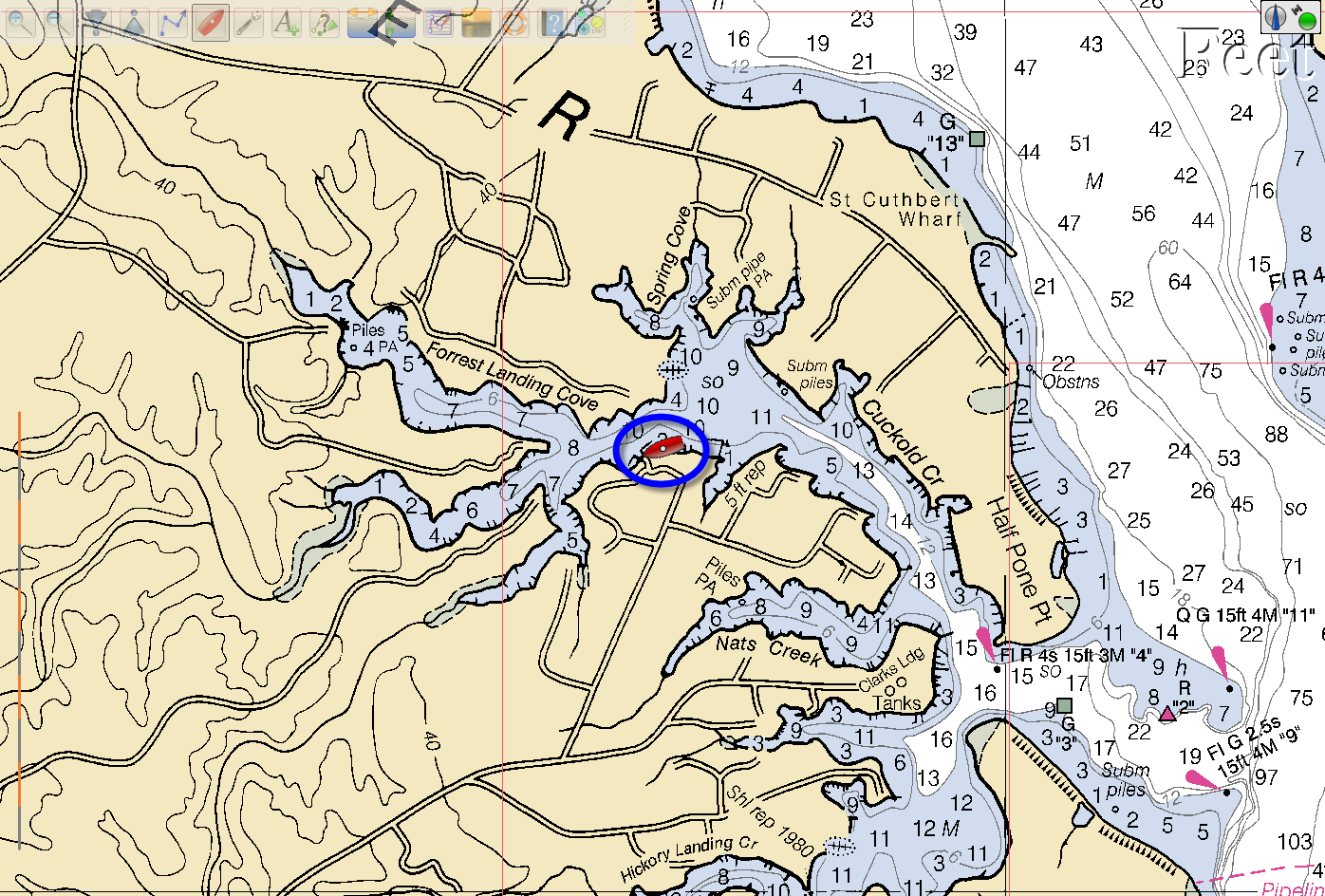 Sarah Berthed in Cuckold Creek Off the Patuxent River |
That light breeze was gone by the next morning, and I once
more headed up the Bay under engine power. This being a
holiday week the Navy was not killing fish at the target range
between Pt. No Pt. and Cedar Pt. and I was able motor directly
to the mouth of the Patuxent River. If the target range is
active the Navy chase boats will direct boats transiting the
area well to the west or east of the direct course to Cedar Pt. By mid-afternoon Sarah was berthed at Dick and Gail Juppenlatz's dock in Cuckold Creek. The saga of the 2012 Trip North is now complete. |