Sailing Topics
| Using LightListManager | |
| Having spent more than a year on updates and
enhancements I'm still trying to figure out a really meaningful
use for the program. Probably the most useful feature of
the program is the Find Updates function that can be used to
produce something similar to the weekly USCG District Summary of
Corrections (https://www.navcen.uscg.gov/ I have learned a lot about how the USCG manages the Light Lists, but this program is still just a filter and display list manager. I think it's kinda cool, but not really an essential tool. Still I'm slowly sneaking up on usefullness. I'll use this page to document some of the uses (trivial or not). The major limitation of the program was that it could only detect and display permanent changes in the Light Lists. The program did not access the USCG or NGA Notices to Mariners (LNMs and NTMs). So it could not provide notification to the user that a Navaid is off station or a light is extinguished, that information is in the LNMs. Then in 2020 I discovered that the USCG does publish the Discrepancies and Temporary Changes sections of the LNM in an xml file. With version 1.11 the LNM status (if any) for each light has been added to the list on the main form. |
|
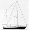
| On the right is a screen capture of the main program form
that displays the filtered light list for the Barnegat Inlet,NJ.
The display now includes a column for the LNM Status (red
circle). This status is available if the LNM xml file has
been downloaded from the USCG web site as shown in the green
ellipse. Clicking the "Update" button initiates the
download of the LNM file. The date and week of the
downloaded file is shown in the text boxes. If no LNM file has been downloaed this column will be blank. |
 |
 |
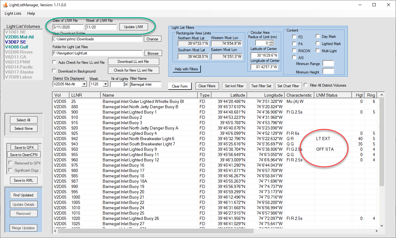
A right mouse click on the light list displays the popup menu that now includes the option of "LNM Details" (red ellipse in the screen capture on the left). clicking this menu item opens the LNM Details form as shown below. |
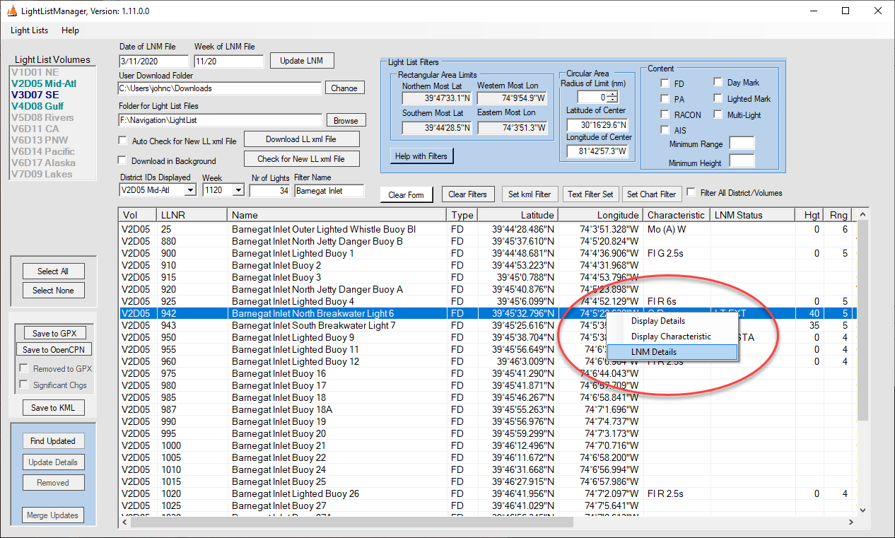
| When the "LNM Details" menu item is clicked the LNM Details form is displayed with comboboxes populated with the LLNR and Description of all light list entries that were selected on the form. Selecting one of the combobox entries displays the contents of the LNM record for this light (in this case the discrepancy for LLNR 942) showing that the light is currently extinguished. If you select a light list entry for which there is no LNM entry, the form will display a blank details section. |
 |
| In addtion to the LNM info described above, here are a few things the program can do with the available Light List data provided by the USCG. | |
From my exercising this program during the last 18 months of development it has become clear that NOAA tracks the Light List changes very closely, and generally the changes are made to the charts within a week or two of when the USCG releases the update to the public. |
|
| Upper Elk River, MD Channel | |
| With the March 8, 2018 update to Volume II I noticed that a
number of day marks had been added for the Upper Elk River in
Maryland. I checked the chart for this area, which is
shown on the right. None of the new marks are shown on the
chart. This is latest RNC issued by NOAA. The
equivalent ENC chart does not show these new day marks either.
The only mark on this part of the chart is the #16 Nun
highlighted by the purple ellipse drawn on the bottom of the chart
image. It should be noted that these marks are privately administered (PA), and not maintained by the USCG, which may have some bearing on the NOAA priorities for chart updates. |
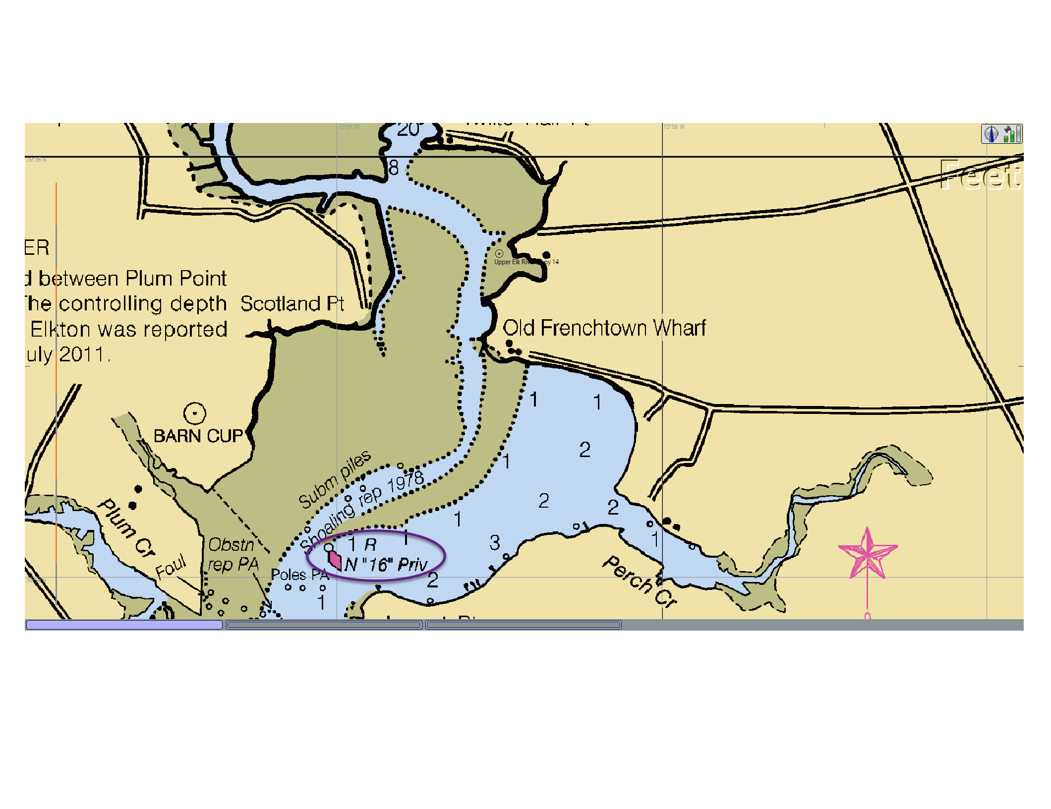 NOAA chart 12274: As of March 8, 2018 |
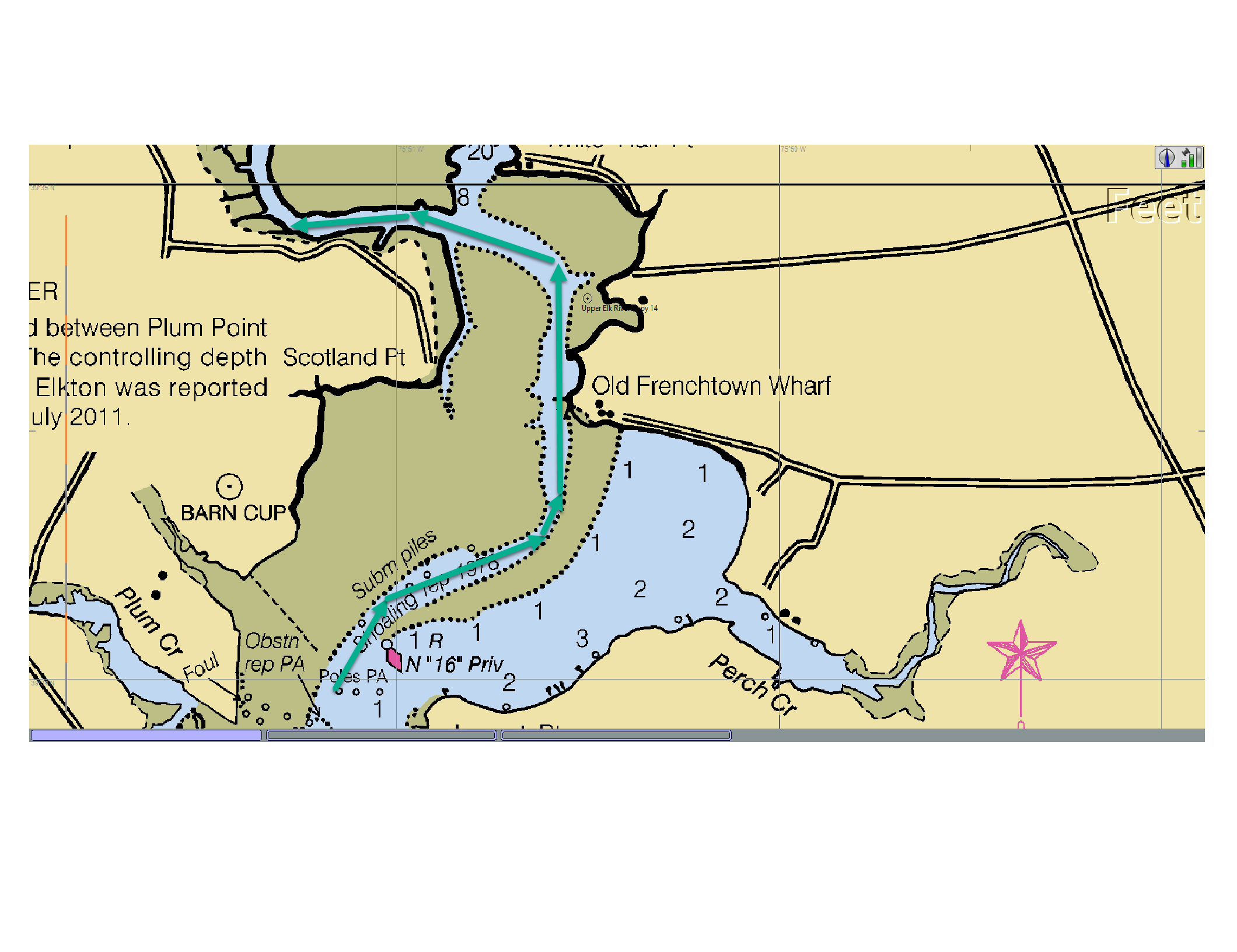 NOAA Chart 12274: Charted Channel Highlighted |
Based on the information on the chart I have drawn the
general location of the channel with green arrows. |
| Next I used LightListManager to export the new marks as
waypoiats in a GPX file and imported the file into OpenCPN.
The screen capture on the right shows the plotted positions of
those waypoints. You will need the click on the chart
image to view it at full resolution. Having done that it will be clear that the charted channel is no longer valid |
 NOAA Chart 12274: New Navaids Displayed as waypoints |
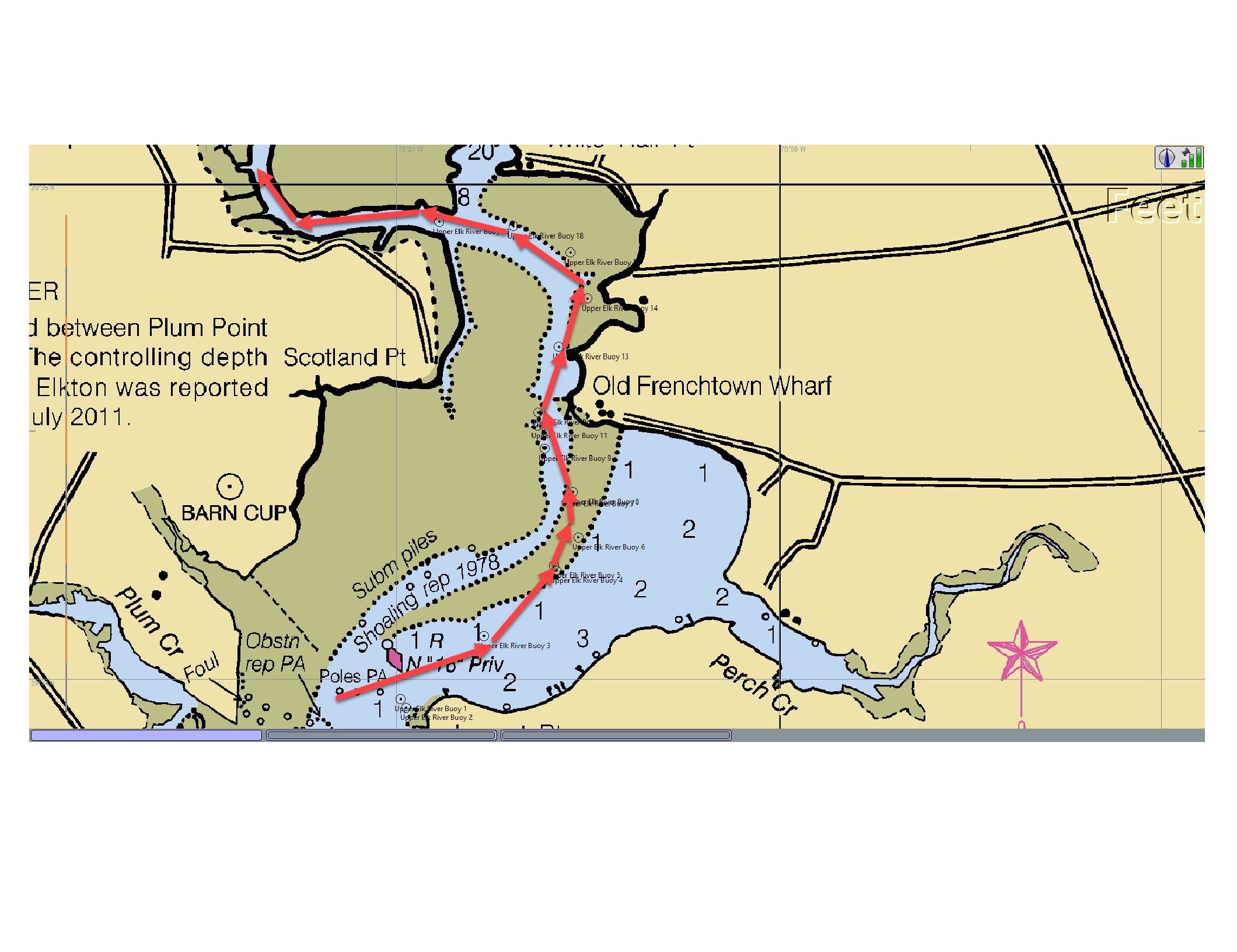 NOAA Chart 12274: Channel Marked by New Navaids Highlighted |
I have drawn the new channel on the chart image on the left. If I were heading up the Elk River I would certainly be confused by the string of marks that according to the chart would take me right over a very shallow shoal. |
| In addition to the new marks, that #16 nun is no longer
where charted, but has been moved further up the river as shown
by the purple arrow. So if I were planning to head up the Elk River I could use LightListManager to anticipate changes in the channel. Then again in over 30 years of cruising the Chesapeake I'ver never gone further up the Elk River than the C&D cannal, well south of the area shown. |
 NOAA Chart 12274: New Position of #16 Num |
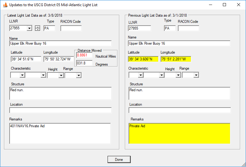 LightListManager Update Details Form for #16 Nun |
On the left is Update Details form displaying the changes
for the #16 Nun. Its new position is nearly 1 nm NE of the
position shown on the chart. I have arbitrarily set the
program to highlight the distance moved in red if it exceeds 100
feet. I expect that NOAA will publish an update to this chart on Mar 22, 2018 to reflect the changes. I assume NOAA is notified of these changes in the same time frame as they are posted on the USCG website so they would not have had time in incorporate them into their March 8 update to the RNC chart library. |
|
However; since this portion of the Elk River is not a major
commercial channel and the changes will require some re-drawing
of the chart features rather than just adding a few Navaids, it
may be a while before the chart is updated. When I downloaded the March 15, 2018 chart updates, there were no changes to this chart. Also the District 5 Light List update included a whole bunch of new and relocated marks in the lower part of the Elk River. It may be quite a while before NOAA catches up with the changes. It also identified a useful enhancement to the program - to find the pending changes to an individual chart and provided those changes as input to a chart plotter. This will required integration with my ChartManager program. |
|
|
A week later NOAA did issue an update to chart 12274, and
included some of the updated light list changes. Those
changes are highlighted by the purple ellipse on the right.
They have removed the #16 mark and added the new#1, #2 and #3.
None of the marks above the #3 have been added. The same
changes have been made to the ENC version of this chart. Adding the other marks will require redrawing channel. |
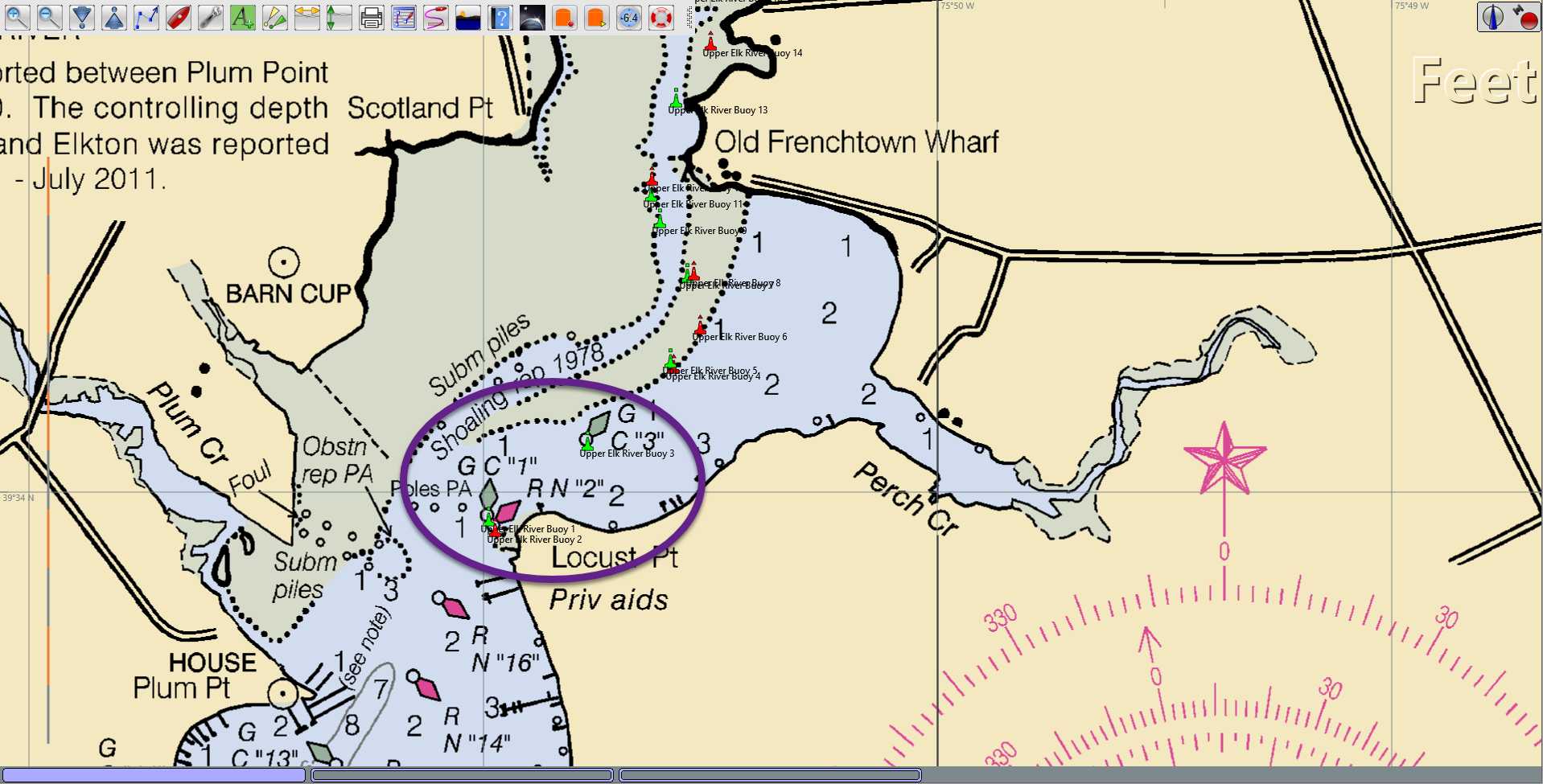 Chart 12274 as of 3/22/2018 |
 Chart Manager Display of Chart 12274 |
On the left is screen capture of the ChartManager display of the
data on the updated chart 12274. The drop down list
identifies all of the changes that have been made to this
edition of the chart, which includes the three new marks on the
Upper Elk River. |
| Barnegat Inlet, NJ | |
| While testing the next program version (1.3.1.5) I noticed that a number of lights in Vol II were not displayed on the NOAA RNC chart of Barnegat Bay, NJ (Chart 12324_5) as shown on the right. |
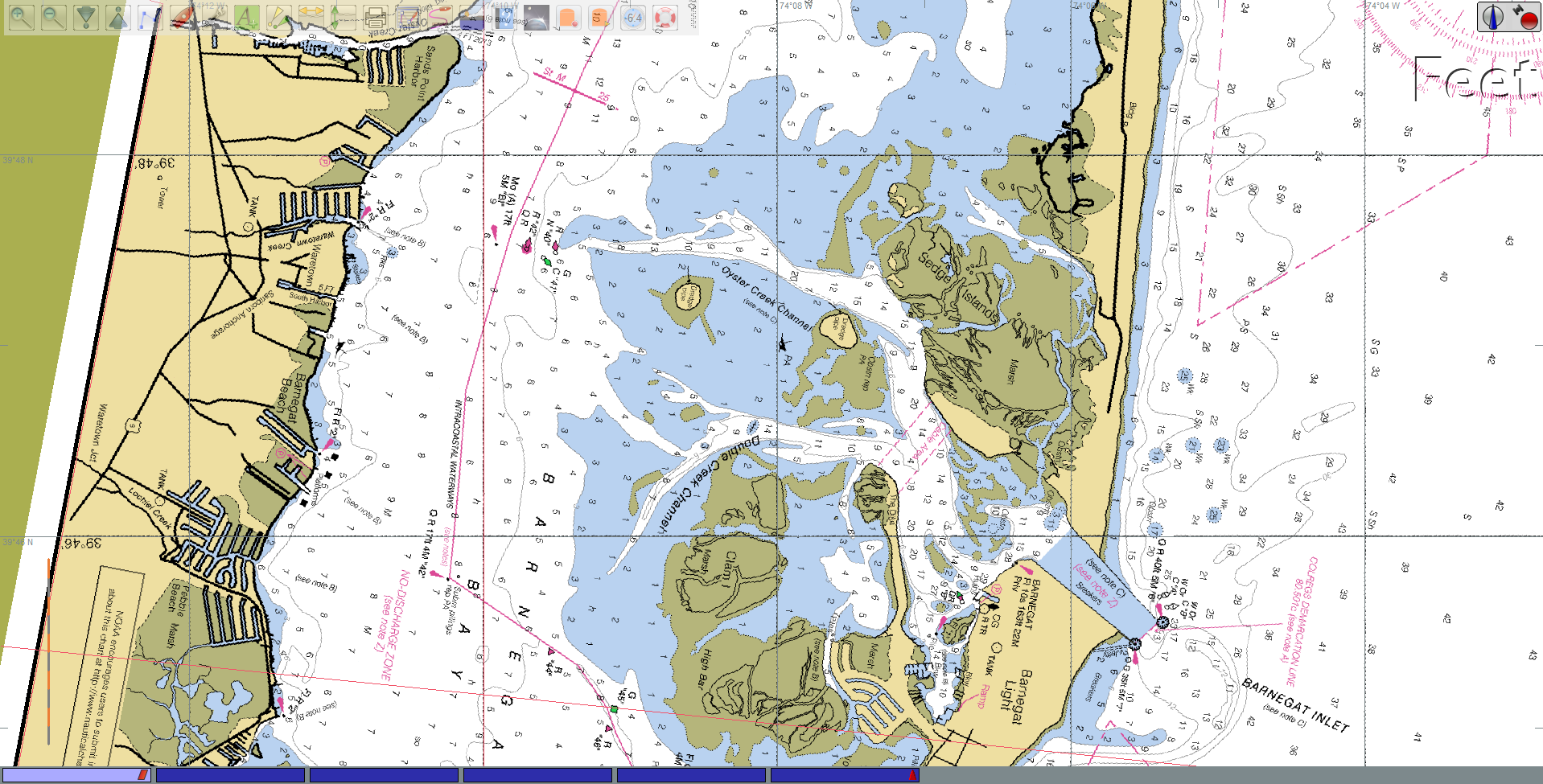 Chart 12324_5: Barnegat Inlet and Bay |
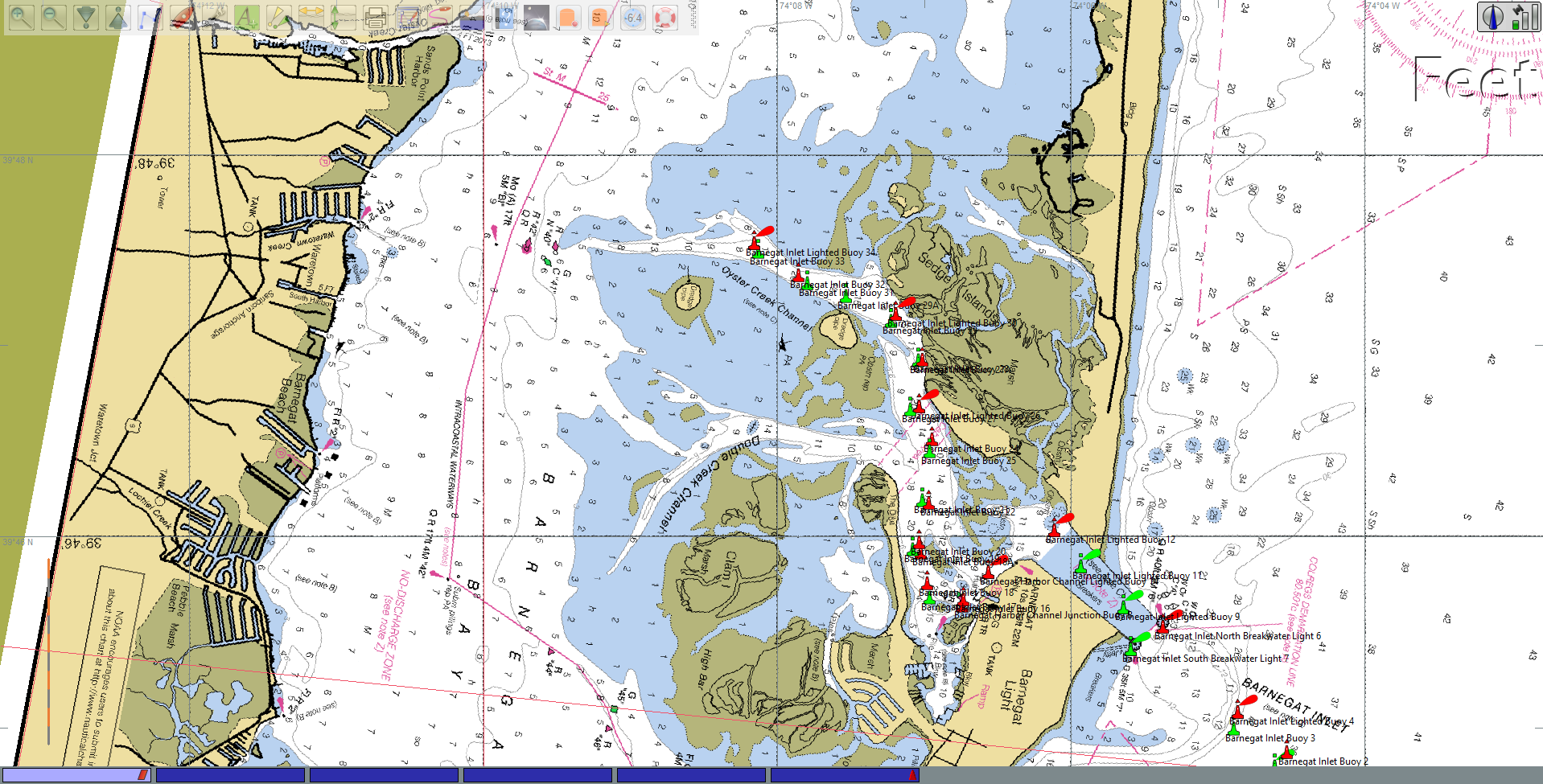 Chart 12324_5: Barnegat Inlet and Bay with LightListManager Waypoints |
On the left is the same chart with the Vol II navaids displayed as waypoints. At this time I was experimenting with different OpenCPN icons for the waypoints rather than just the circles previously used. If you click on the chart image to display it at full resolution you can see a number of lights and day marks have been added in the vicinity of the inlet and the Oyster Creek channel. |
| On the right is zoomed in view of the same chart with the
waypoints displayed. There is a note on the chart (hard to find when viewed electronically) that the marks for the Inlet and the Oyster Creek Channel are not charted because of their frequently being moved. So this is not a case where the charts have not been updated to reflect the latest LNM, but rather where the channel marks will never be displayed. |
 Chart 12324_5: Zoomed-In View of Oyster Creek Channel |
| So LightListManager can produce meaningful
updates for even the most recent NOAA chart versions for
channels and inlets such as these whose marks are not charted. |
|
| Using LightLIstManager and OpenCPN Layers for Uncharted Inlets | |
| The Barnegat Inlet, described above, is just one of many problem inlets (mostly on the U.S. East Coast), for which the inlet channel and channel marks are not charted by NOAA. These inlets are subject to frequent shoalling and shifting of the channel. The USCG or whatever agency is responsible for the marks will reposition the marks each spring to reflect the new location of the channel (if any still exists). | |
| One problem inlet very close to my home port in
Jacksonville, FL is the St. Augustine Inlet. In the screen
capture on the right I have created an area filter for this
inlet and have saved the 11 marks selected by the filter to a
GPX file. I used Google Earth to establish the area limits for this filter. Go to this link for a tutorial on using Google Earth with LightListManager. |
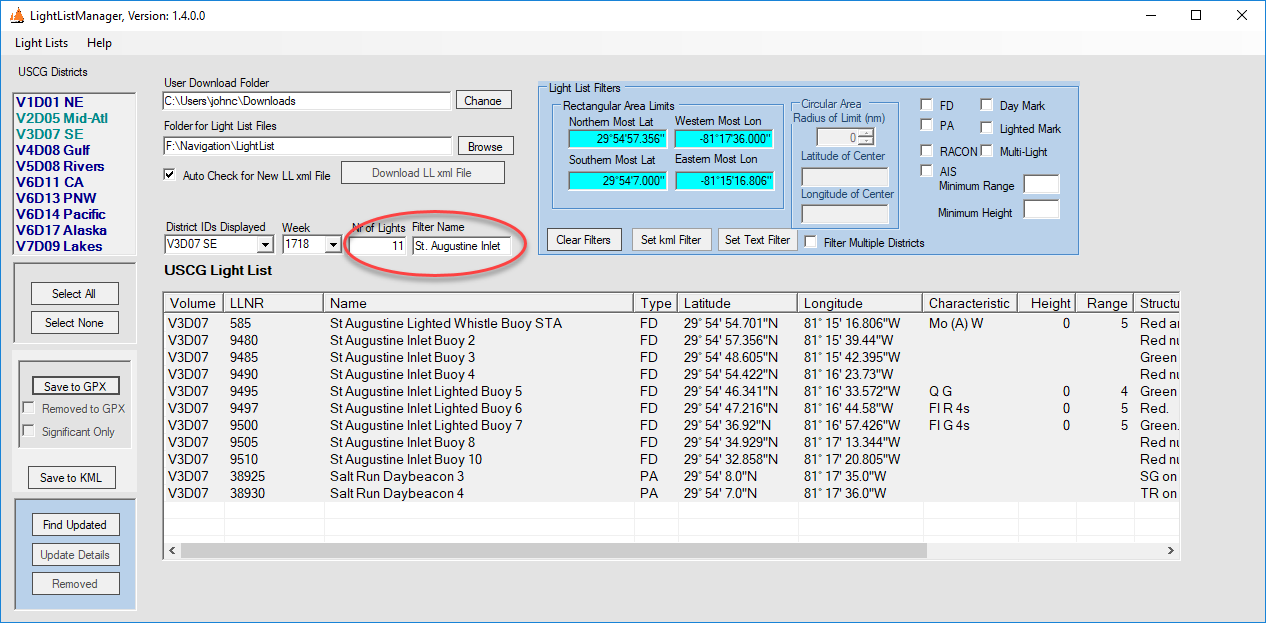 USCG Light List Filtered for the St. Augustine Inlet |
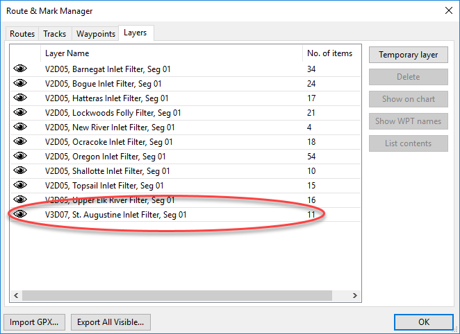 Layers Form in OpenCPN |
Then I copied that GPX file in the OpenCPN layers folder so that it shows up in the Route and Mark Manager form as one of several other layers. |
| When I click the List Contents button on the Layers form, each of the marks in the GPX file shows up as a separate waypoint in the Waypoints form. |
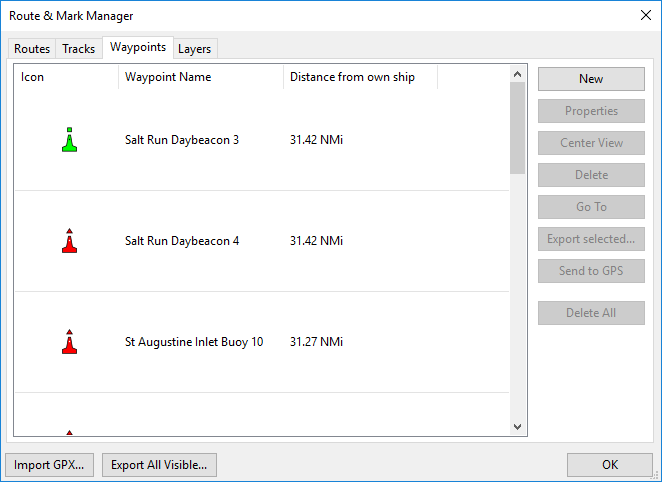 Channel Marks from GPX File Listed as Waypoints |
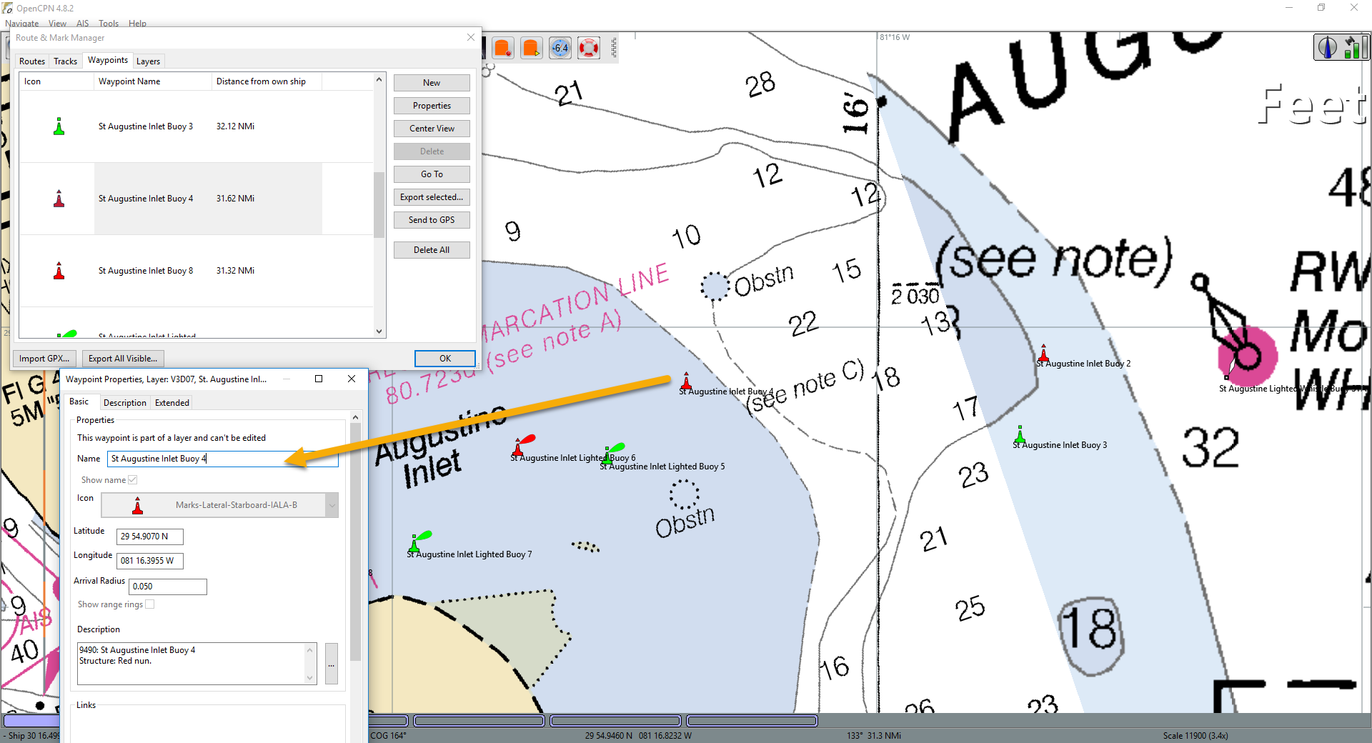 St. Augustine Inlet Marks Plotted on RNC Chart |
When I center the view on Buoy 4, OpenCPN displays this
waypoints showing the marked channel into St. Augustine. I
can right click on any of these waypoint/marks and detailed
intormation on the mark is displayed as the waypoint properties. You will need to click on this screen capture to display it a t full resolution to see all of the information. |
| Here is the same area as displayed by the NOAA ENC charts. |
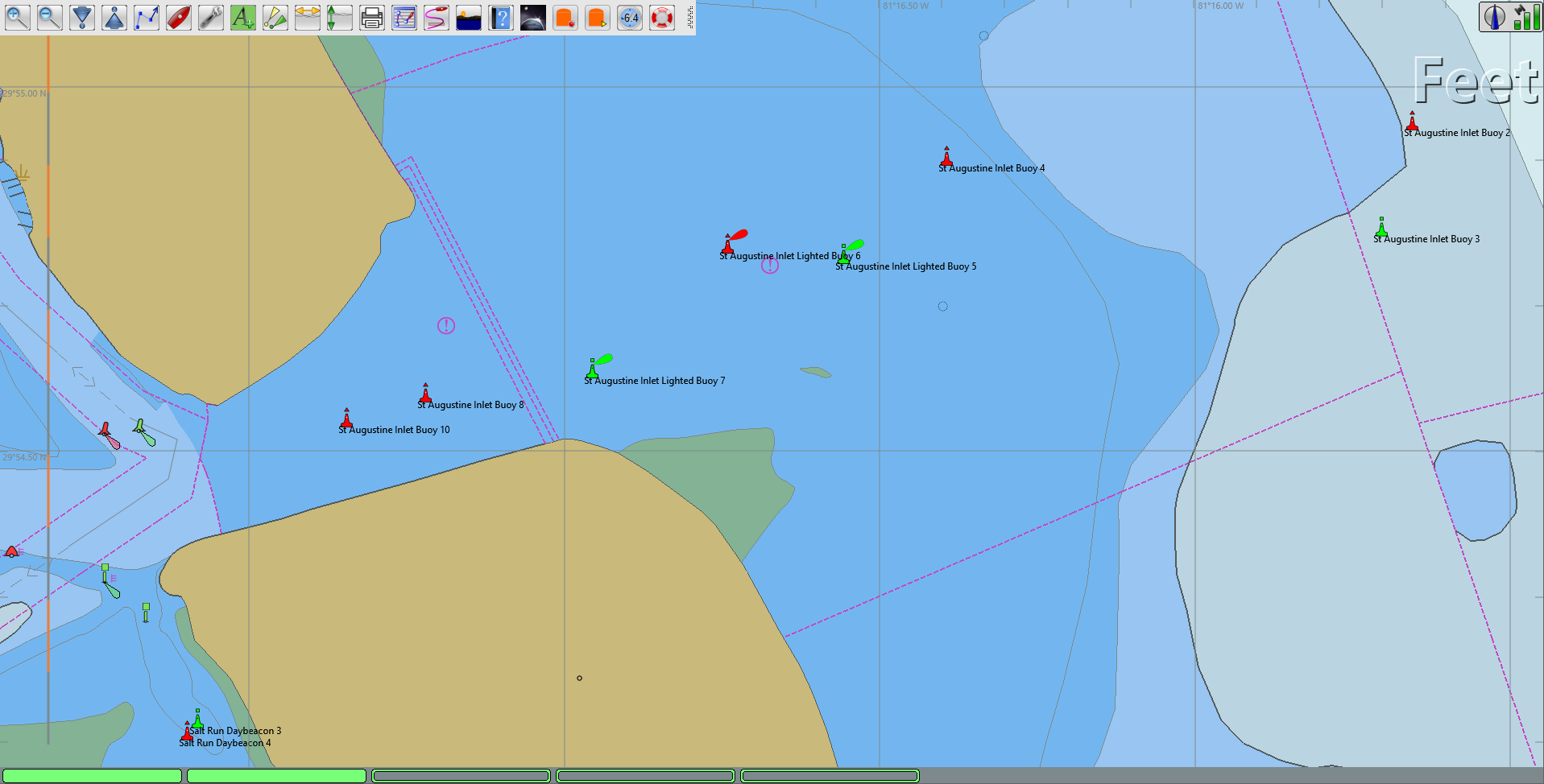 St. Augustine Inlet Marks Plotted on ENC Chart |
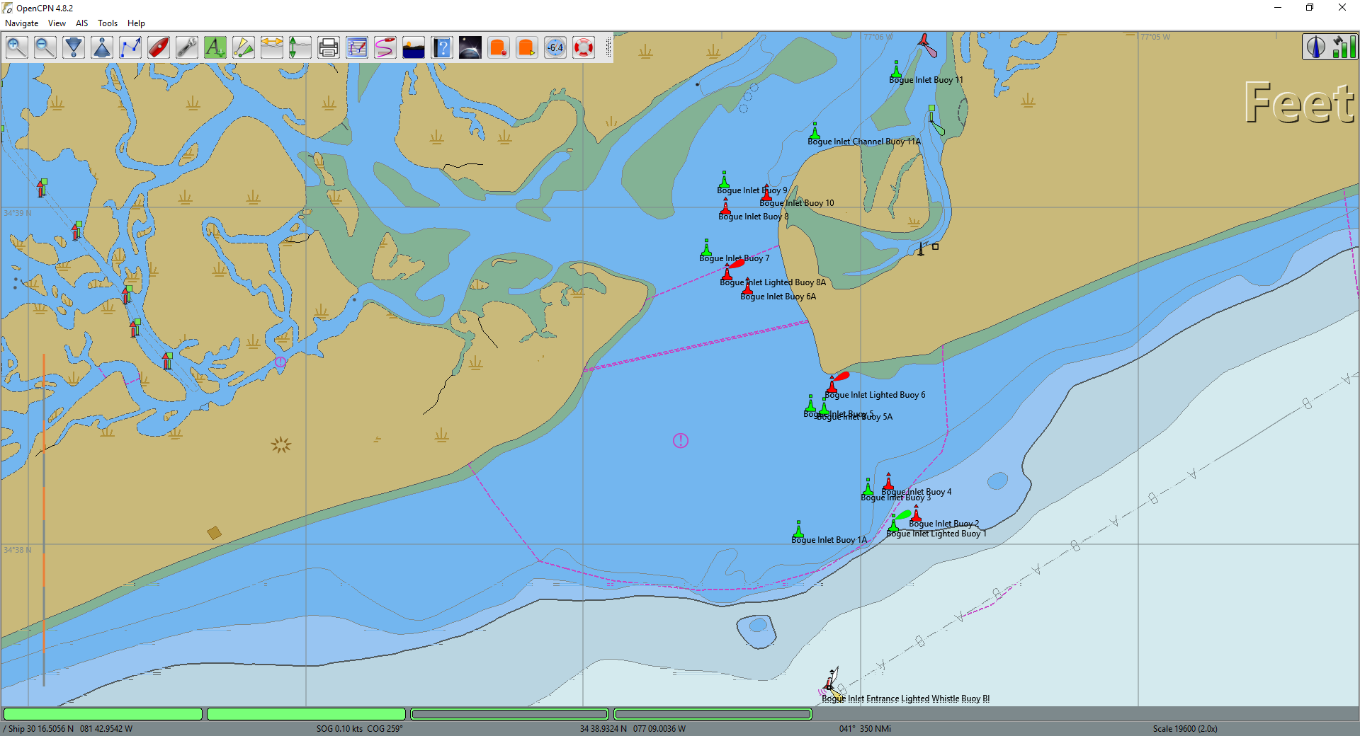 Bogue Inlet Marks Plotted on ENC Chart |
I have used LightListManager to create GPX waypoint files for most of the problem inlets in the SE USA. On the left is a screen capture of the plotted marks for the Bogue Inlet in North Carolina. |
| If you look closely at the marks/waypoints the channel is a
little hard to determine. On the right I've attempted to
draw the channel for this inlet (orange arrows). This points out that even with the location of the marks plotted on the chart there is no guarantee that following those marks wil allow a vessel to safely pass through the inlet. Plotted marks are not a substitute for local knowledge, but it is a start. Also, the USCG Light List xml file is not always error-free. Some errors are typos, others are errors from the source (e.g., PA lights). I have shown a channel route going from the sea buoy to the 1A daymark. This looks a little strange and may be the result of an error in the position of that mark. Caveat emptor! |
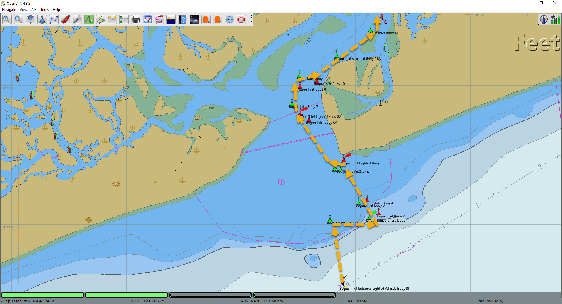 Bogue Inlet with Possible Route Plotted on ENC Chart |
| Here are a few more of the inlets for which I have created GPX files with waypoints/marks. | |
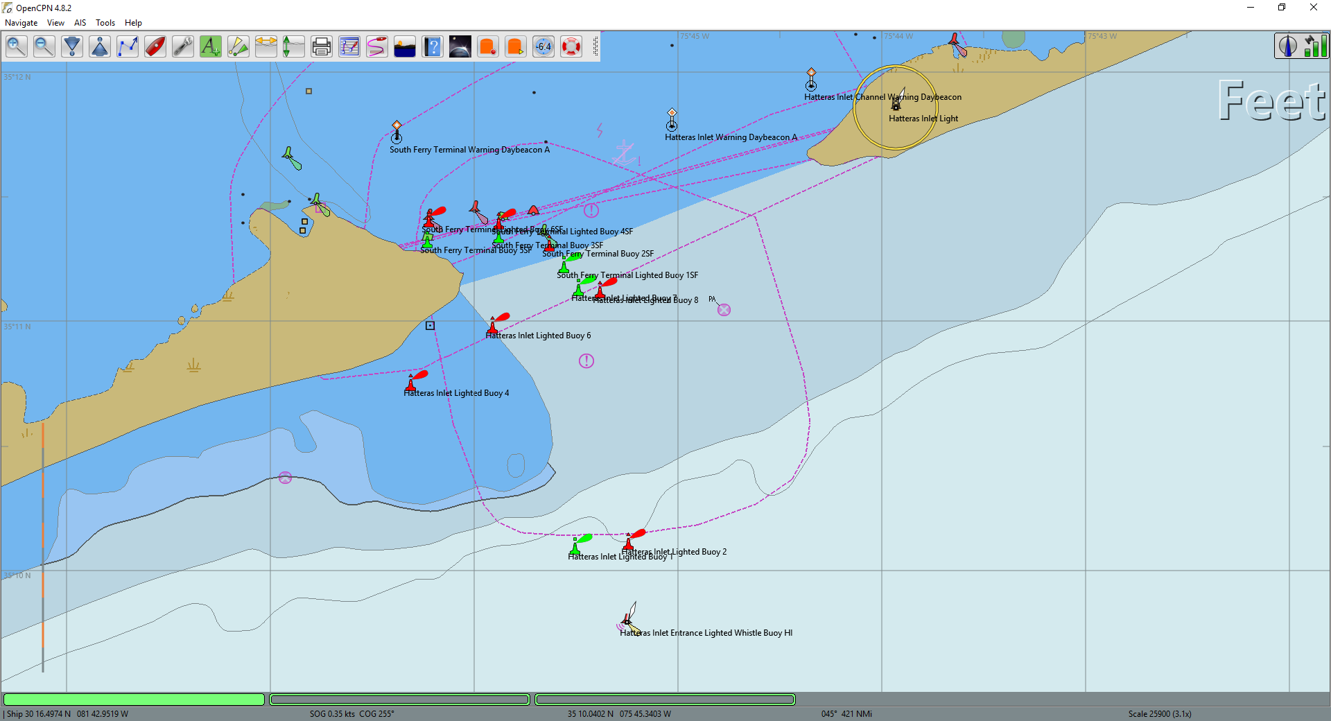 Hatteras Inlet, NC on ENC Chart |
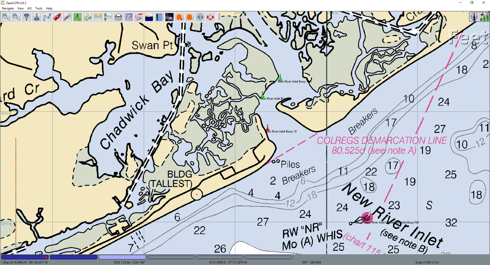 New River Inlet, NC on RNC Chart |
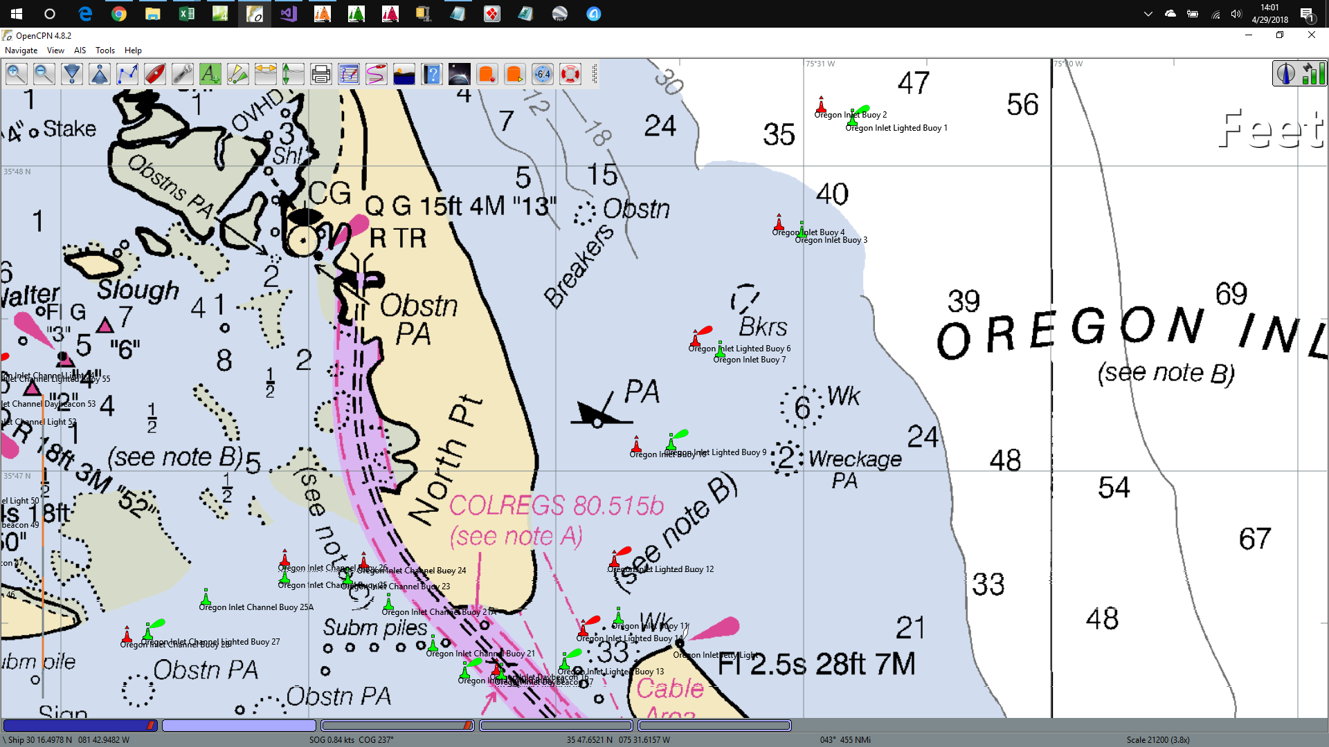 Oregon Inlet, NC on RNC Chart |
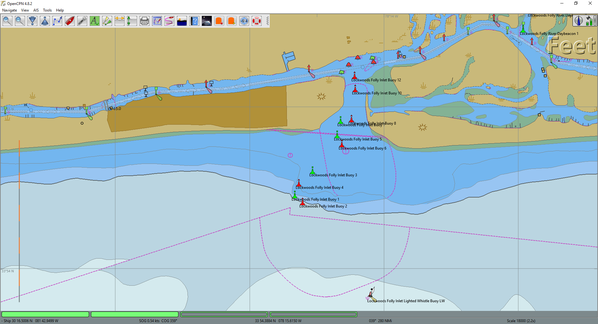 Lockwoods Folly Inlet, NC on ENC Chart |
| Below is a video I made of how the LightListManager might be used to navigate the uncharted St. Augustine, FL inlet. It covers the use of the OpenCPN layers for this inlet as well as using the LightListManager Radar Display. | |