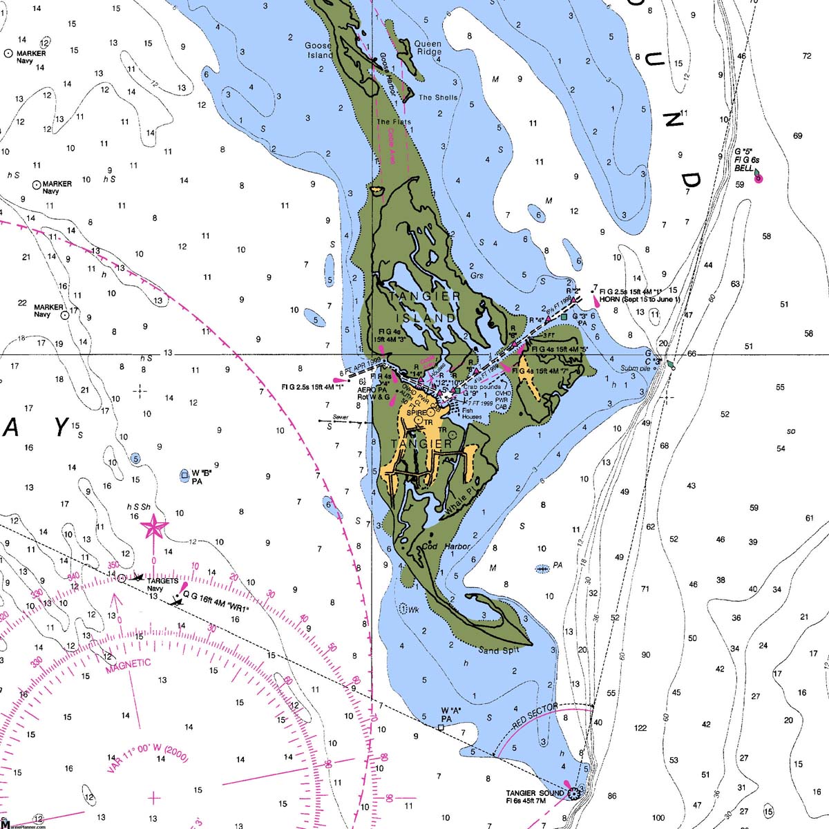
The Chesapeake Bay
| Tangier Island | |
 Tangier Island |
Tangier Island is one of the Chesapeake's two true islands (not a peninsula or not connected to the main land by a causeway) with a significant permanent population. The other being Smith Island, just to the north across the MD/VA state line. The economies of both islands are almost totally dependent upon the bay (crabbing and oystering), but over the last 30 years tourism has also become important. The combination of a remote island and the isolated lifestyle of these islands has made them a popular destination for sailors on the Chesapeake Bay for several generations. |
| In the late 1970s, when the pictures below were taken, there was a tourist excursion ferry out of Reedville, VA that used to take people for day and overnight trips to Tangier Island. I don't know if that service is still in operation. The islands are served commercially by other ferry services, primarily out of Crisfield. These ferries also took children to school on the Eastern Shore. I think even the Tangier children went to school in Crisfield, MD although they are residents of Virginia. There might be a school on Tangier, at least there was a gymnasium when I last visited in 1979. | |
|
Moderate draft vessels (6' or less) should have no
trouble visiting Tangier from either the Tangier Sound or bay-side entrances.
Vessels drawing more than 6' should probably use the bay-side entrance. This is the harbor in Tangier, taken from what was then the only commercial marina on the island. |
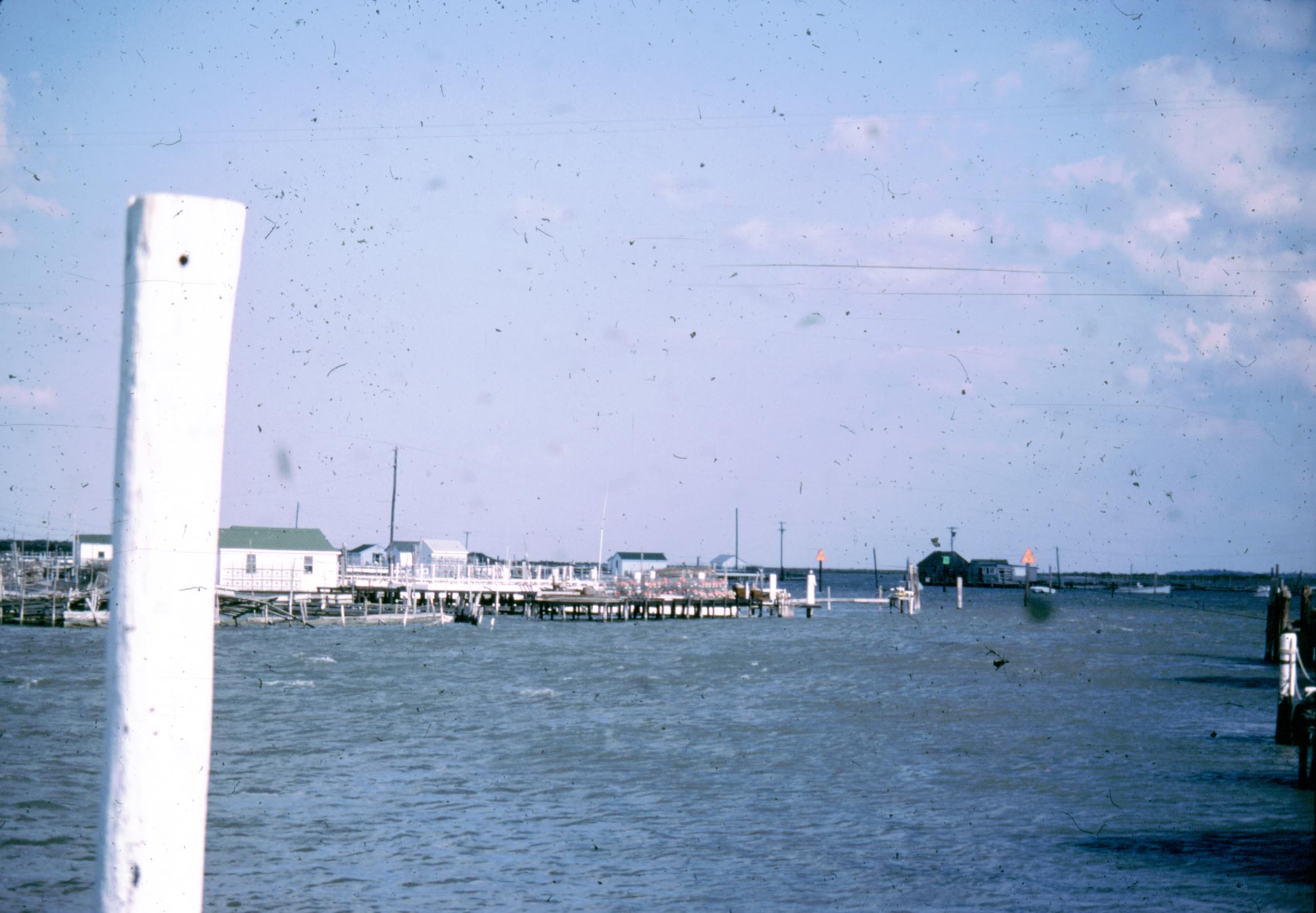 Tangier Island Harbor |
|
|
|
 Waterman Community on Tangier Island |
The island is mostly marsh, and the homes are clustered wherever there is solid ground. |
| At the time I last visited in 1979, there were few automobiles on Tangier Island, but they had discovered golf carts. Still most people got around the island by small boat or on foot. |
 Tangier Island Road |
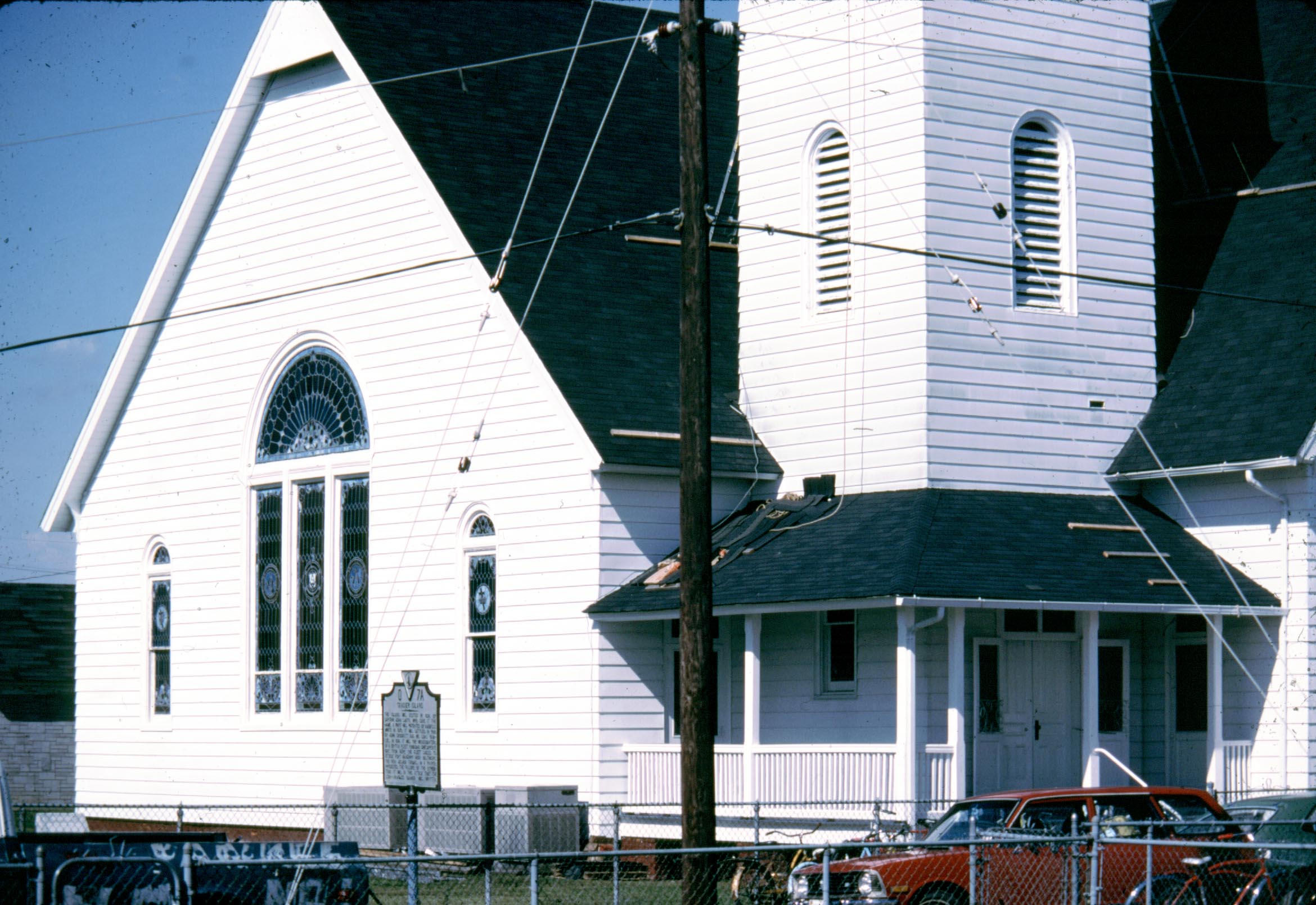 Chruch on Tangier Island |
|
| With a water table just a few inches below the surface, graves are above ground. The Pruitt and Crockett names seemed to be the most prominent on the grave markers. |
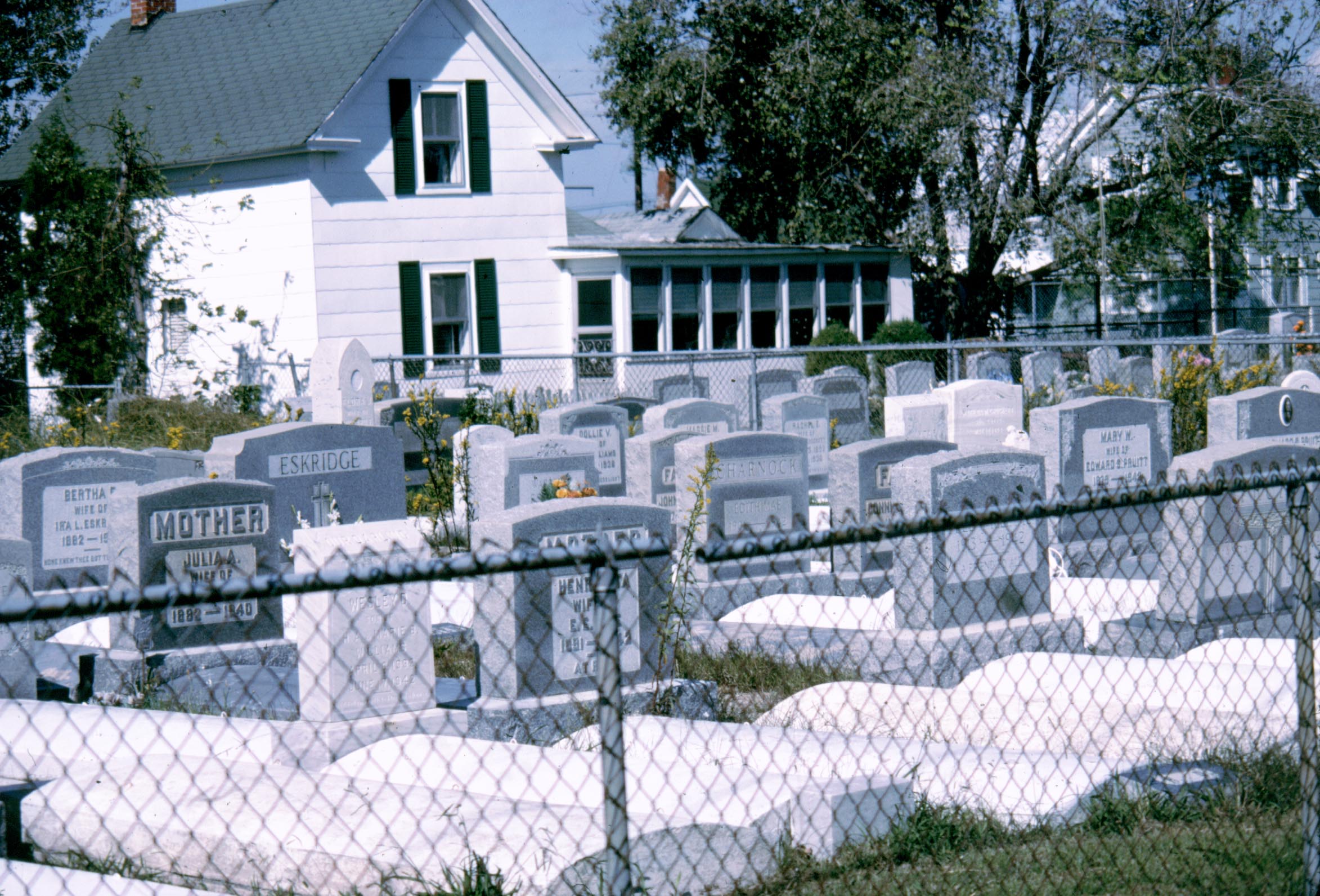 Cemetary on Tangier Island |
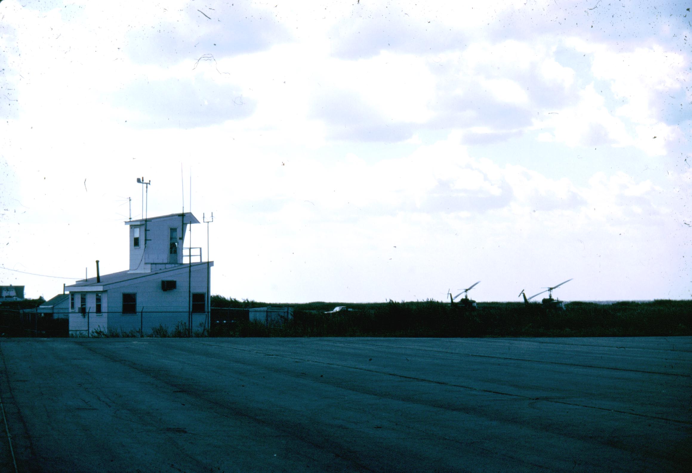 Airfield on Tangier Island |
At this time (1979) there was a small airfield on Tangier. It is still shown on the charts so I assume it is still operational. |
| The day after John, Christy and I arrived on Tangier Island from the Pocomoke in the fall of 1979 a strong cold front came through with 20+ kt. winds out of the NW. This gave us a convenient reason to spend an extra day on the island. |
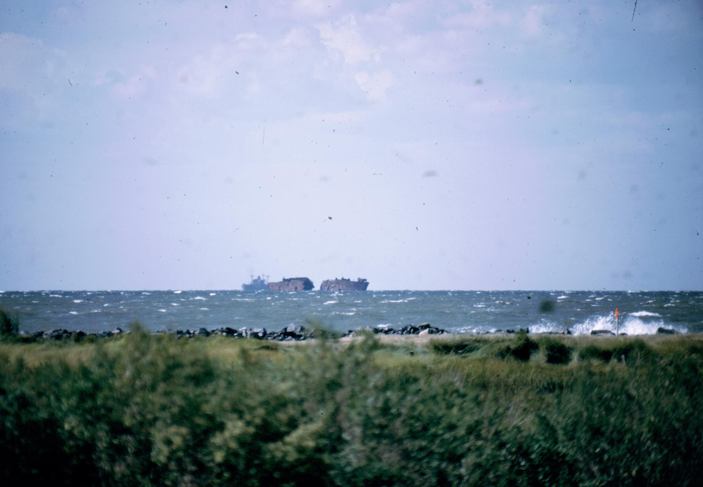 Man-Made Reef Off Tangier Island |
Conditions like these have constantly eroded both Tangier and Smith Islands. There has been a great deal of work done to curb this erosion, including the creation of a man-made reef off Tangier. I belive those freighter hulks are part of that reef. I don't know if any of these efforts have had a beneficial effect. |
|