Sailing Topics
| Day 9: Beaufort, NC to Top Sail Sound | |
| After three days waiting out the gale force winds in Beaufort, NC on Saturday, Oct 16 we finally started heading back down the ditch. We had hoped to go outside at Moorhead City, but the forecast for continuing SW and S winds took that out of consideration for at least the next week. So we're heading for Southport and the Cape Fear Inlet to see if conditions improve contrary to the forecast. | |
 Although
the day was sunny and the wind was not out of the North it was still a cold
day on the ditch. Initially we had a strong current with us adding a
full knot to our speed. By mid-day the tide had changed we had a
counter current for most of the rest of the day. Although
the day was sunny and the wind was not out of the North it was still a cold
day on the ditch. Initially we had a strong current with us adding a
full knot to our speed. By mid-day the tide had changed we had a
counter current for most of the rest of the day. |
|
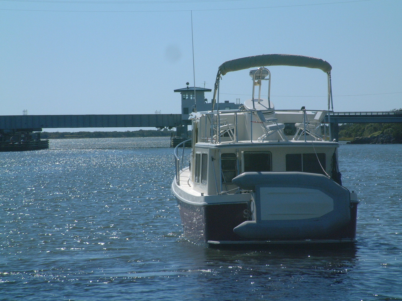
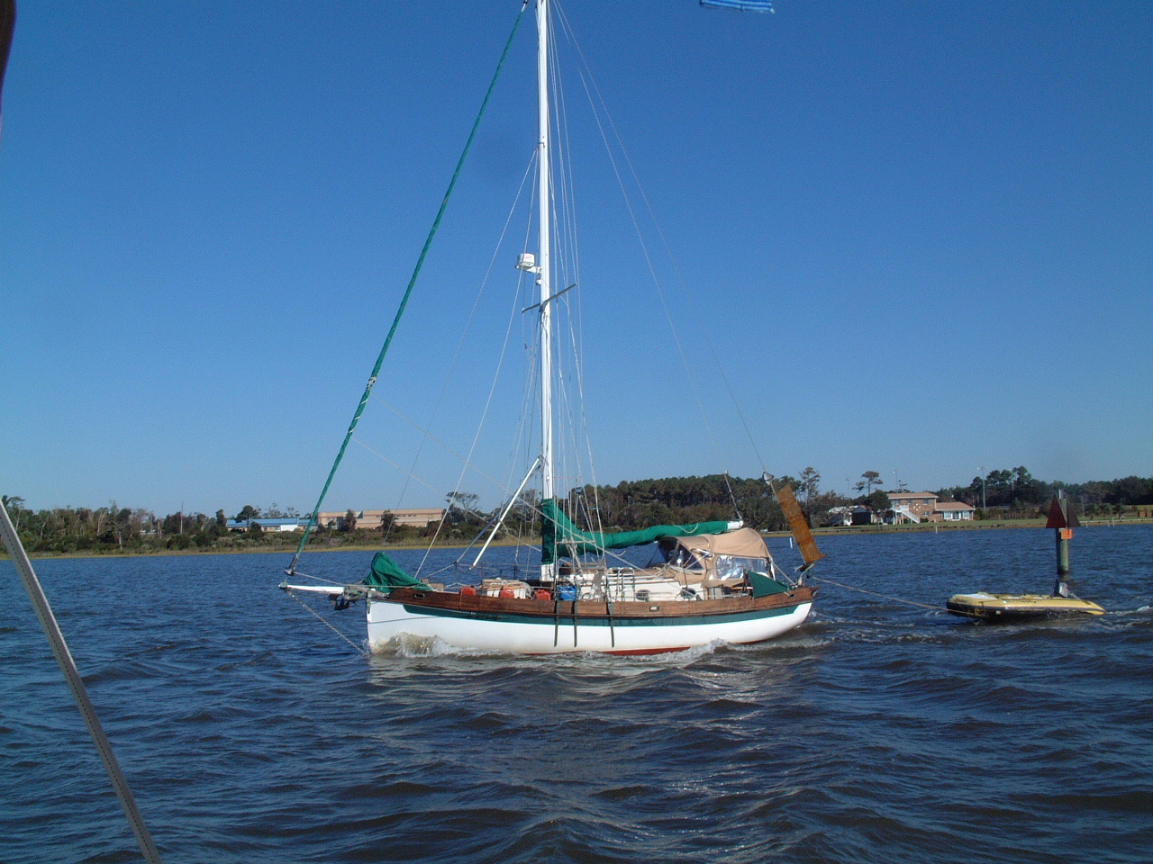 Along
the way we were passed by a number of power boats and we passed a few
sailboats including this interesting small cruising sailboat. Along
the way we were passed by a number of power boats and we passed a few
sailboats including this interesting small cruising sailboat. |
|
 The
ICW in this area is very narrow and very shallow if you stray outside of the
channel. The
ICW in this area is very narrow and very shallow if you stray outside of the
channel. |
|
| This area of the ICW includes the live fire exercise area of Camp Lejeune, the Marine Corps training base. When the Marines are conducting firing exercises this portion of the ICW is closed. Today was a weekend and we encountered no delays transiting the Marine Corps ICW. Finally we cleared the swing bridge at Onslow Beach and left the Camp Lejeune area. |
 |
 |
|
 |
|
 |
|
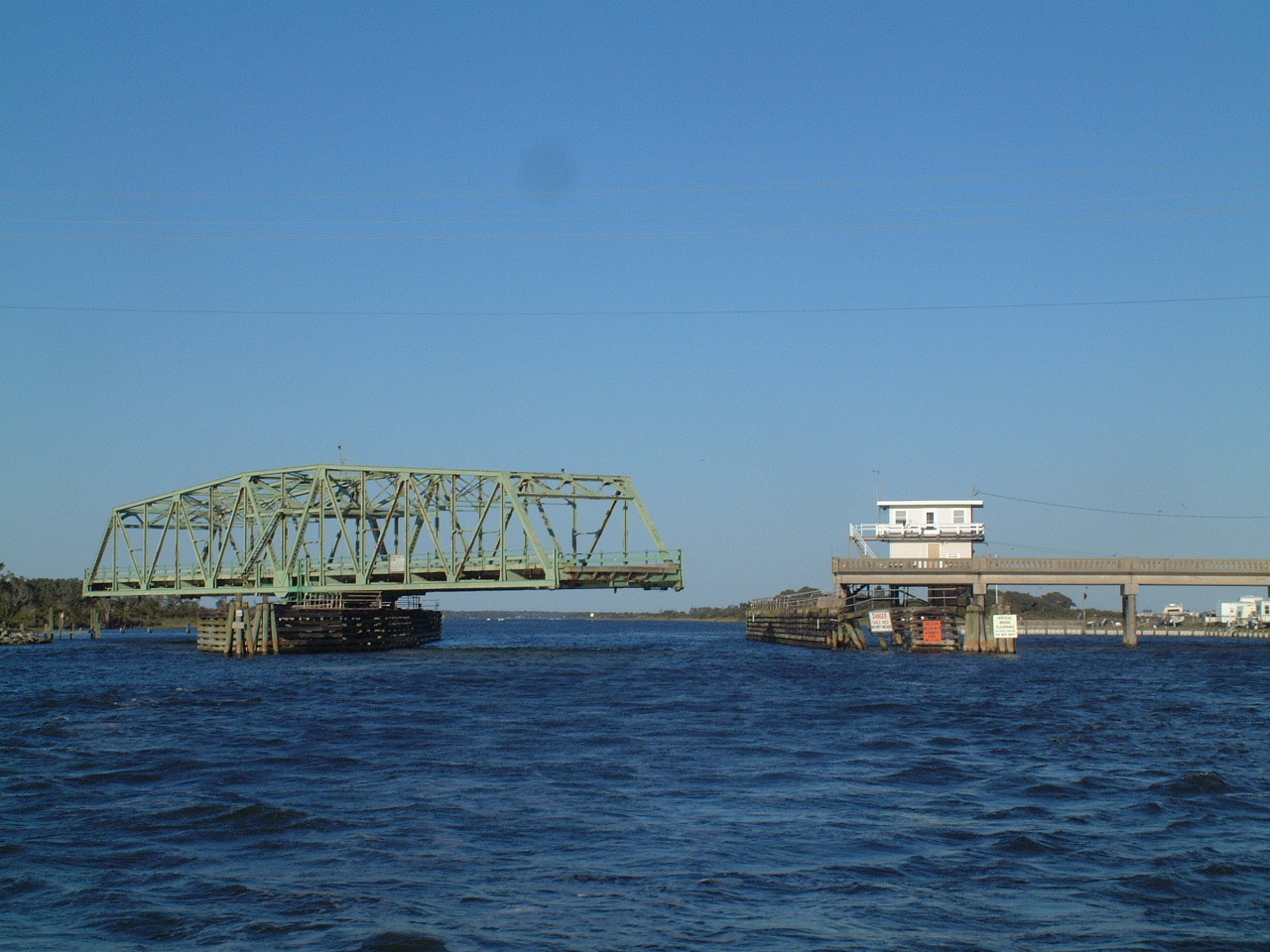
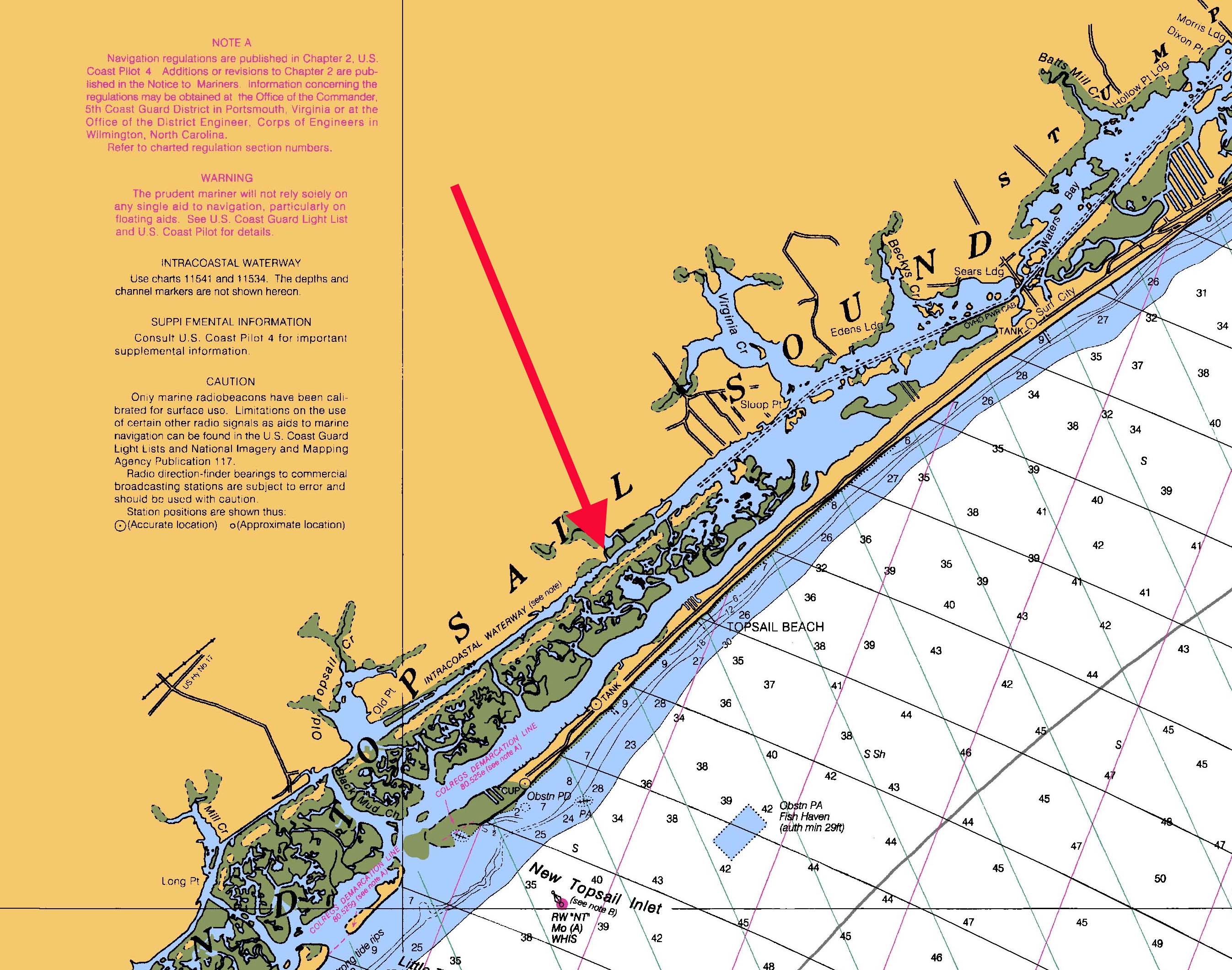
| By mid afternoon we had to decide how far we could go this
day. We passed the popular anchorage at mile 245 as it was still early
in the afternoon. To find a decent marina we had to pass through the
Surf City swing bridge at 5:00PM. This bridge only opens on the hour
and if we missed the 5:00PM opening we would not be able to get to get to a
decent marina before dark. There were a number marginal anchorages
enroute, but none offered much protection from the strong W winds. At 4:00PM we realized we were still over 8 miles from the bridge, making less than 7 MPH (we navigated on the ICW using primarily statute miles (SM) and miles per hour (MPH) ) and bucking head winds and an adverse current. There was no way we believed we could make the bridge by 5:00 PM. I elected to increase engine RPMs from 2000 to 2400 and we picked up nearly one MPH. Then the counter current diminished and suddenly we were making 8.5 MPH over the bottom. We arrived at the bridge 2 full minutes before the scheduled opening and proceeded on to the Harbor Village Marina (red arrow on chart) about 6 miles south of the bridge.
|
 |
 |
|
| Go to Next Leg | |