Sarah's Atlantic Circle
| Lagos to Madeira | |
| During my winter in Lagos I started to plan the return to the USA the following spring. I wrote an article on my planning and the actual voyage and submitted it to Ocean Navigator for publication. A condensed version of the article was eventually published in the Ocean Navigator Newletter a year or so later. Here is a link to the original article as submitted to Ocean Navigator. | |
| On May 6, 2007 Bob Calt and I departed the Marina de Lagos enroute
to the Portuguese Island of Madeira as our first stop on the voyage back
to the Chesapeake Bay. We had delayed our departure by nearly a week waiting for the Atlantic high pressure ridge to settle into a favorable position over the Azores Island chain. Now we could expect strong northerly winds to push us to the SW toward the island of Madeira. |
|
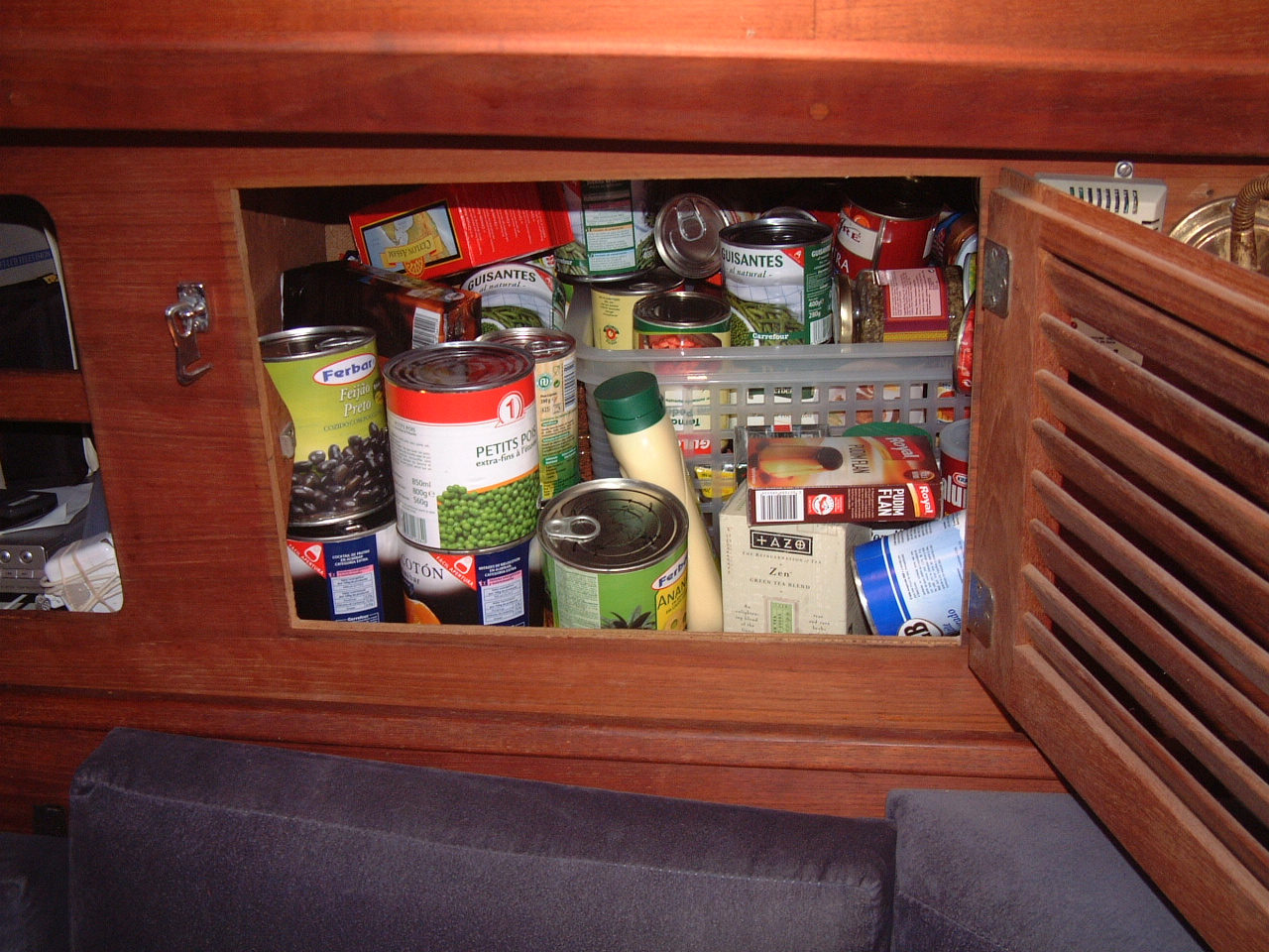 Although
we expected to be able to re-provision in Madeira we attempted to stock
Sarah with as many food and supplies as practical before departure. As
usual this meant that most lockers on Sarah were filled to overflowing. Although
we expected to be able to re-provision in Madeira we attempted to stock
Sarah with as many food and supplies as practical before departure. As
usual this meant that most lockers on Sarah were filled to overflowing. |
|
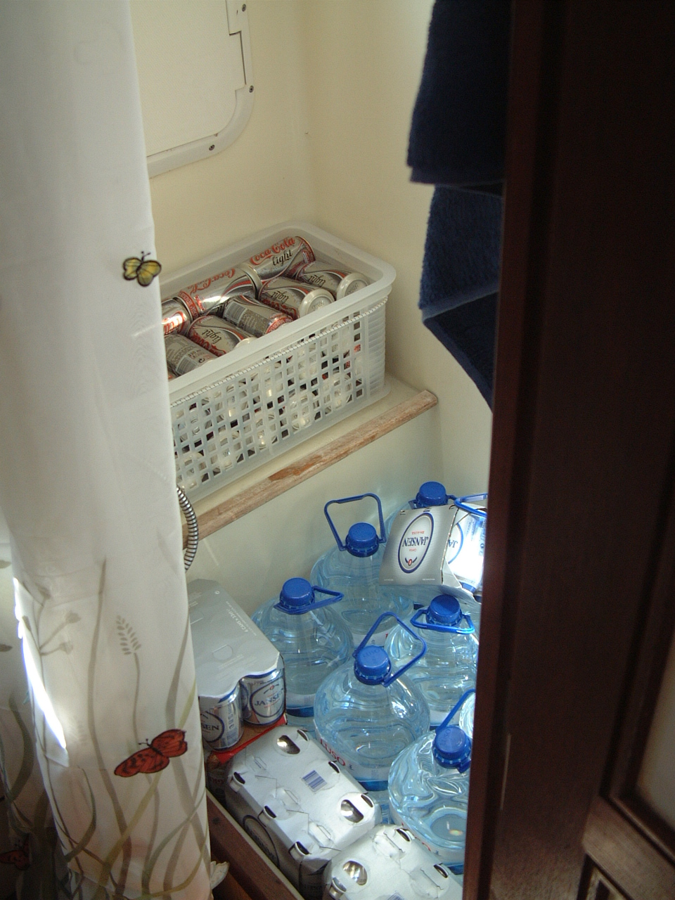 Heavy
items, particularly bottled water and sodas were stored in the shower
stall. Heavy
items, particularly bottled water and sodas were stored in the shower
stall. |
|
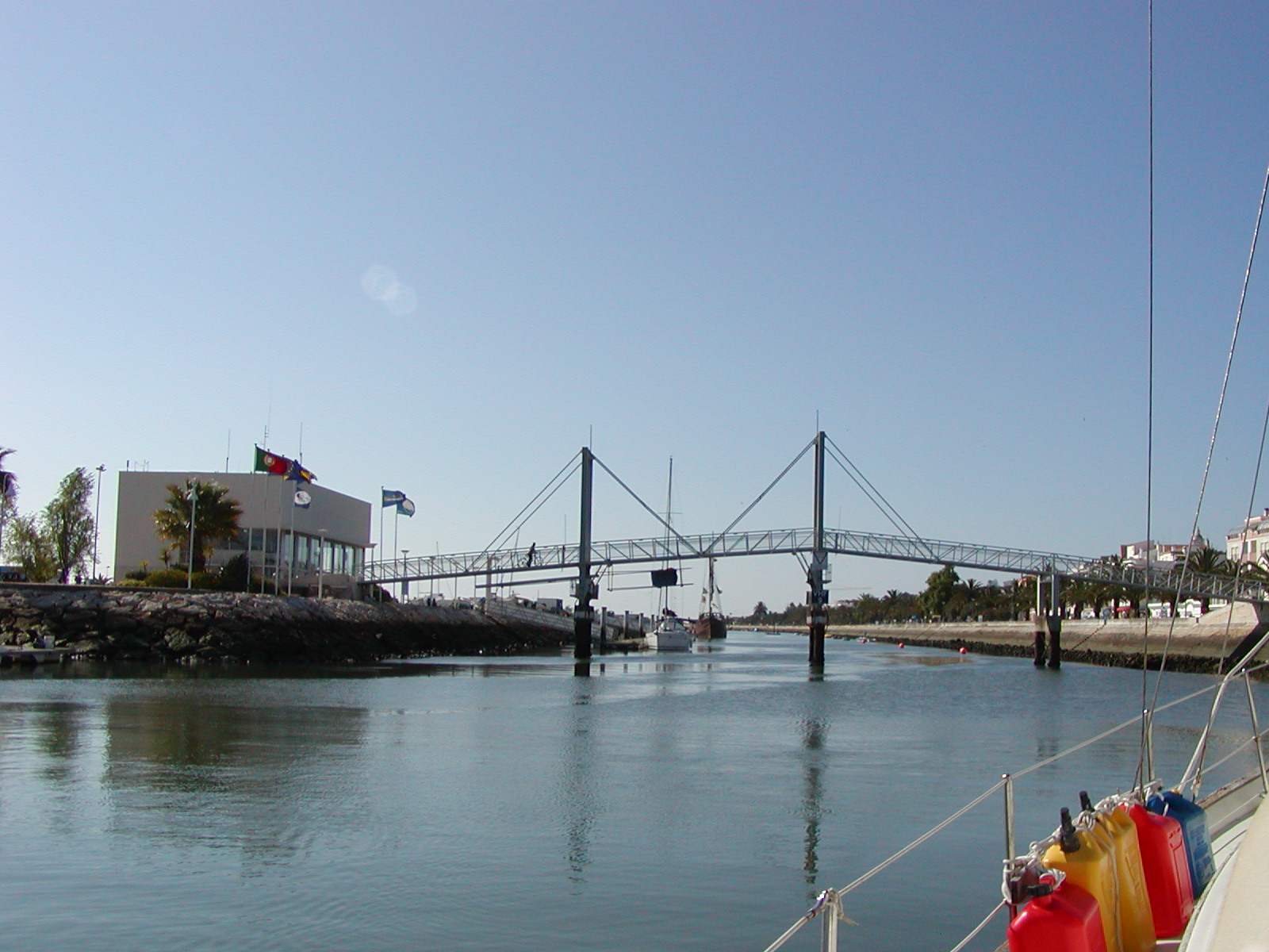 Photo by Bob Calt |
Before departing the Marina we had to wait until the lift bridge was opened. |
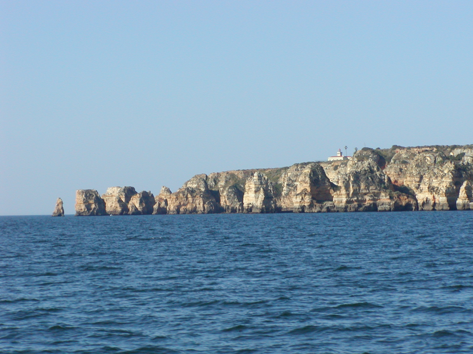 Then
we passed south of the Ponta da Piedade rock formations outside of the
Lagos and headed for Cabo Sao Vicente. Then
we passed south of the Ponta da Piedade rock formations outside of the
Lagos and headed for Cabo Sao Vicente. |
|
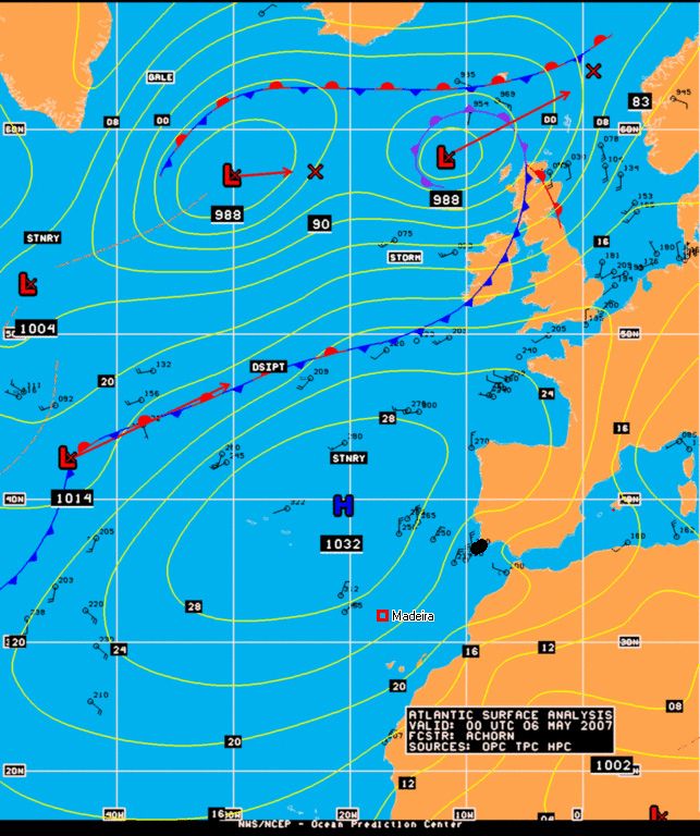 Chart by NOAA |
Once
we cleared Cabo Sao Vicente we picked up a strong breeze out of the NNW,
which drove us quickly toward Madeira. We initially steered Sarah with
the Monitor Windvance, but after 24 hours I discovered that the control
lines were chafing badly. I didn't want to attempt to replace the
contol lines underway in fairly large seas so we steered the remainder
of the way to Madeira under autopilot. The NOAA Atlantic Surface Analysis for May 6 at 00z (12 hours before our departure) shows the well established high pressure over the Azores with strong northerly winds off the coast of Portugal, extending nearly all the way to Madeira. |
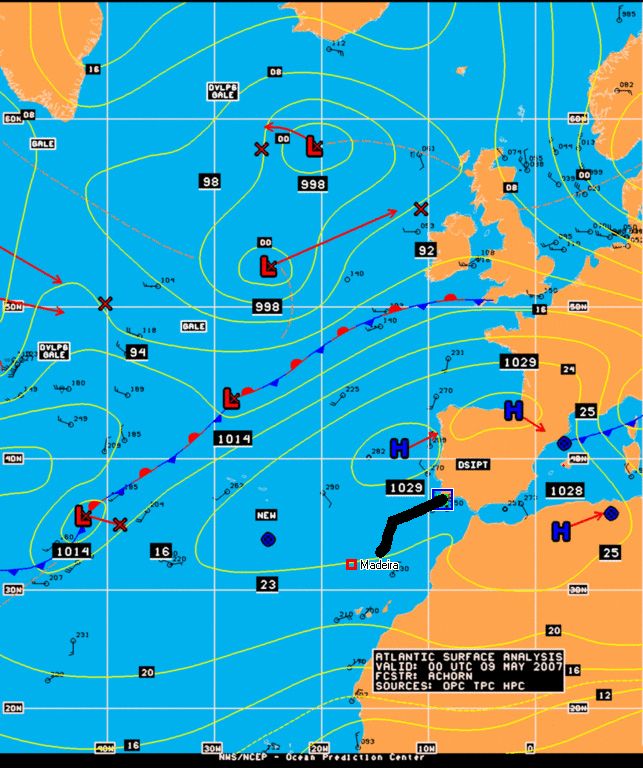 Chart by NOAA |
For the first 36 hours of the passage we sailed west and north of the rhumb line course to Madeira to keep the NNE winds on our starboard quarter. Grandually the winds veered more easterly so that we could jybe to the south and eventually re-cross the rhumb line. |
 On
the third day the breeze died and we picked up what we thought was a
stowaway - this small swallow. It must have hitched a ride on another
vessel and left trying to find land. It found Sarah instead and landed
exhausted on the foredeck. On
the third day the breeze died and we picked up what we thought was a
stowaway - this small swallow. It must have hitched a ride on another
vessel and left trying to find land. It found Sarah instead and landed
exhausted on the foredeck.At first the bird ignored us, probably trying to find out what sort of an island it had discovered and where the food was. After a few hours it flew into the cabin. It was so exhausted and hungry it no longer feared our touching it. |
|
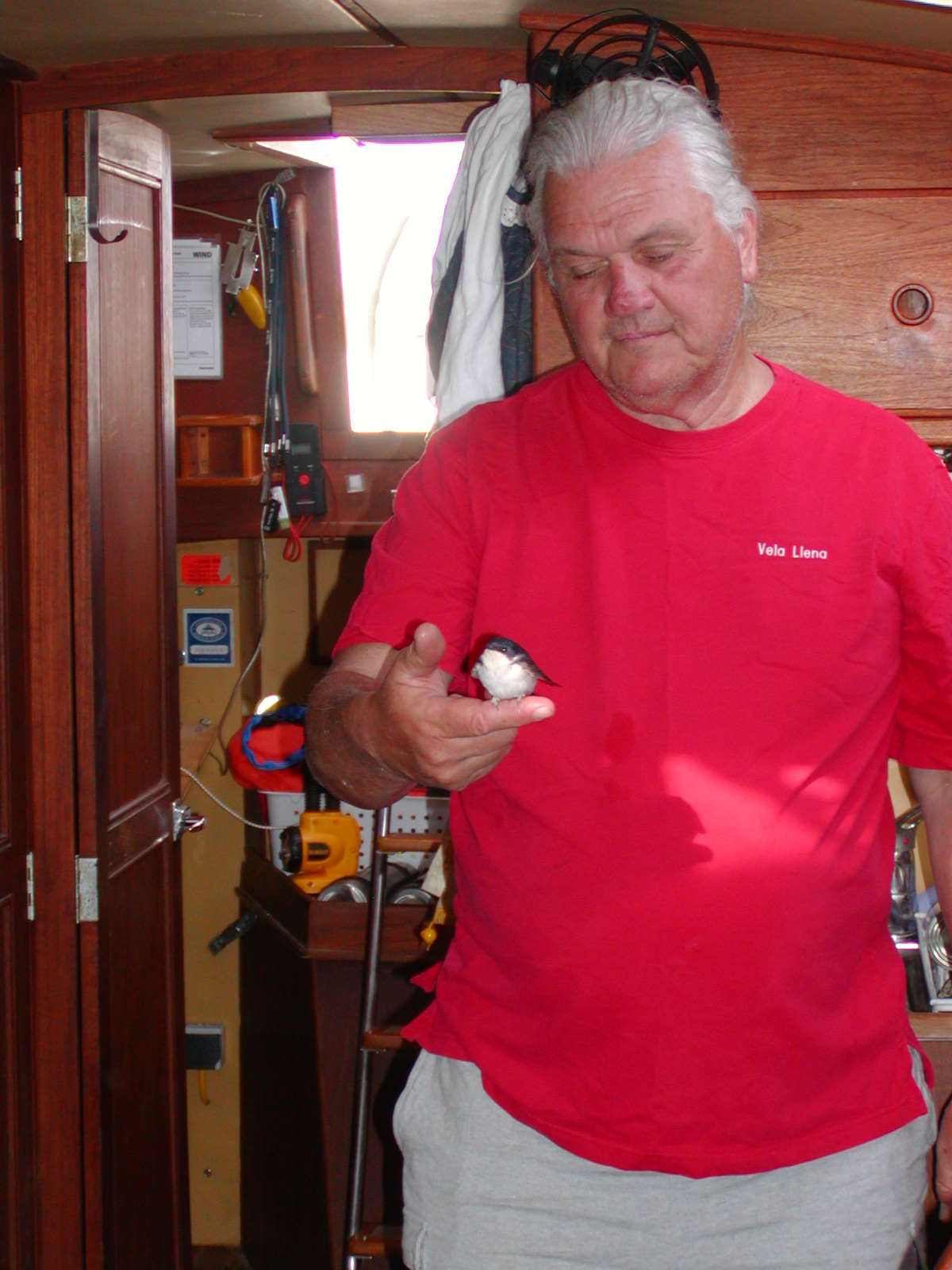 Photo by Bob Calt |
We tried to feed it some water and water soaked bread crumbs, but it didn't seem to think that was food. Swallows are insect eaters and there aren't too many insects 200 nm off shore. While perched on my finger the swallow repeatedly tried to get some sleep by tucking its head back under its wing. |
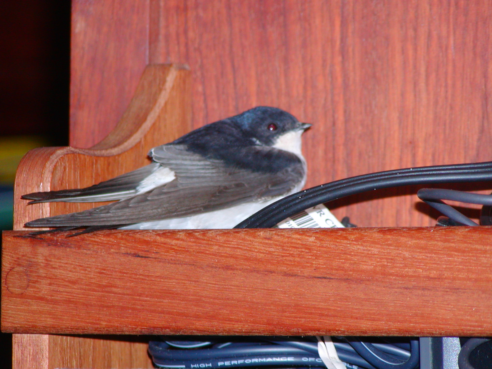 Photo by Bob Calt |
That
evening we could see the swallow flying back and forth in front of
Sarah's bow light as we motored toward Madeira. The next morning, off Madeira, I found the dead swallow on the foredeck. It must have died of starvation. I dropped the body overboard and assumed we had seen the last of stowaway swallows. Later that day when we berthed Sarah in Calheta I discovered the body of a second swallow under my laundry bag. So there was a pair of them and they both died. Those deaths took a little off the enjoyment of our landfall on Madeira |
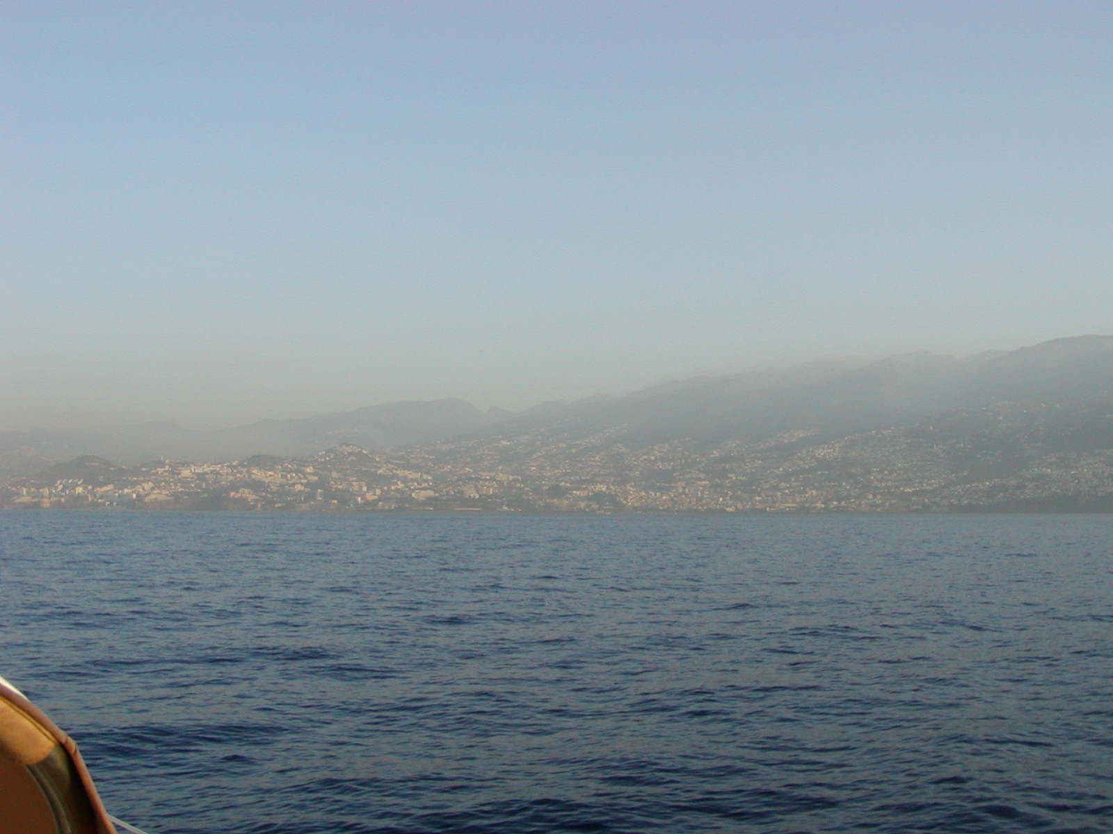 Photo by Bob Calt |
We made our landfall on Madeira well before dawn. At night the lights of the island were clearly visible, but as we got closer and the Sun began to rise, the island became obscured by a thick fog. Later that morning the fog lifted into a heavy haze and we could make out details on the island as we motored down the south coast toward the marina in Calheta. The photo on the right shows some of the urban area near the principal city of Funchal. |
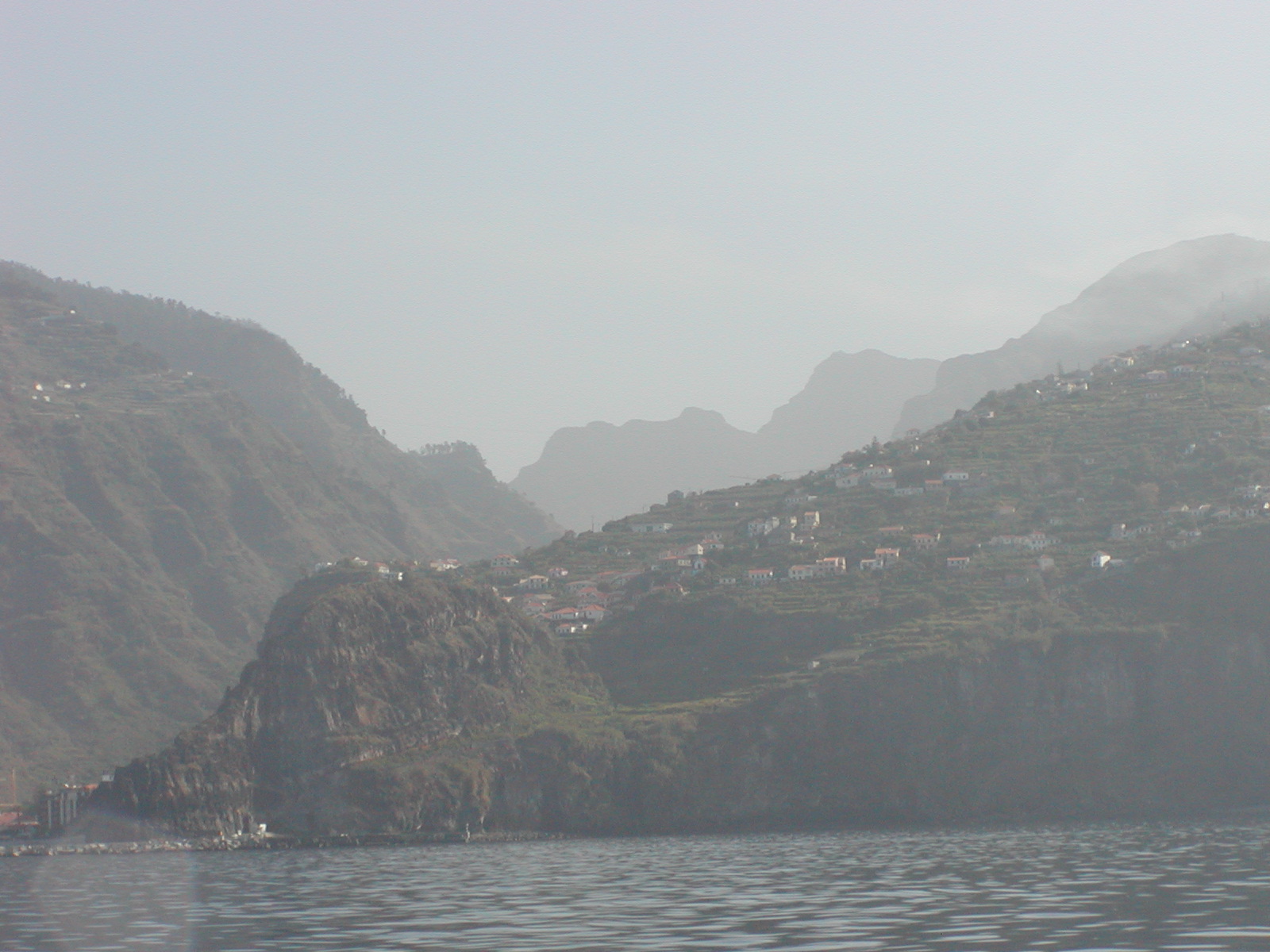 Photo by Bob Calt |
Even
with the haze we could see that Madeira is a very rugged, mountainous
island. The island consists of a series of mountain ridges (the locals
call them Lombos - Portuguese for loin or rib) that run cross-wise (N-S)
along the island. We would later experience the massive engineering
project that has produced a major highway system on the island
consisting of tunnels through the Lombos and bridges to span the valleys
in-between.
|
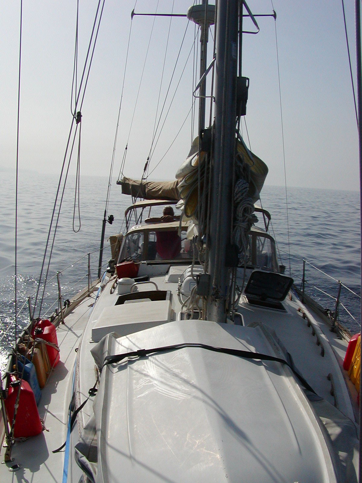 Photo by Bob Calt |
We spent the entire morning motoring along the south coast of Madeira heading for Calheta in calm seas. |
| Here is a link to the log of the voyage from Lagos to Madeira in a MS Excel Workbook | |
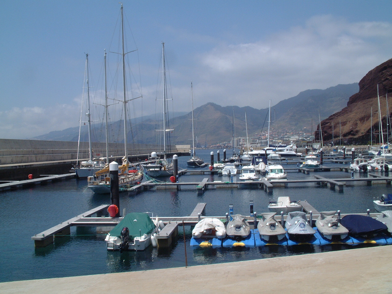
| While on Madeira I surveyed the yacht harbors on the island. | |
| Porto de Recreio da Calheta | |
 I
had surveyed the available marinas in Madeira before we departed Lagos.
There are four marinas on the main island of Madeira and one on the
smaller island of Porto Santo. Since we wanted to spend a good deal of
time touring the island of Madeira and didn't want to be tied to ferry
schedules, I limited my survey to those on Madeira. I sent emails to
all four, but received responses from only two - Porto de Recreio da
Calheta and Marina de Lugar do Baixo. Lugar do Baixo responded that the
marina was closed and recommended I go to Calheta. Calheta responded
that they would have plenty of space for Sarah - so Calheta it was. I
had surveyed the available marinas in Madeira before we departed Lagos.
There are four marinas on the main island of Madeira and one on the
smaller island of Porto Santo. Since we wanted to spend a good deal of
time touring the island of Madeira and didn't want to be tied to ferry
schedules, I limited my survey to those on Madeira. I sent emails to
all four, but received responses from only two - Porto de Recreio da
Calheta and Marina de Lugar do Baixo. Lugar do Baixo responded that the
marina was closed and recommended I go to Calheta. Calheta responded
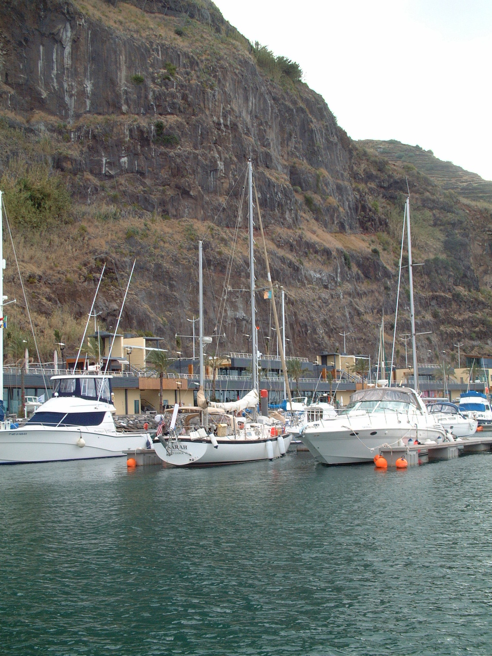
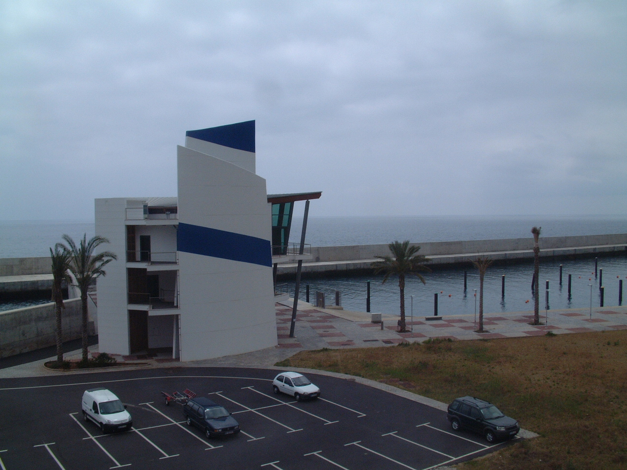
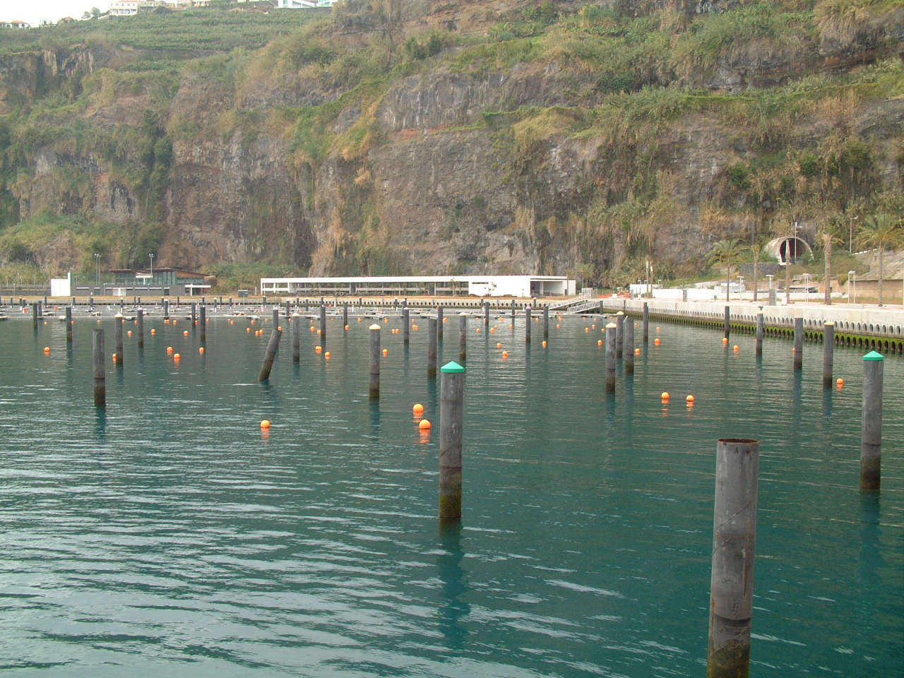
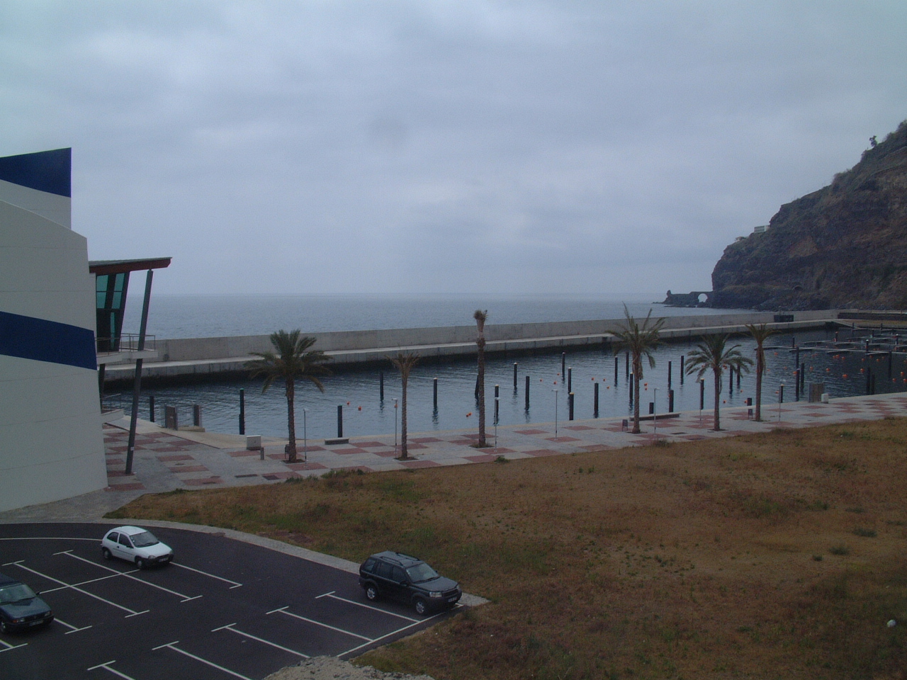
that they would have plenty of space for Sarah - so Calheta it was.The Porto Recreio da Calheta is located very near the western end of the island, about 40 km from the principal city and port of Funchal. This makes the location ideal for our departure to the west, but I was not sure how convenient the marina would be for re-provisioning for the 2600 nm trip to Bermuda. When we arrived Sarah was berthed on the floating docks. The marina is located in a very picturesque location at the base of a sheer cliff. While we were a long way from any decent-sized town, there is a Pingo Doce supermercado right next to the marina. This supermarket was nearly the size of the Pingo where I principally shopped while in Lagos, so there would be no problems re-stocking the boat. |
|
 Photo by Bob Calt |
While we were in Calheta Bob hiked to the top of the cliff and took this picture of Sarah. |
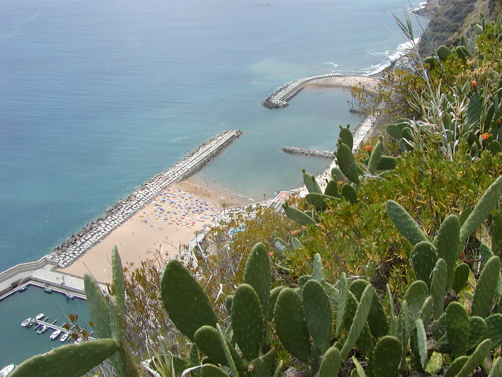 Photo by Bob Calt |
Next to the marina is a large upscale resort hotel and a man-made public beach. There are few natural sand beaches on Madeira - most are just rocks. The good beaches are on Porto Santo, a long ferry ride away. So these man-made beaches are very popular with the locals and tourists. |
| Marina Quinta do Lorde | |
 For most of the days we were on Madeira I rented a car. I spent one of those days visiting the other three marinas on the island. This is a view of the Marina Quinta do Lorde on the eastern end of the island near the city and port of Canical. All of the marinas are on the south side of the island to get some protection from the prevailing northerly winds. Still, all of the marinas (including Calheta) are subject to a strong surge. Reportedly Quinta do Lorde suffers the least from the surge. |
|
|
|
|
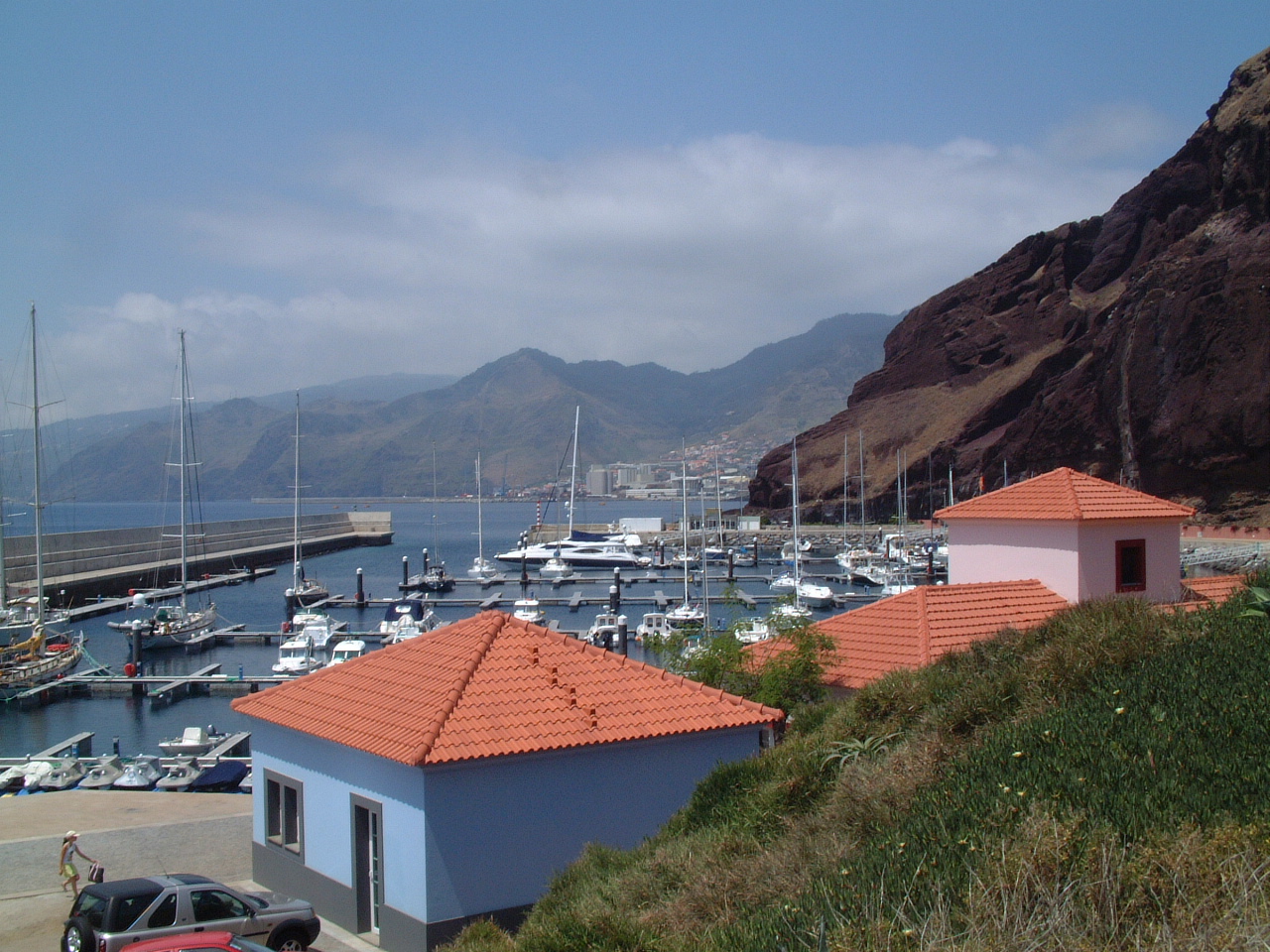 Like
Calheta, Quinta do Lorde is a long way from any town. Unlike Calheta,
there is no local supermarket or other facility for re-provisioning near
this marina. A rental car would definitely be necessary to go
shopping. There is one restaurant nearby. Like
Calheta, Quinta do Lorde is a long way from any town. Unlike Calheta,
there is no local supermarket or other facility for re-provisioning near
this marina. A rental car would definitely be necessary to go
shopping. There is one restaurant nearby. |
|
 At
this time of year (May) the marina was less than 1/2 full. I suspect it
is never full as it is a very remote location. At
this time of year (May) the marina was less than 1/2 full. I suspect it
is never full as it is a very remote location. |
|
| Marina Lugar de Baixo | |
 I
stopped at the Lugar de Baixo knowing it was closed. This time the
large administrative building contained only a cleaning crew, none of
whom spoke English nor could they understand my Portuguese (few do). I
stopped at the Lugar de Baixo knowing it was closed. This time the
large administrative building contained only a cleaning crew, none of
whom spoke English nor could they understand my Portuguese (few do).My guess is the marina is closed because of excessive surge in the marina basin and/or silting. There was evidence of the later cause in the presence of a dredger off shore of the marina. |
|
 There
is also evidence of surge in several pilings that have been bent over
and the complete removal of the floating docks. There
is also evidence of surge in several pilings that have been bent over
and the complete removal of the floating docks. |
|
 It
is unclear that this marina will re-open in the near future. It is hard
to believe that this investment of hundreds of thousands of Euros will
just be abandoned. It
is unclear that this marina will re-open in the near future. It is hard
to believe that this investment of hundreds of thousands of Euros will
just be abandoned. |
|
| Marina do Funchal | |
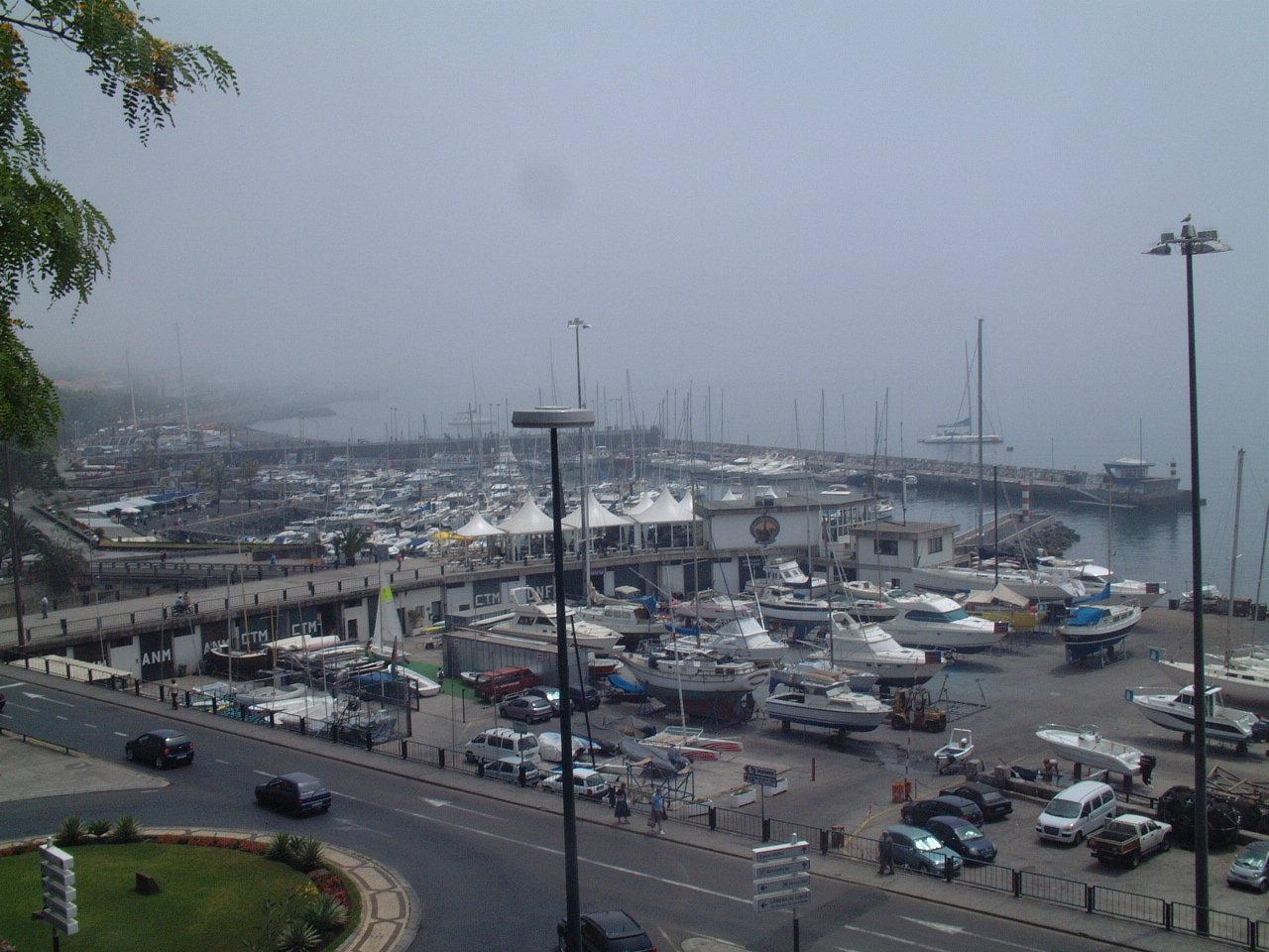 For
a long time the Funchal Marina was the only facility for yachts on the
entire island. It had a reputation for being dirty with lots of surge
and always full. They have cleaned up the marina a good deal, and I
saw no evidence of surge on this calm day. However it is clear that
the marina is still very full. For
a long time the Funchal Marina was the only facility for yachts on the
entire island. It had a reputation for being dirty with lots of surge
and always full. They have cleaned up the marina a good deal, and I
saw no evidence of surge on this calm day. However it is clear that
the marina is still very full. |
|
 I
could see a few open berths on this visit, however May is not the busy
season for visiting yachts on Madeira. In the fall I suspect berths in
Funchal would be very difficult to come by. I
could see a few open berths on this visit, however May is not the busy
season for visiting yachts on Madeira. In the fall I suspect berths in
Funchal would be very difficult to come by. |
|
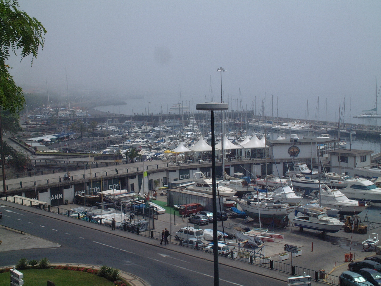 Funchal
does have a working boatyard - something Calheta and Quinta do not
have. So if you need major repairs while on Madeira, Funchal is
probably the only option. Funchal
does have a working boatyard - something Calheta and Quinta do not
have. So if you need major repairs while on Madeira, Funchal is
probably the only option. |
|
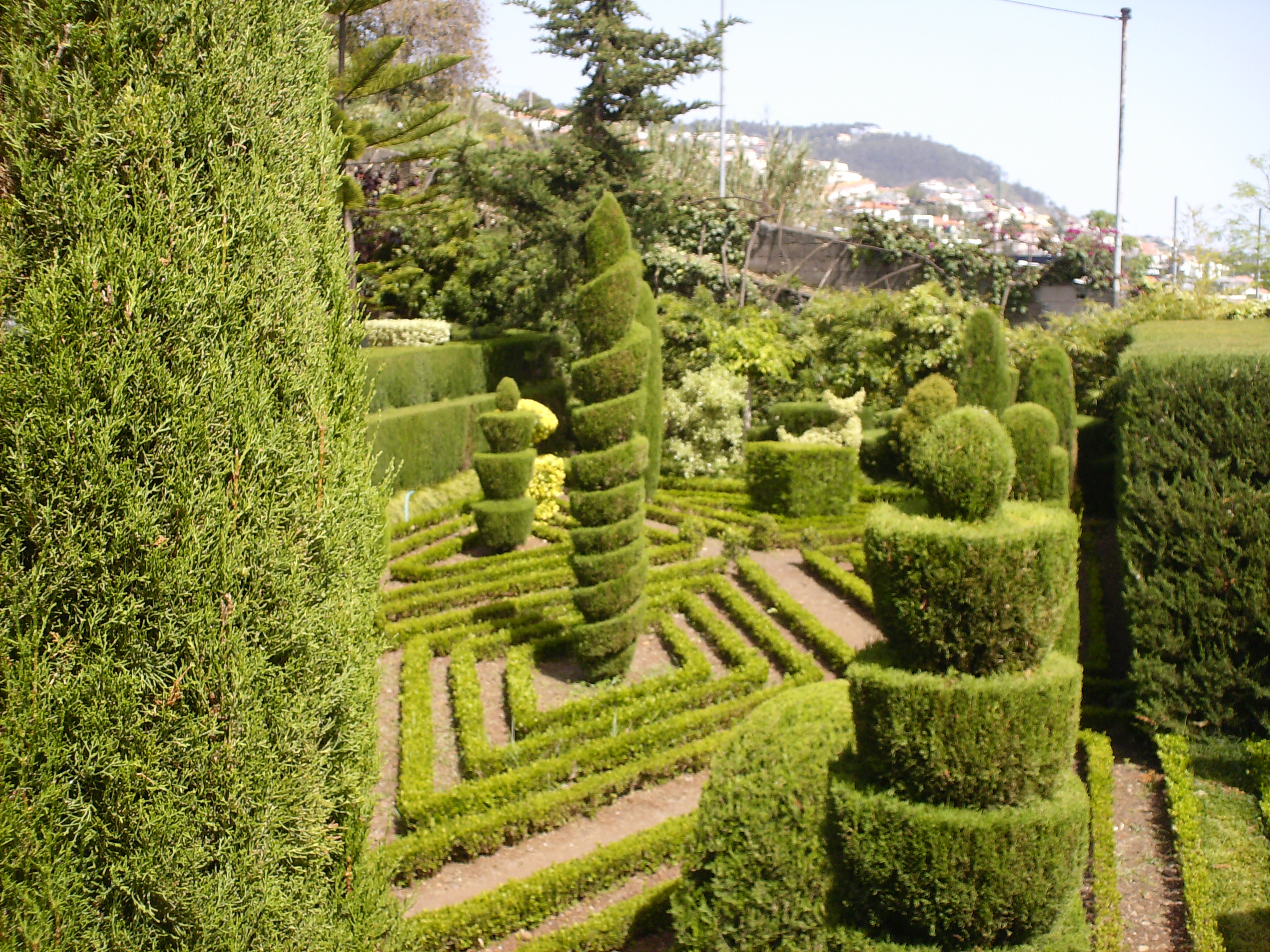
| Jardim Botanico da Madeira | |
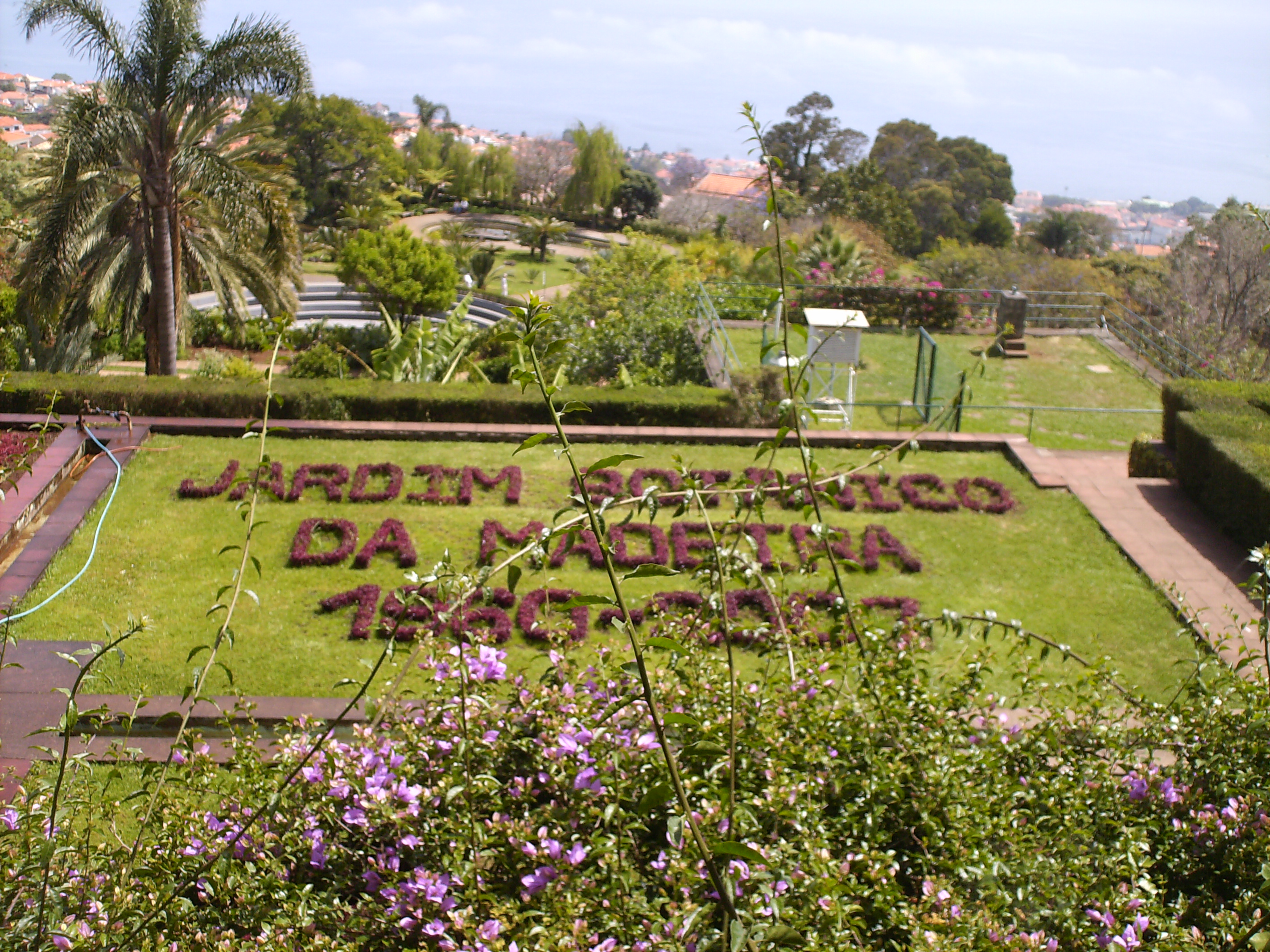 One
of the major attractions on Madeira is the Botanical Gardens. One
of the major attractions on Madeira is the Botanical Gardens. |
|
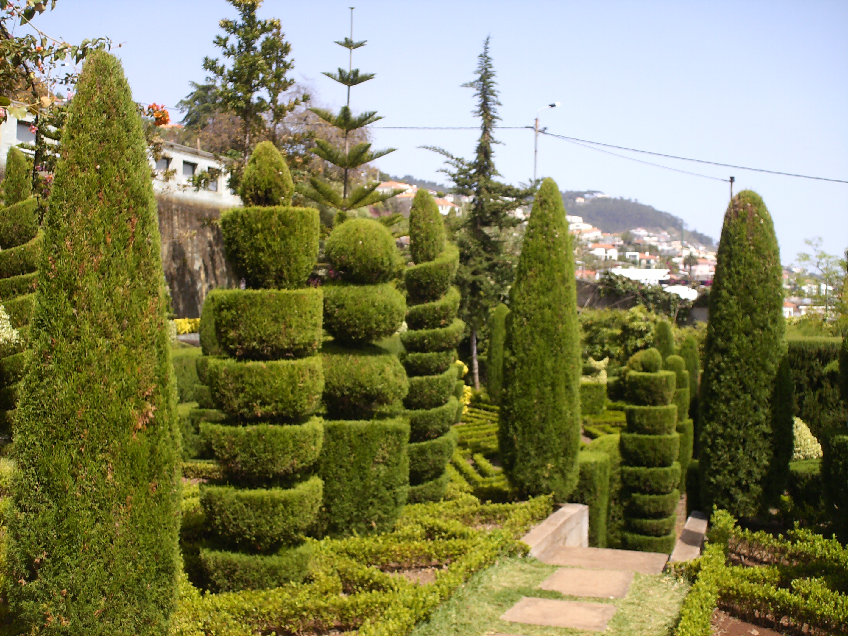 The
picture on the left and below are of the sculpture garden in the
Botanical Gardens The
picture on the left and below are of the sculpture garden in the
Botanical Gardens |
|
 |
|
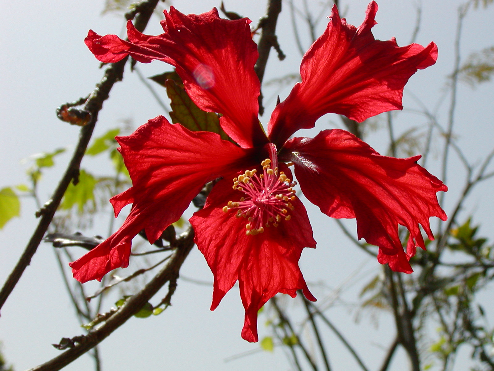 Photo by Bob Calt |
The Botantical Gargens feature a wide variety of plants, trees and flowers, both native to the island and from elsewhere in the word. |
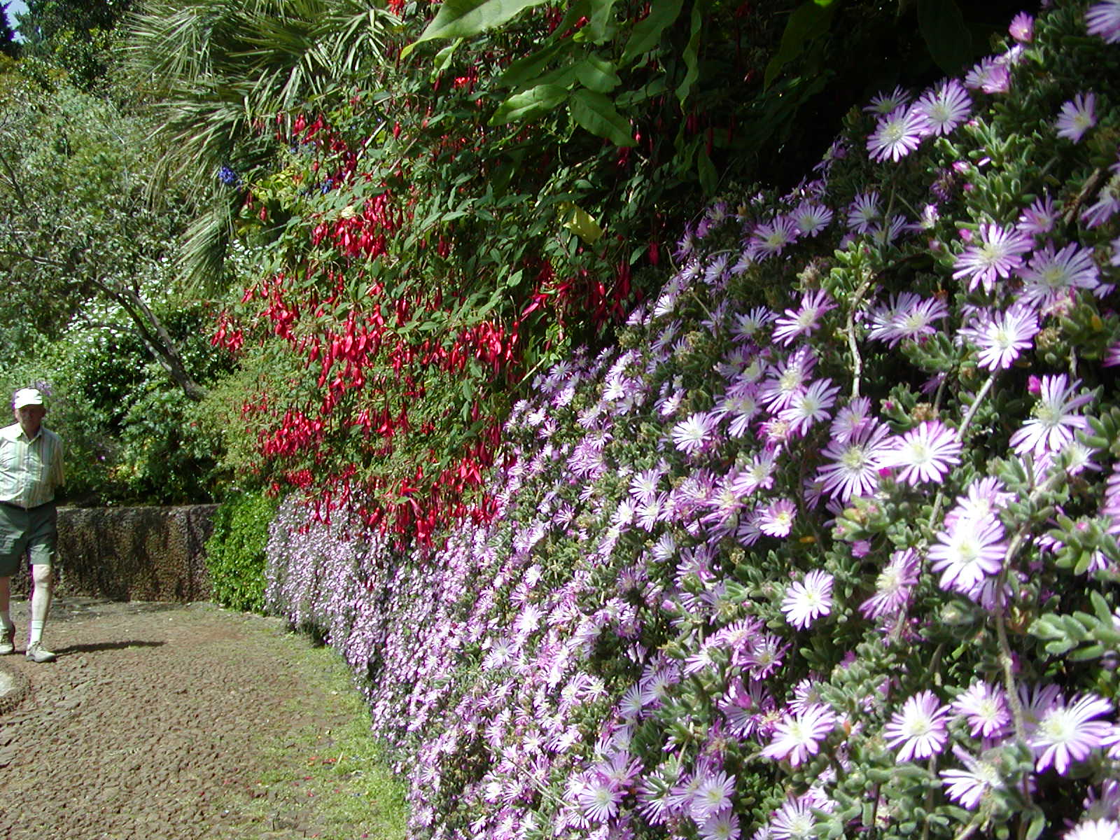 Photo by Bob Calt |
|
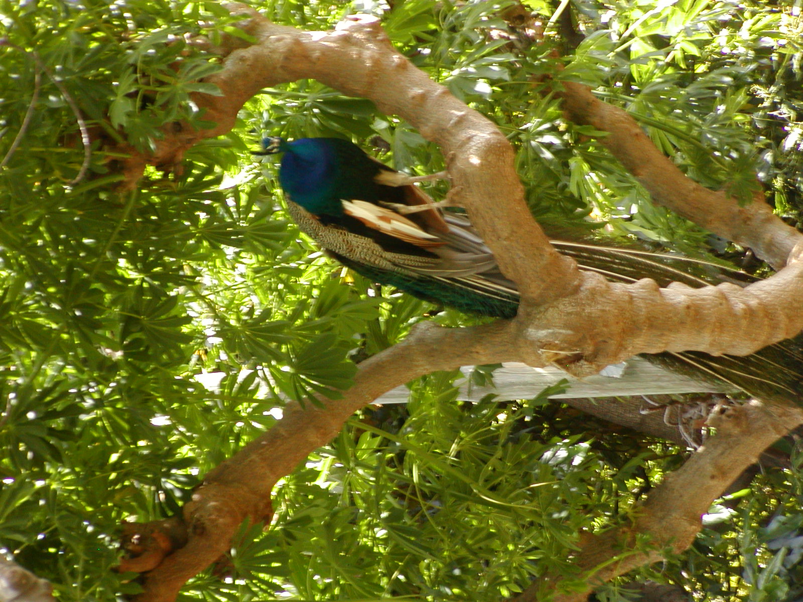 Photo by Bob Calt |
The gardens also include an aviary. A number of Peacocks including the tree-perched one in the photo on the left roam freely throughout the gardens. |
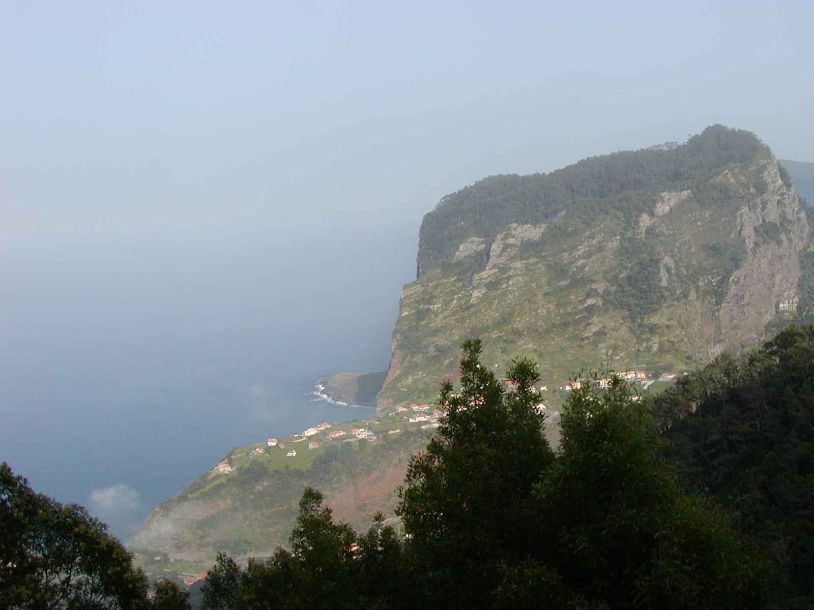 Photo by Bob Calt |
On the left is another picture of the rugged coastline of Madeira. This is the north coast. |
| The Highway System of Madeira | |
|
Our travels around the island were facilitated by the amazing highway
system that has been created on Madeira. The large number of
mountain ridges that cross the island made the building of roads
difficult and expensive. Initially these roads followed the
outline of those ridges and the valleys between. Portugal joined
the EU in the 1980s and that membership appears to have provided the
financing and technology to modernize those roads. Instead of
going around the ridges, Portugal dug through them and built massive
bridges over the valleys. With the old roads it reportedly took
nearly 4 hours to drive from Calheta to Funchal. With the new
highways Bob and I were able complete that trip in less than 25 minutes. Below is a 7 minute video clip I took while driving between Funchal and Calheta.. |
|