Sarah's Atlantic Circle
| Costa Blanca |
 After
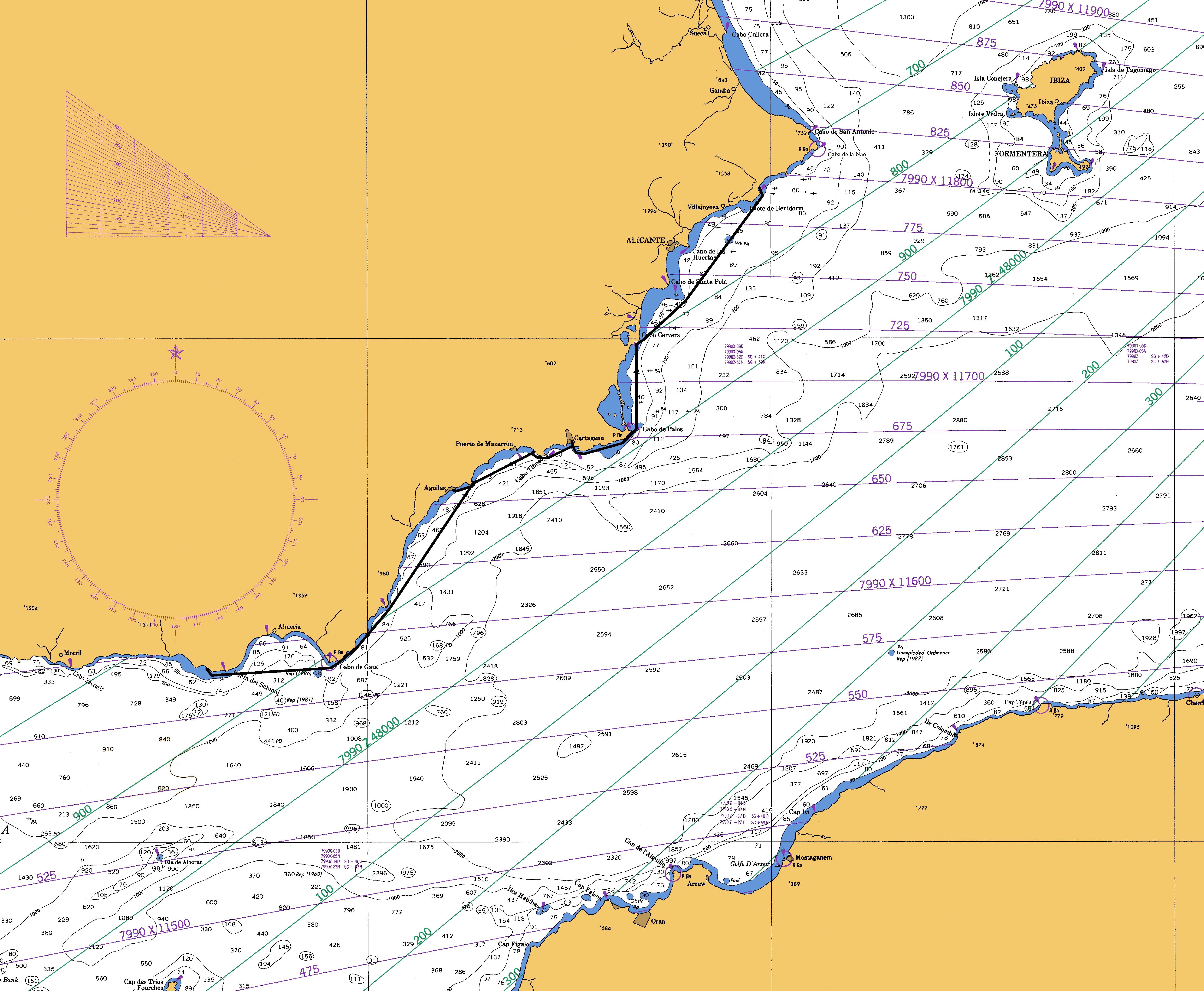
nearly a month at the Almerimar marina I resumed my Mediterranean cruise,
departed the Costa del Sol and entered the Costa Blanca of Spain. After
nearly a month at the Almerimar marina I resumed my Mediterranean cruise,
departed the Costa del Sol and entered the Costa Blanca of Spain.The chart on the right tracks my progress from Almerimar to Altea, just before my eventual crossing to the Balearic Islands of Spain. My route is depicted by the black line on the chart. It is difficult to see in this thumbnail, but if you double-click on the chart you can view it at full resolution.
|
| Cabo de Gata, June 16, 2006 |
 Departing
Almerimar I headed across the Bahia de Almeria toward the Cabo de Gata. The
Cabo de Gata is the demarcation between the Costa del Sol and the Costa
Blanca. Departing
Almerimar I headed across the Bahia de Almeria toward the Cabo de Gata. The
Cabo de Gata is the demarcation between the Costa del Sol and the Costa
Blanca. |
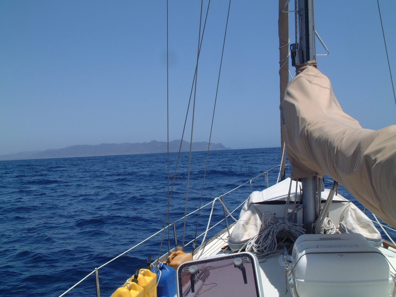
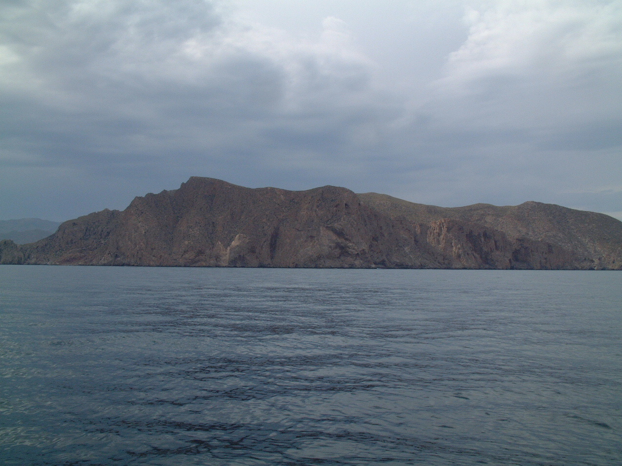
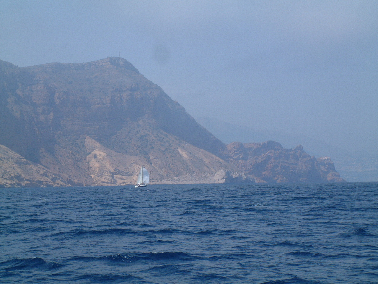
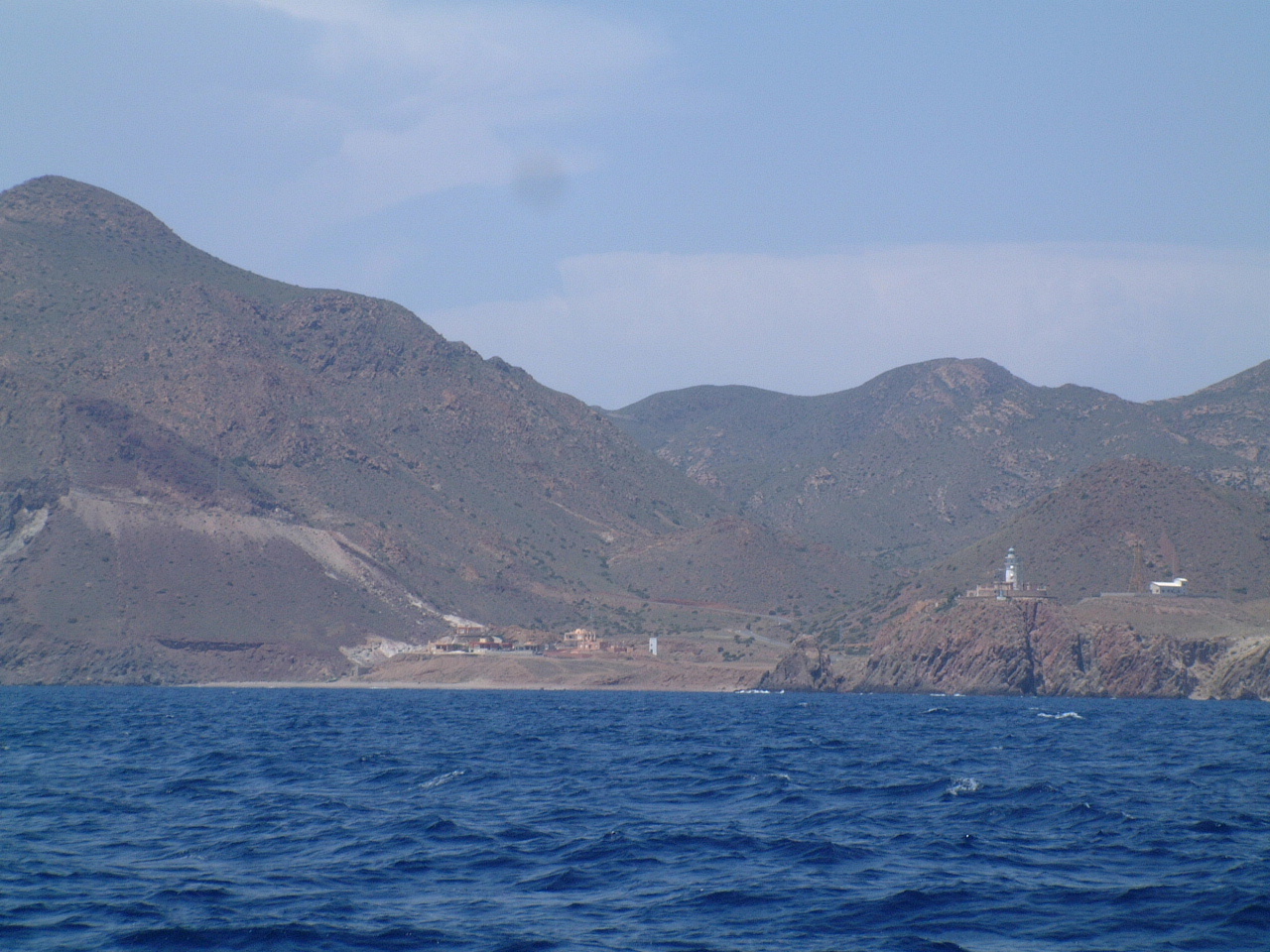 As
I passed the Cabo de Gata I had the opposite
view that my brother Jeff and I had when we drove to this cape on our
land cruise of the Costa del Sol. If you click on the picture to download
the full resolution image you can see the road on which we stopped on the
left side of the picture. The Cabo de Gata lighthouse is on the right side
of the picture. As
I passed the Cabo de Gata I had the opposite
view that my brother Jeff and I had when we drove to this cape on our
land cruise of the Costa del Sol. If you click on the picture to download
the full resolution image you can see the road on which we stopped on the
left side of the picture. The Cabo de Gata lighthouse is on the right side
of the picture. |
| Puerto de Genoves, June 16, 2006 |
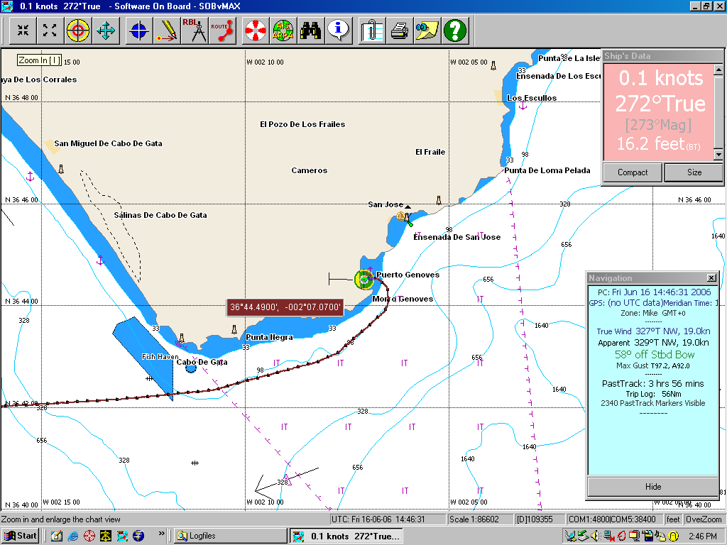 After
rounding the Cabo de Gata I continued for about 5 nm north and then entered
the Puerto de Genoves. This a large anchorage that is very well protected
from all directions except the east. I anchored in about 15' of water well
off the beach as shown in the SOB screen capture on the left. After
rounding the Cabo de Gata I continued for about 5 nm north and then entered
the Puerto de Genoves. This a large anchorage that is very well protected
from all directions except the east. I anchored in about 15' of water well
off the beach as shown in the SOB screen capture on the left. |
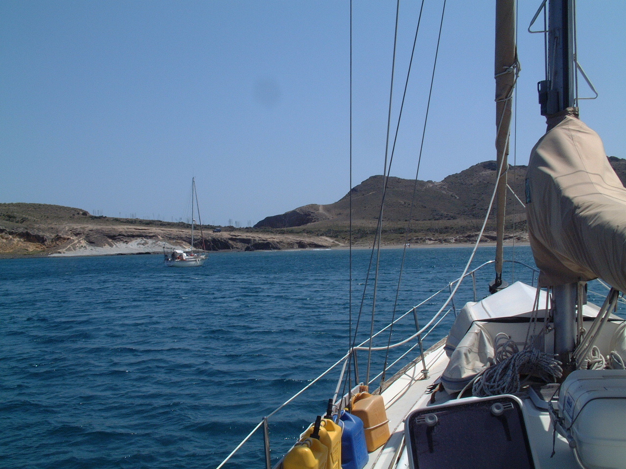 When I entered the anchorage the wind had picked up out of the SW to about 15 knots. However in the anchorage the winds appeared to be Katabatic, that is down slope winds from the mountain range to the west. The Katabatic effect accelerated the wind speed to over 25 kts. Later that evening, before dark, the winds increased to over 30kts with gust to 40. I was glad the holding ground in sand was very secure and with the relatively shallow depth I did not have to put out too much anchor rode. Still Sarah sailed actively on the anchor until the winds finally died to less than 20 kts around midnight. The combination of the strong winds and this being my first time anchoring Sarah since we left Flores in the Azores last summer made for a less than peaceful night. Since I was not sure I wouldn't be having to re-anchor sometime during the night, it was also a non-alcoholic evening. |
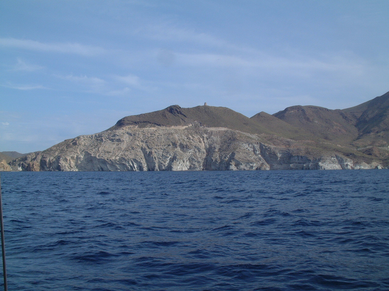 By
the next morning the winds were very light out of the SW. It was an effort
breaking the anchor free as it had buried deep into the sand bottom. My
back is still sore, but it caused me no problems when hauling the anchor
back onboard. By
the next morning the winds were very light out of the SW. It was an effort
breaking the anchor free as it had buried deep into the sand bottom. My
back is still sore, but it caused me no problems when hauling the anchor
back onboard.Around 9:00 AM I departed the Puerto de Genoves and motored up the Costa Blanca. The picture on the left shows the pale limestone cliffs that give this coast of Spain its name. |
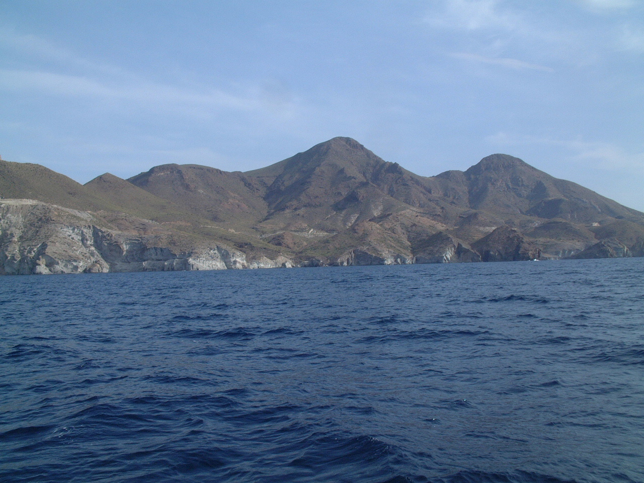 However
most of the coast looks just as moreno as the Costa del Sol However
most of the coast looks just as moreno as the Costa del Sol |
 That
evening I was headed for the Ensenada de la Fuente just east of the harbor
at Aguilas. The ensenada (cove) is located around the headland on the right
side of this picture. According to the cruising guide I could anchor off
the beach with full protection from all directions except the NE. When I
entered the ensenada I discovered the cove was blocked by a string of nets.
I couldn't determine if the nets were to protect the beach for swimmers or
were part of a fish farm, but the effect was the only place to anchor was in
over 50' water. I turned around and left the Ensenada de la Fuente. That
evening I was headed for the Ensenada de la Fuente just east of the harbor
at Aguilas. The ensenada (cove) is located around the headland on the right
side of this picture. According to the cruising guide I could anchor off
the beach with full protection from all directions except the NE. When I
entered the ensenada I discovered the cove was blocked by a string of nets.
I couldn't determine if the nets were to protect the beach for swimmers or
were part of a fish farm, but the effect was the only place to anchor was in
over 50' water. I turned around and left the Ensenada de la Fuente.Cruising guides are helpful, but they can get out of date real fast. My guide was published in 2005. |
| Aguilas, June 17, 2006 |
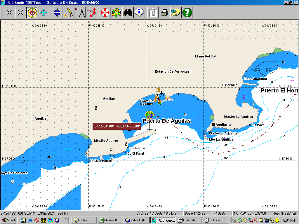 So
instead I headed back to Aguilas and anchored in the harbor. There was
another anchorage (Hornillo) noted in the cruising guide right next to this
harbor, but when I ducked quickly in there I could see it was full of small
boats fishing. It might clear out toward dark when the fishing boats leave,
but I decided not to find out. So
instead I headed back to Aguilas and anchored in the harbor. There was
another anchorage (Hornillo) noted in the cruising guide right next to this
harbor, but when I ducked quickly in there I could see it was full of small
boats fishing. It might clear out toward dark when the fishing boats leave,
but I decided not to find out.My track back to Aguilas and my anchor position are shown in the SOB screen capture on the left. |
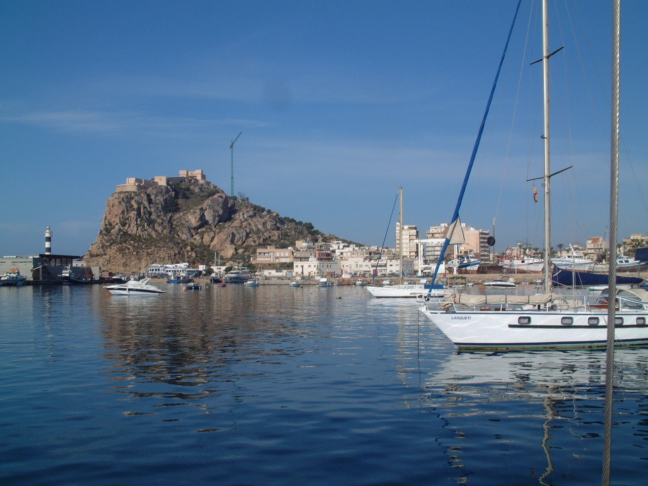 Aguilas is a large and attractive harbor. |
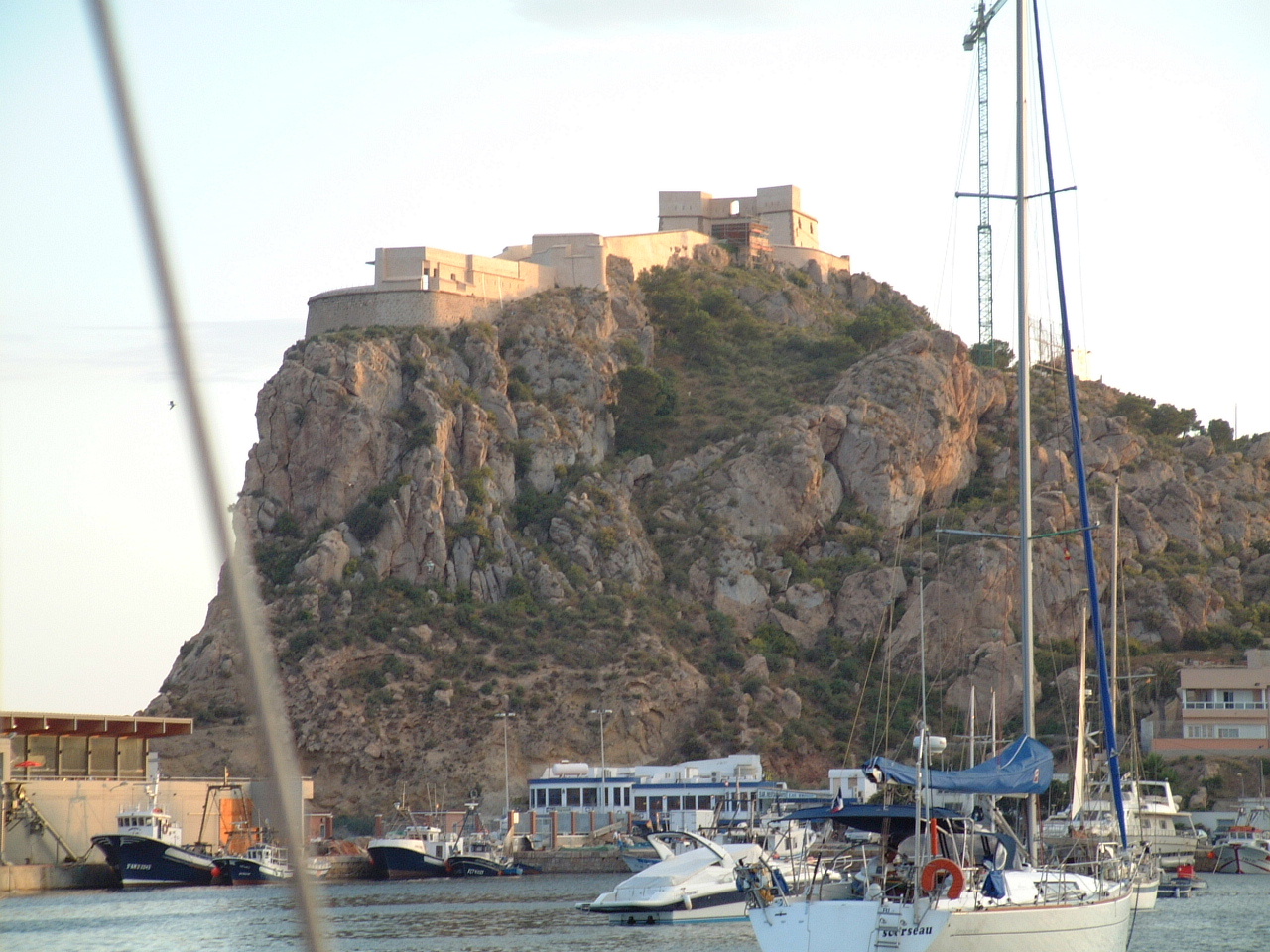 The
harbor at Aguilas is fairly well protected (except for winds out of the
S-SE) with a large anchorage. The
harbor at Aguilas is fairly well protected (except for winds out of the
S-SE) with a large anchorage. |
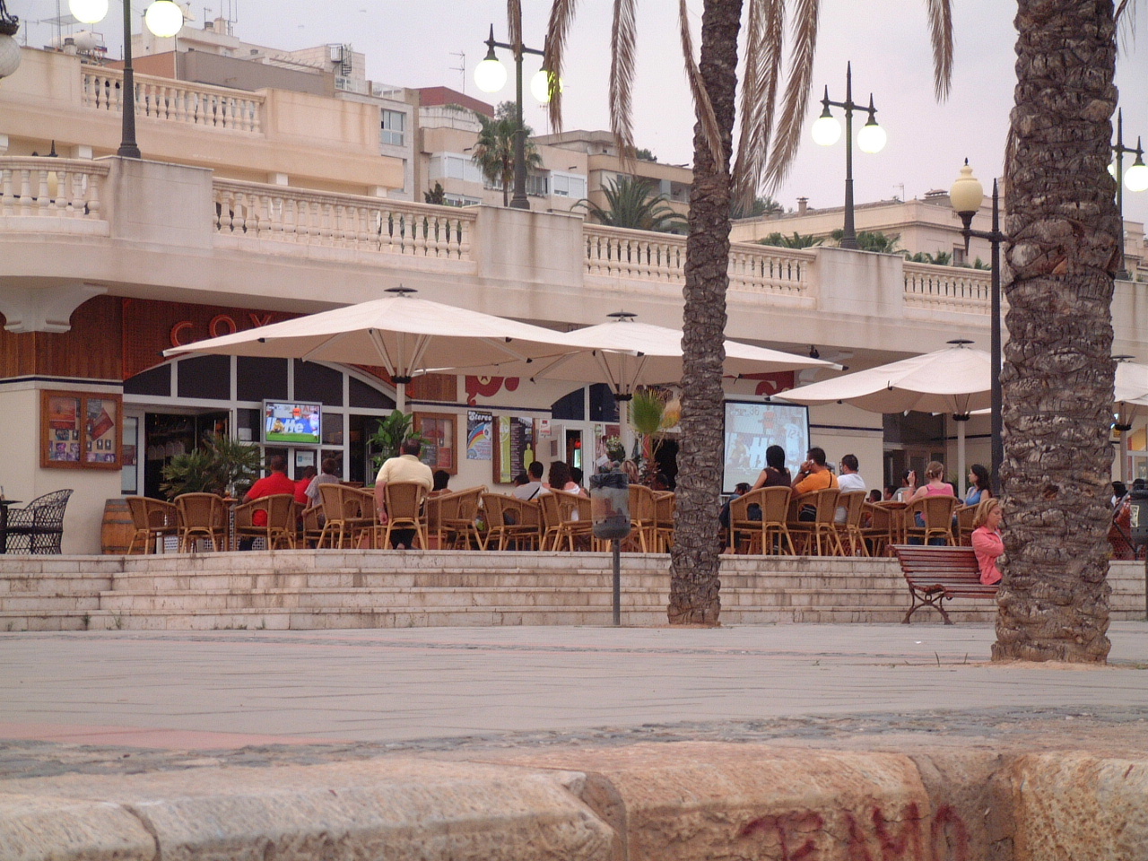
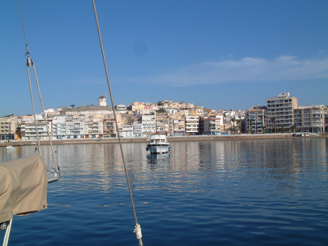 Aguilas
is a combination of fishing village and tourist town, which appears to be
the norm for most of the Mediterranean coast of Spain. Aguilas
is a combination of fishing village and tourist town, which appears to be
the norm for most of the Mediterranean coast of Spain.The wind mill at the top of the hill (center of the picture) was lit up during the night and turning. Since there was no wind I assume it is not a working mill, but just a tourist prop. |
| Ensenada de Mazarron, June 18, 2006 |
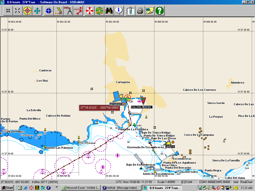
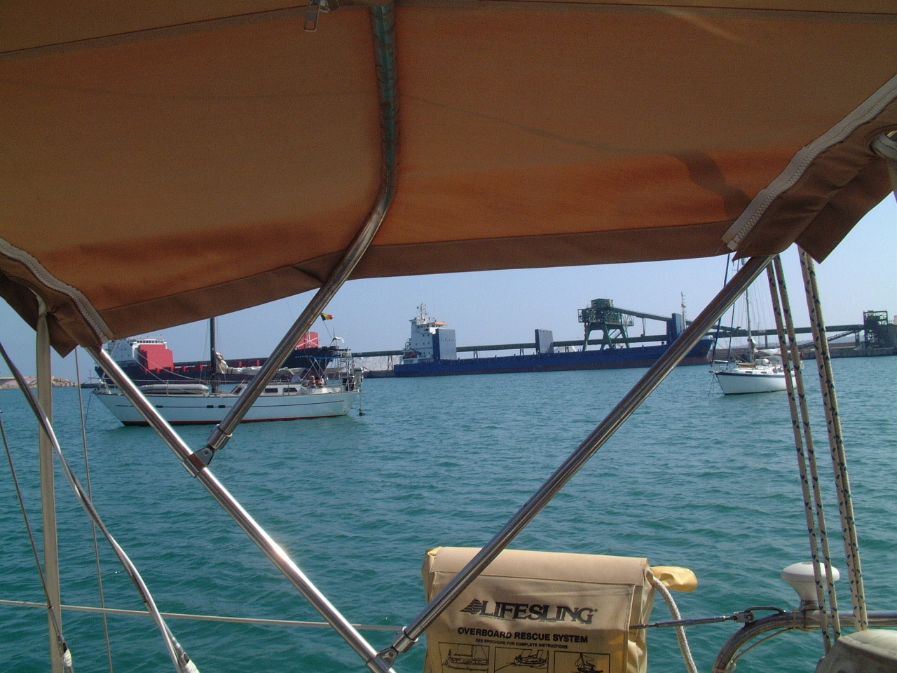
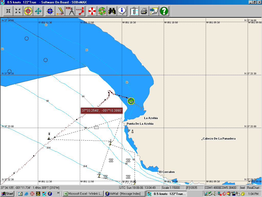 My destination after Aquilas was Cartagena. When I departed the harbor at Aguilas I immediately pickup a 10-12 kts breeze out the NE. For the first time this year I was able to sail Sarah with all three sails (Genoa, Main & Mizzen) for more than a few minutes. The downside was that I could not fetch the harbor at Cartagena without going hard on the wind and tacking frequently. Since there was a large anchorage at the Ensenada de Mazarron 5nm to the west of Cartagena and I could fetch that harbor on a close reach without tacking I changed my destination. I anchored in about 25' of water well off the beach in the ensenada as shown in the SOB screen capture on the right. The screen capture also shows my track coming into the cove. The wind speed increased dramatically as I neared the headland and it was a little struggle to get the sails down and under control before I hit the beach. |
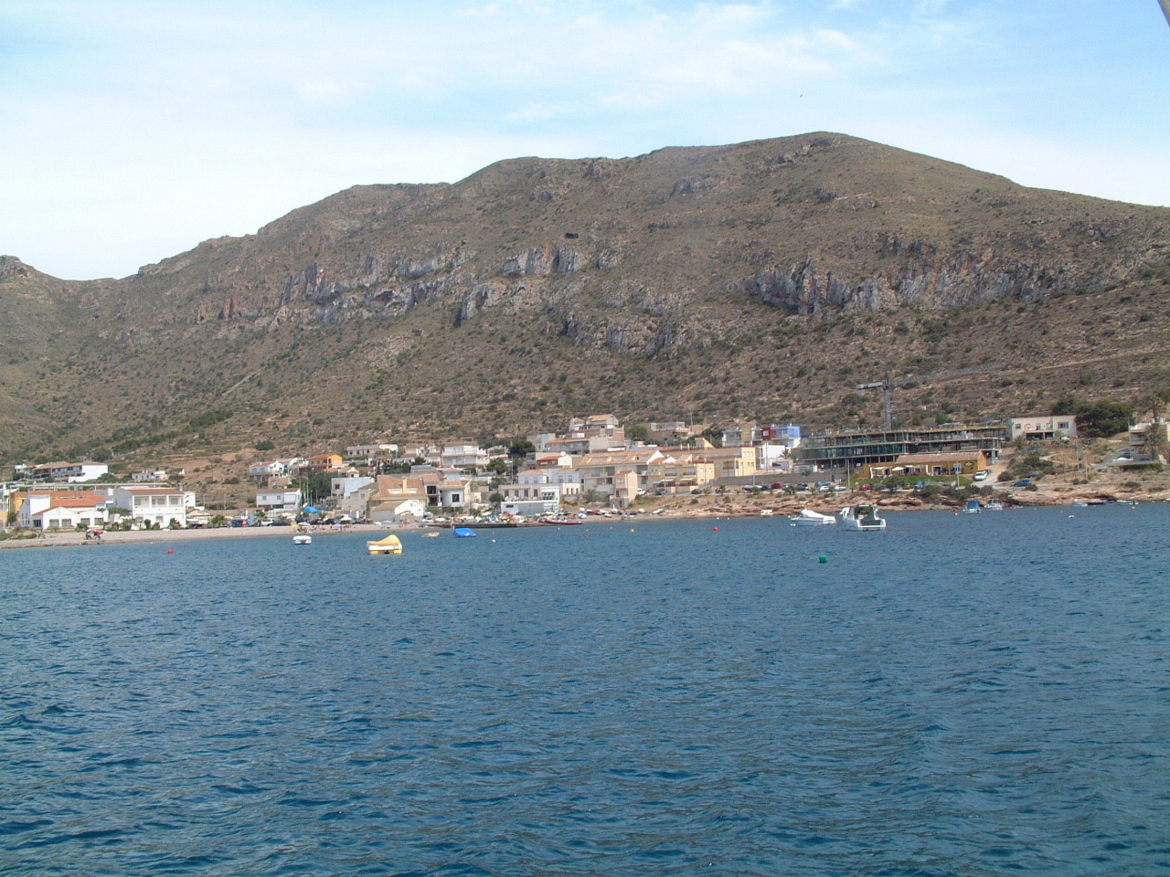 La
Azohia is a small resort town at the head of the cove. This appears to be a
popular weekend destination for local boats. La
Azohia is a small resort town at the head of the cove. This appears to be a
popular weekend destination for local boats. |
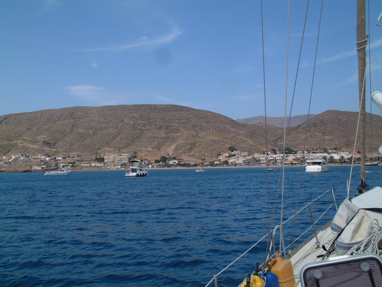 This
was Sunday, and there were a lot of boats anchored off the beach. Most left
later that afternoon. This
was Sunday, and there were a lot of boats anchored off the beach. Most left
later that afternoon. |
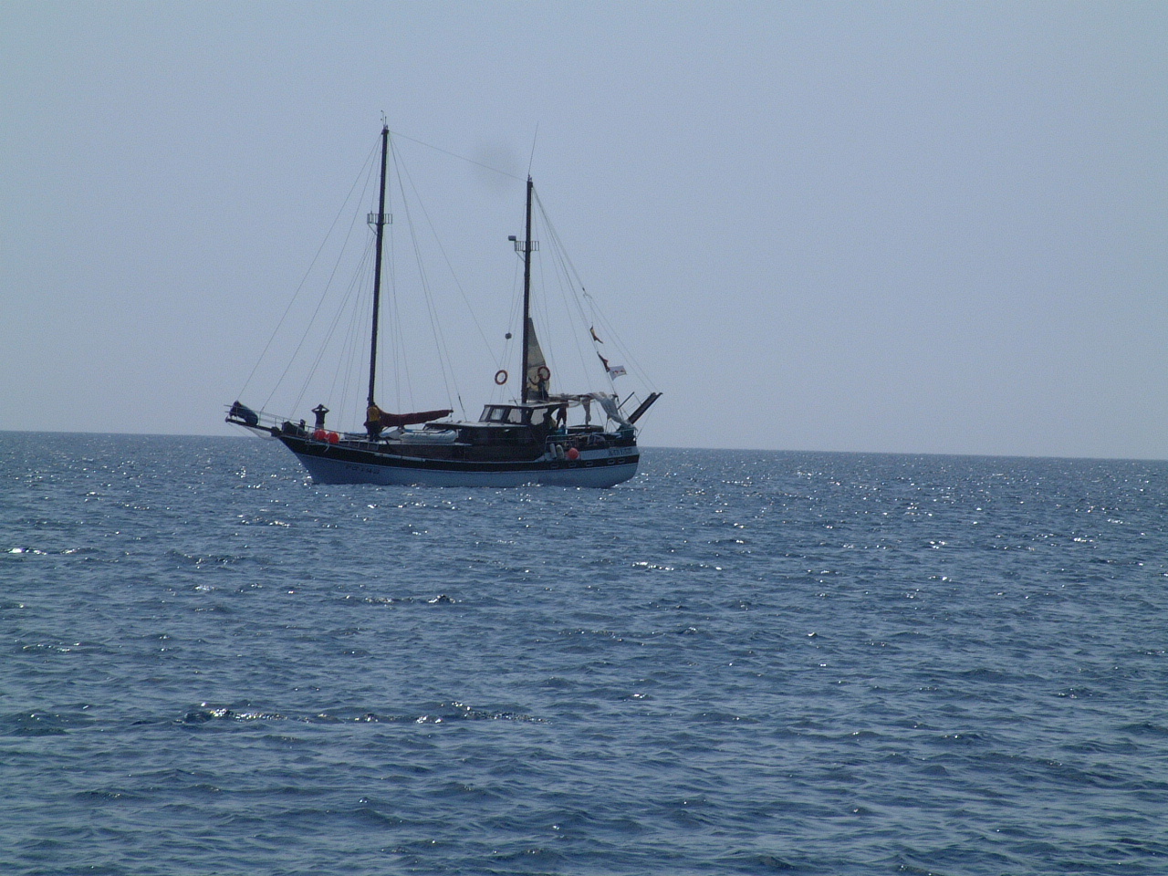 This
large (60') ketch entered the anchorage and appeared to be looking for a
place to drop their hook. For some reason they changed their mind and left. This
large (60') ketch entered the anchorage and appeared to be looking for a
place to drop their hook. For some reason they changed their mind and left. |
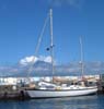
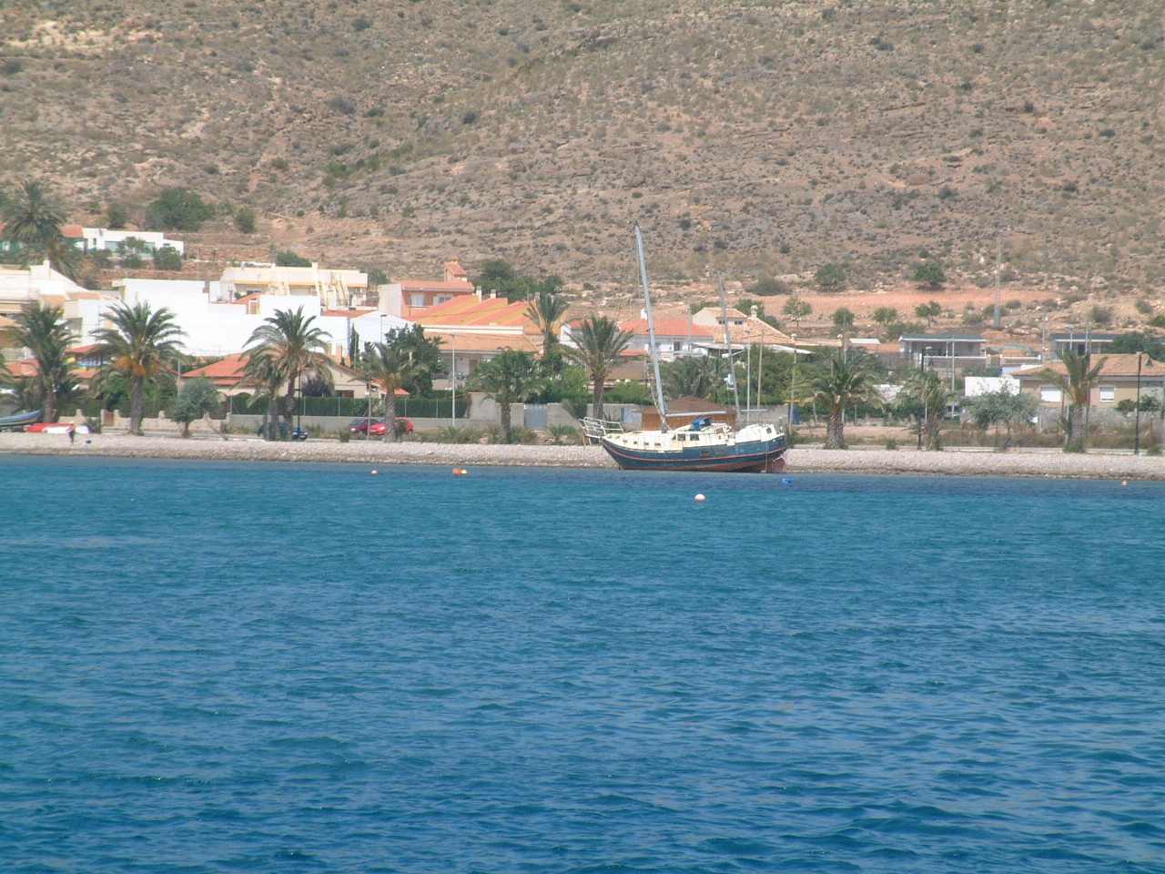 Maybe
seeing this slightly smaller ketch on the beach made them want to leave. It
looks like this boat dragged anchor and was blown onto the beach in a gale.
There was no activity around the boat to suggest someone was trying to
either salvage the boat or free it from the beach, so I assume it has been
there for awhile. Maybe
seeing this slightly smaller ketch on the beach made them want to leave. It
looks like this boat dragged anchor and was blown onto the beach in a gale.
There was no activity around the boat to suggest someone was trying to
either salvage the boat or free it from the beach, so I assume it has been
there for awhile. |
| Cartagena, June 19 - 22, 2006 |
 The
next day I slept in until after 9:30 as I had a trip of only 5nm to the port
of Cartagena. There was no wind, but it was such a short distance I would
have likely motored anyway. The
next day I slept in until after 9:30 as I had a trip of only 5nm to the port
of Cartagena. There was no wind, but it was such a short distance I would
have likely motored anyway.Knowing there are limited yacht facilities in the port I had attempted to call the Puerto Deportivo de Cartagena several times on the phone. I got a quick message in very rapid Spanish (is there any other kind?) which I could not understand and then was put on hold. Eventually an hombre answered, I did my usual, ¿Habla usted Ingles?" and got a "No entiendo" response. I asked, "¿Esta Puerto Deportivo de Cartagena?" and got a, "No esta Puerto Deportivo" response. So either the phone number I had from the guide was incorrect, or this hombre just didn't want to talk to me. Once more I was headed into a crowded harbor not knowing if there would be any space for me. A few miles out of the harbor I called the Puerto Deportivo on the VHF Radio, Channel 9 and got an immediate response from an English speaker. When I asked for a berth she told me I had to call the Club Regatta de Cartagena, the local Yacht Club. |
 This
instruction was in direct conflict with the cruising guide as it says the
Yacht Club is private and an invitation is required to use their facilities
and visiting yachts should contact the Puerto Deportivo. This
instruction was in direct conflict with the cruising guide as it says the
Yacht Club is private and an invitation is required to use their facilities
and visiting yachts should contact the Puerto Deportivo.
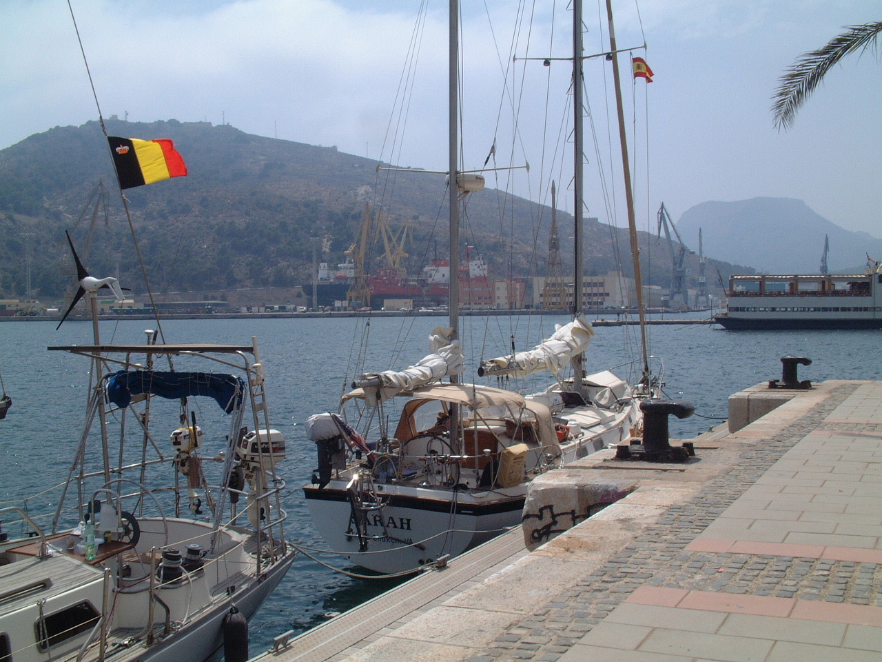
As it turned out the Yacht Club is indeed private, but it appears the club has taken over the management of visitor berths at the Puerto Deportivo (they are adjacent to each other). That may explain why the phone number in the guide did me no good. I called the Club Regatta on the VHF radio and got an immediate response (sounded very much like the lady who answered for the Puerto Deportivo) and I was informed they could provide me with a berth for the next few nights. As I entered the marina a female dock master directed me to tie up to the reception dock along the inner seawall. It turned out that this was to be my actual berth in the marina, shown in the picture on the right. The major shortcoming of this berth is that there is no electricity available, so I am living off the generator very much as I would at anchor. |
 The
other shortcoming of this berth is that there is no security. The dock to
which I am tied is part of a public park with many restaurants and bars. It
is a popular place for families, couples, and singles to stroll during the
evening. This actually makes the location not unpleasant as people will
walk up to my berth and ask me if I really sailed all the way from the los
Estados Unidos to Cartagena. The
other shortcoming of this berth is that there is no security. The dock to
which I am tied is part of a public park with many restaurants and bars. It
is a popular place for families, couples, and singles to stroll during the
evening. This actually makes the location not unpleasant as people will
walk up to my berth and ask me if I really sailed all the way from the los
Estados Unidos to Cartagena.Since this is Europe and the World Cup is underway everyone is glued to the TV screens at night watching the games. On this night the bar in front of my berth had screens set up outside for their customers. Because of the cheering of the crowd I assume Spain was playing this night, and won. I can't say Cartagena was one of the more interesting cities I've visited in Spain. It is a nice city, with a pleasant waterfront and a good shopping district. However there are not much in the way of sights to take in. There are some Roman ruins, including an amphitheatre that is being re-furbished for concerts and performances. Anyway, I found little of interest and hence very few pictures to show for my three days at the marina. I'm beginning to think the source of my back problems is all of the hiking and back packing I'm doing to get provisions at each port. In Cartagena it is a long hike to the Mercadona, and I've made several trips. After each such trip my back seems to be worse. |
| Torrevieja, June 22 - 24, 2006 |
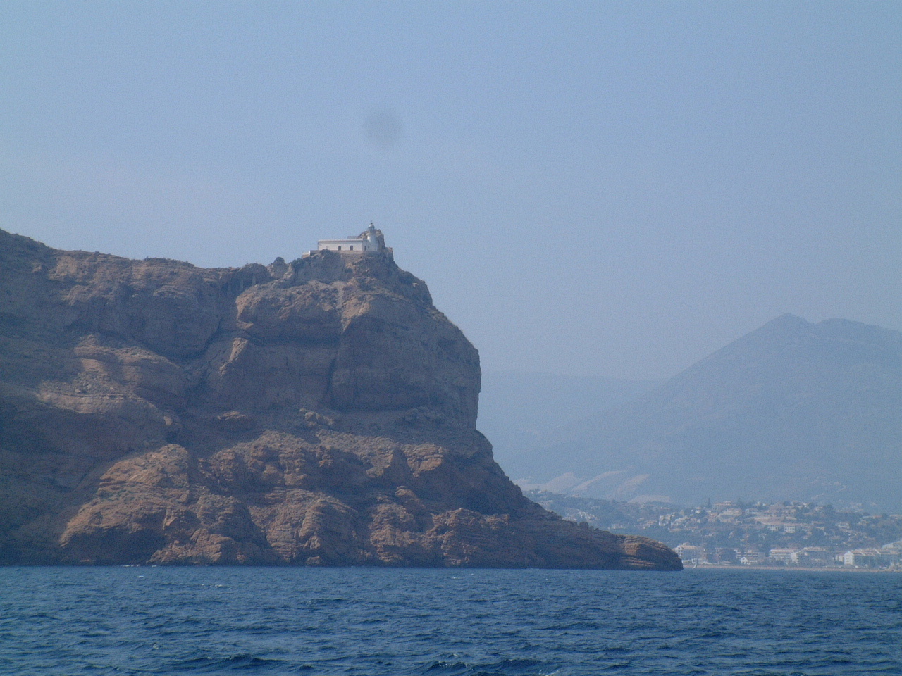
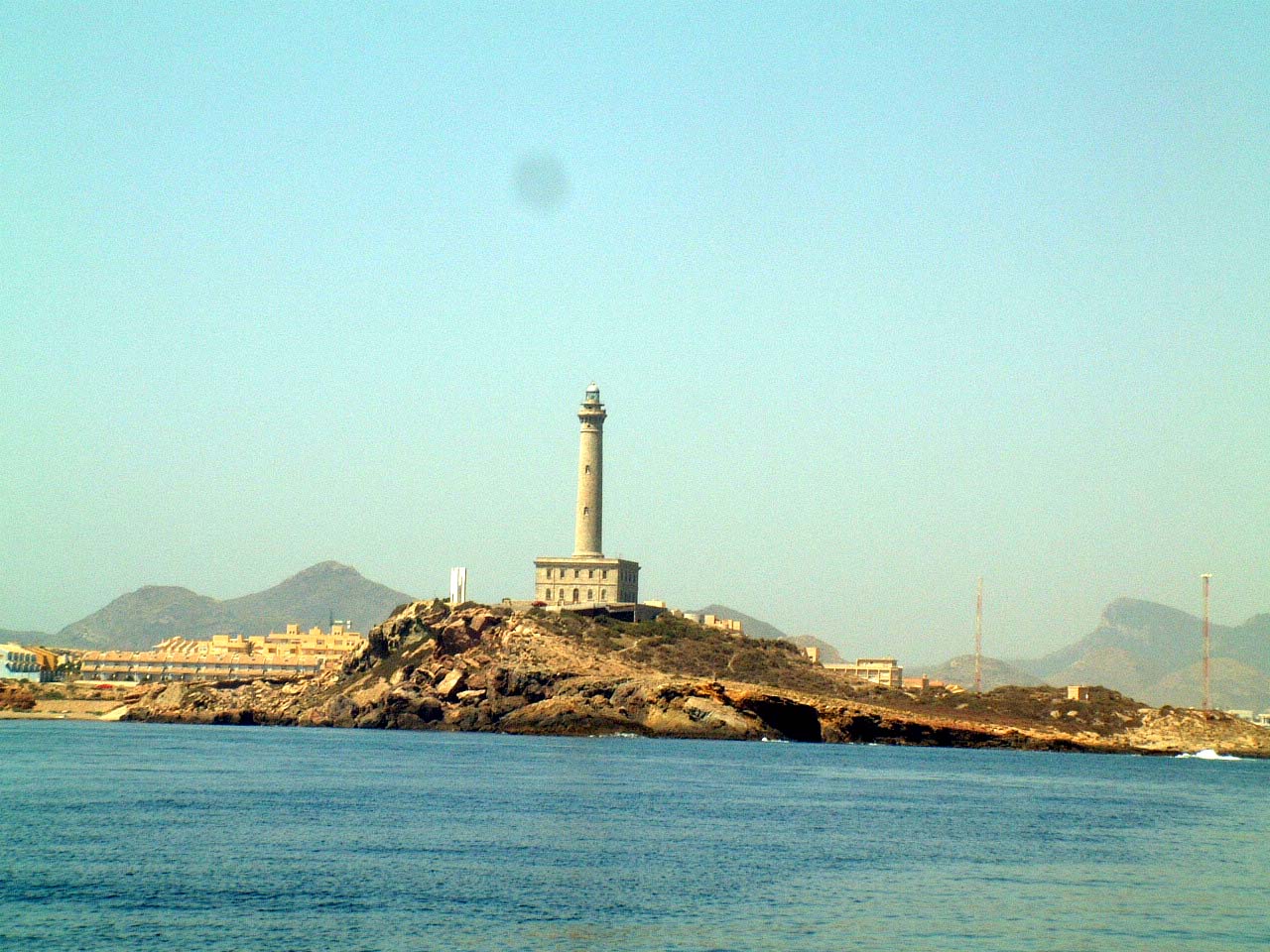 When
I left Cartagena the wind was calm, so another day of motoring. About 15nm
east of Cartagena is the Cabo de Palos and its distinctive lighthouse shown
on the right. When
I left Cartagena the wind was calm, so another day of motoring. About 15nm
east of Cartagena is the Cabo de Palos and its distinctive lighthouse shown
on the right. |
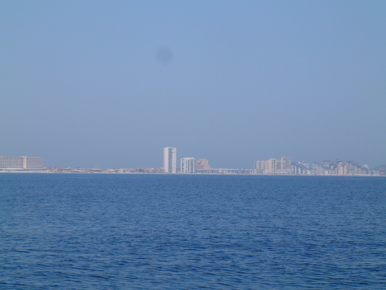 Above
the Cabo de Palos is the Mar Menor, a large inland sea separated from the
Med by a long thin stretch of land called La Manga (the sleeve). This is
another highly developed tourist and vacation destination. It may not be as
developed as Miami Beach, but it is a good imitation. Above
the Cabo de Palos is the Mar Menor, a large inland sea separated from the
Med by a long thin stretch of land called La Manga (the sleeve). This is
another highly developed tourist and vacation destination. It may not be as
developed as Miami Beach, but it is a good imitation. |
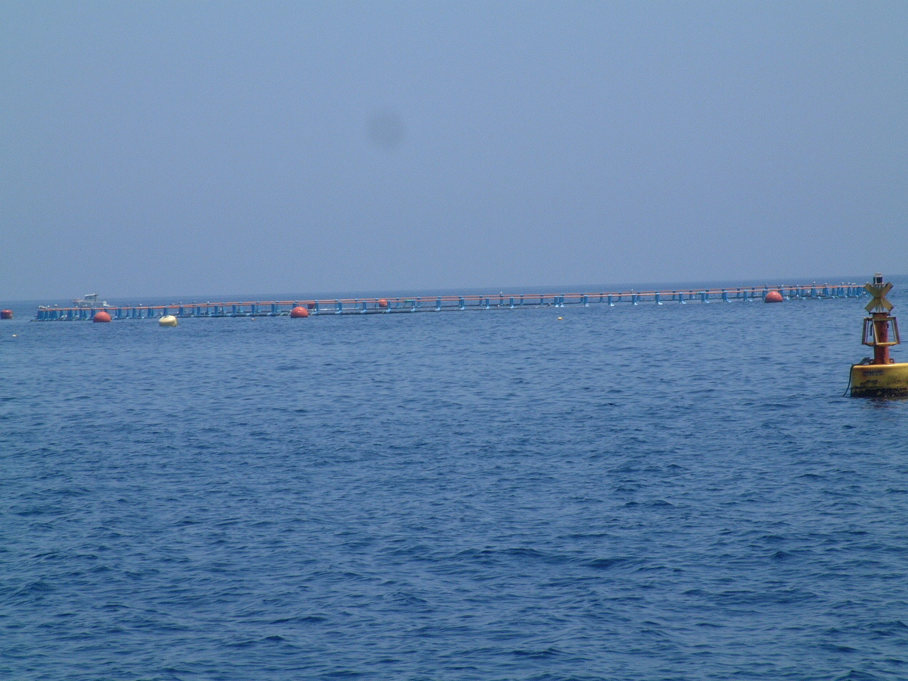 Along
this coast are the ever present Fish Farms. Along
this coast are the ever present Fish Farms. |
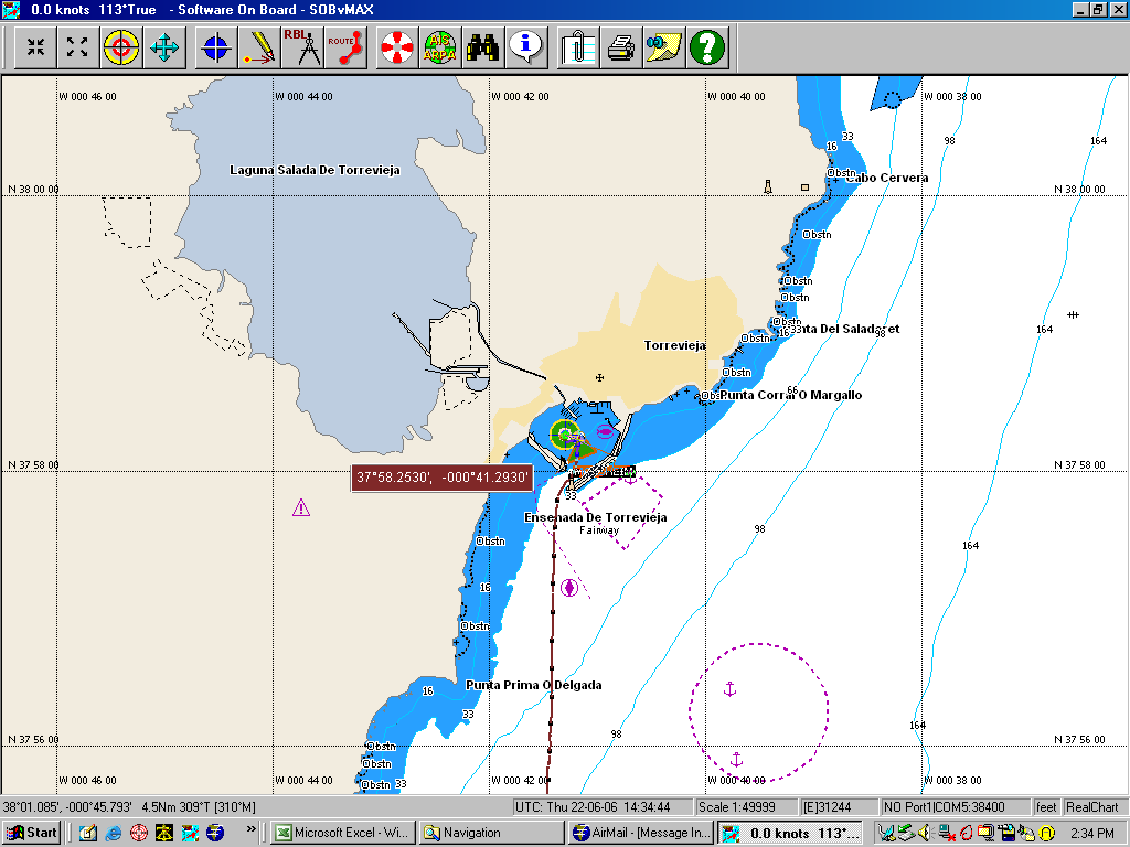 That
night I pulled into the harbor at Torrevieja and anchored. Torrevieja is
unusual because the harbor is large enough for several marinas, a cargo ship
depot and a small boat anchorage all within the breakwaters. That
night I pulled into the harbor at Torrevieja and anchored. Torrevieja is
unusual because the harbor is large enough for several marinas, a cargo ship
depot and a small boat anchorage all within the breakwaters. |
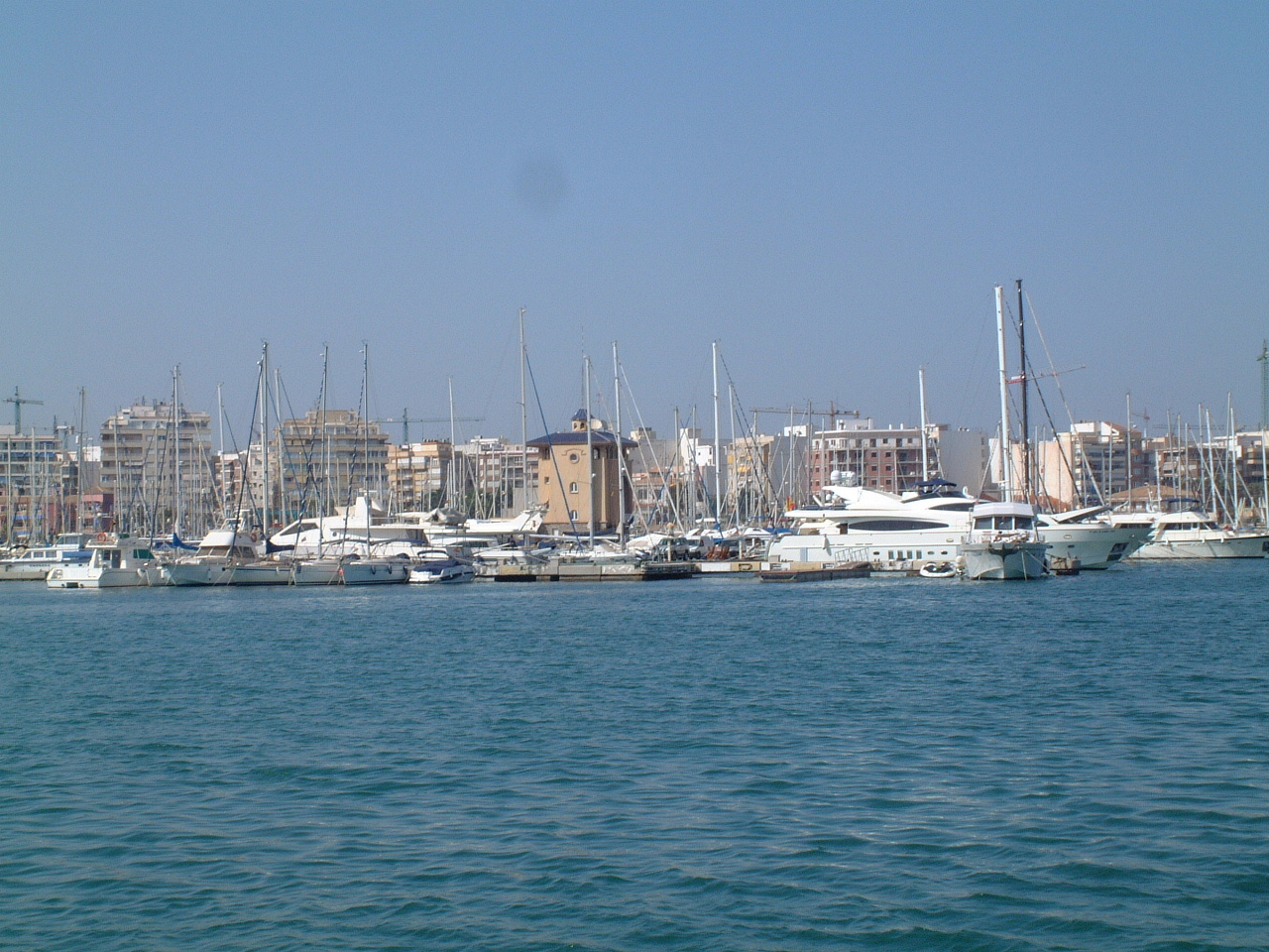 This
is the public marina at Torrevieja. This
is the public marina at Torrevieja. |
 Another
marina is under construction and from the looks of it will be completed by
next year (2007). Another
marina is under construction and from the looks of it will be completed by
next year (2007). |
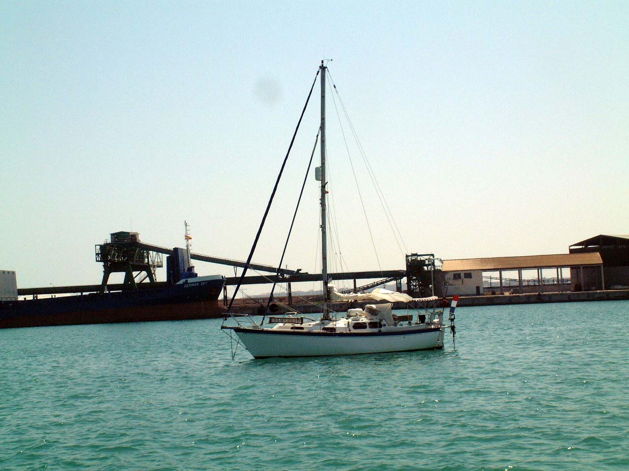 This
is Spindrift a yacht out of Holland. Tom and Joke (yo-ka) and I have been
sharing anchorages since we both left Almerimar. We are both headed for the
Balearics so it looks like we will be sailing in tandem for awhile. This
is Spindrift a yacht out of Holland. Tom and Joke (yo-ka) and I have been
sharing anchorages since we both left Almerimar. We are both headed for the
Balearics so it looks like we will be sailing in tandem for awhile. |
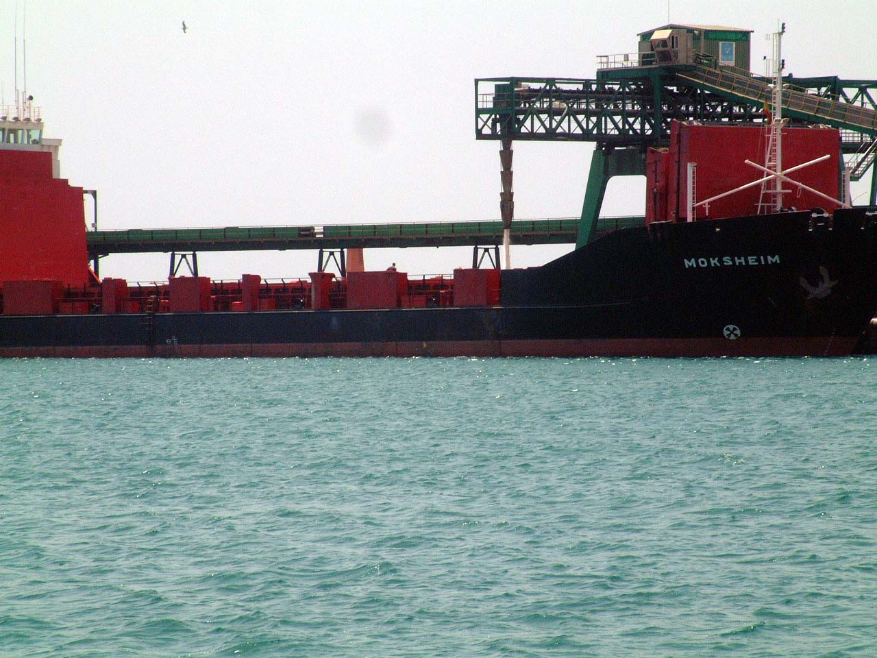
 One
of the reasons the harbor at Torrevieja is so large is because of the salt
dock. Torrevieja is called the salt cellar of the world. The salt is
loaded onto cargo ships from this dock. At the time this picture was taken
there were two German cargo ships in port. The one on the right is being
filled. One
of the reasons the harbor at Torrevieja is so large is because of the salt
dock. Torrevieja is called the salt cellar of the world. The salt is
loaded onto cargo ships from this dock. At the time this picture was taken
there were two German cargo ships in port. The one on the right is being
filled.If you click on the picture to view at full resolution you can make out two large mounds of salt behind the ships. |
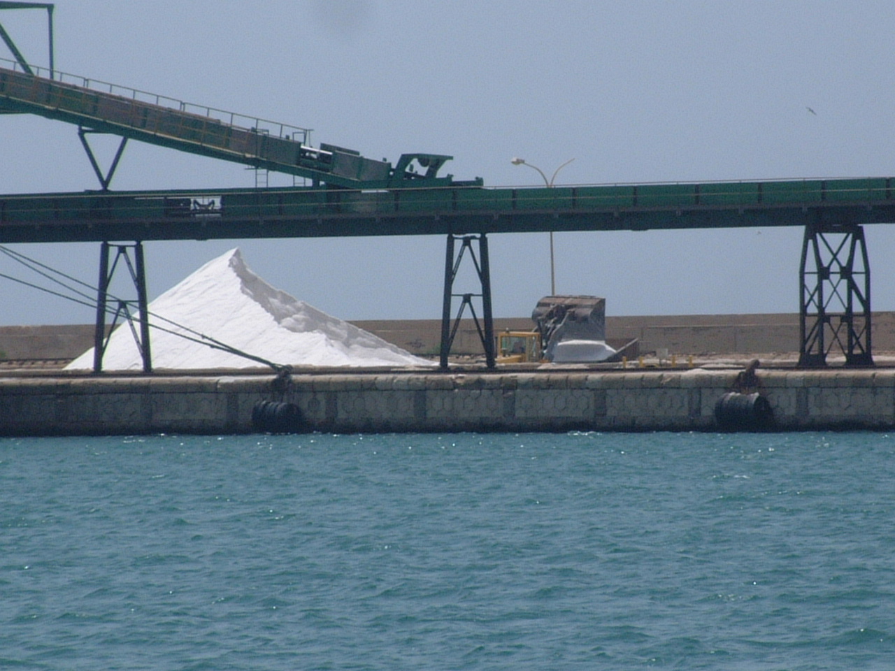 A
day later one of the mounds and one of the ships is gone. In the picture on
the right is the remains of the second as the loading of the second ship
continues. A truck scoops up a large chunk of the mound and drops it into a
hopper from which the salt is carried via conveyor to the ship. A
day later one of the mounds and one of the ships is gone. In the picture on
the right is the remains of the second as the loading of the second ship
continues. A truck scoops up a large chunk of the mound and drops it into a
hopper from which the salt is carried via conveyor to the ship. |
 In
this picture the salt is poring into the hold on the ship. In
this picture the salt is poring into the hold on the ship. |
| Altea, June 24 - 29, 2006 |
 I
departed Torrevieja after one night thinking I might get to near Calpe,
about 55 nm. The wind, which had been calm the day before was now blowing
about 10-15 kts out of the NE. When I departed the harbor I encountered a
very steep chop of about 3' with occasional waves to around 4'. With the
wind right on my nose, this made for a very slow and uncomfortable motor
trip. Thinking I might cut the trip short at Alicante, I called the marina,
but was informed they had no room for that night. So faced with many hours
of motoring in a pitching boat I decided to turn around and return to
Torrevieja for one more night. I
departed Torrevieja after one night thinking I might get to near Calpe,
about 55 nm. The wind, which had been calm the day before was now blowing
about 10-15 kts out of the NE. When I departed the harbor I encountered a
very steep chop of about 3' with occasional waves to around 4'. With the
wind right on my nose, this made for a very slow and uncomfortable motor
trip. Thinking I might cut the trip short at Alicante, I called the marina,
but was informed they had no room for that night. So faced with many hours
of motoring in a pitching boat I decided to turn around and return to
Torrevieja for one more night.
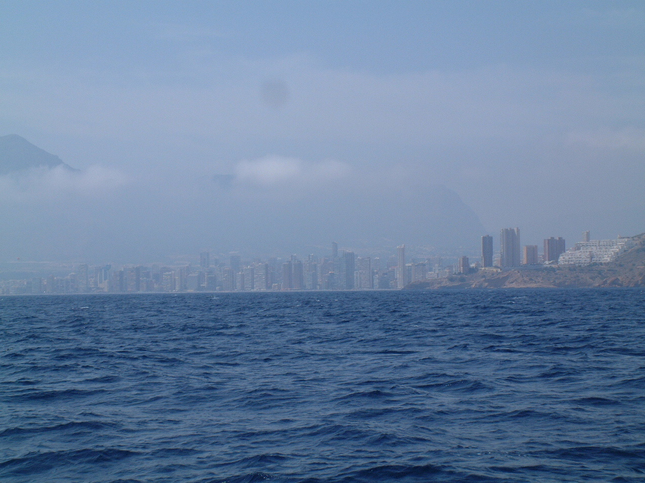
The next day the winds were calm and the seas were down. It was another motor trip, but at least it was comfortable. I decided to stop at the Puerto de Altea, about 10 nm west of Calpe. On the way I passed the amazing resort town of Benidorm. How do they find enough tourist to fill all these places? |
 Just
west of Altea is the Sierra Helada and the Punta del Albir. Just
west of Altea is the Sierra Helada and the Punta del Albir. |
 This
is the lighthouse on the Punta del Albir. The town of Altea can be seen in
the background. This
is the lighthouse on the Punta del Albir. The town of Altea can be seen in
the background. |
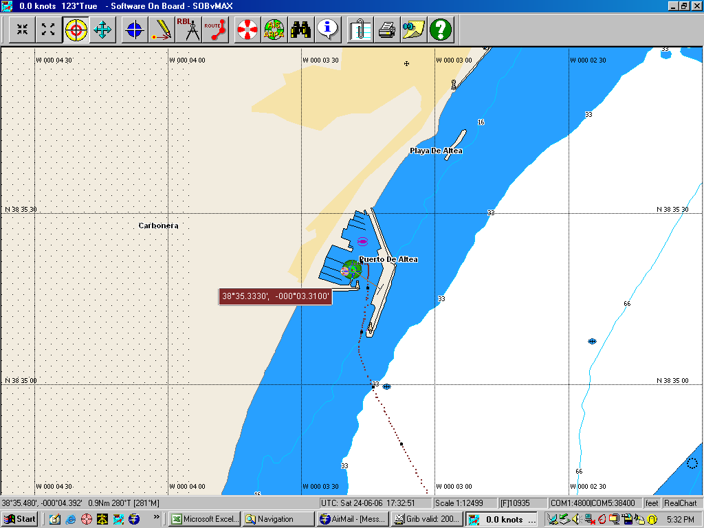 I
took a berth at the Club Nautico de Altea as shown in the SOB screen capture
on the left. I had planned to stay one night then push on around the Punta
de Ifach (Calpe) to get closer to Ibiza for my crossing that island. My
back had been bothering me since before Almerimar and I decided I needed to
rest it for a few days and checked into Altea for 3 nights. Then I decided
to stay two more nights. My plan was to depart Altea and sail directly to
Ibiza. I
took a berth at the Club Nautico de Altea as shown in the SOB screen capture
on the left. I had planned to stay one night then push on around the Punta
de Ifach (Calpe) to get closer to Ibiza for my crossing that island. My
back had been bothering me since before Almerimar and I decided I needed to
rest it for a few days and checked into Altea for 3 nights. Then I decided
to stay two more nights. My plan was to depart Altea and sail directly to
Ibiza. |
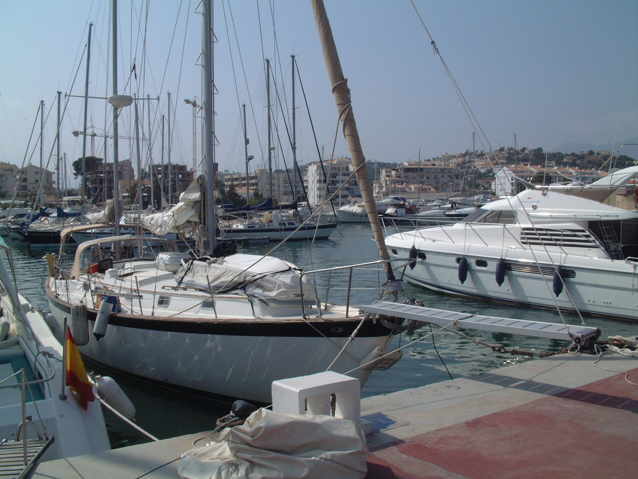 Sarah,
berthed at the Club Nautico de Altea. Sarah,
berthed at the Club Nautico de Altea. |
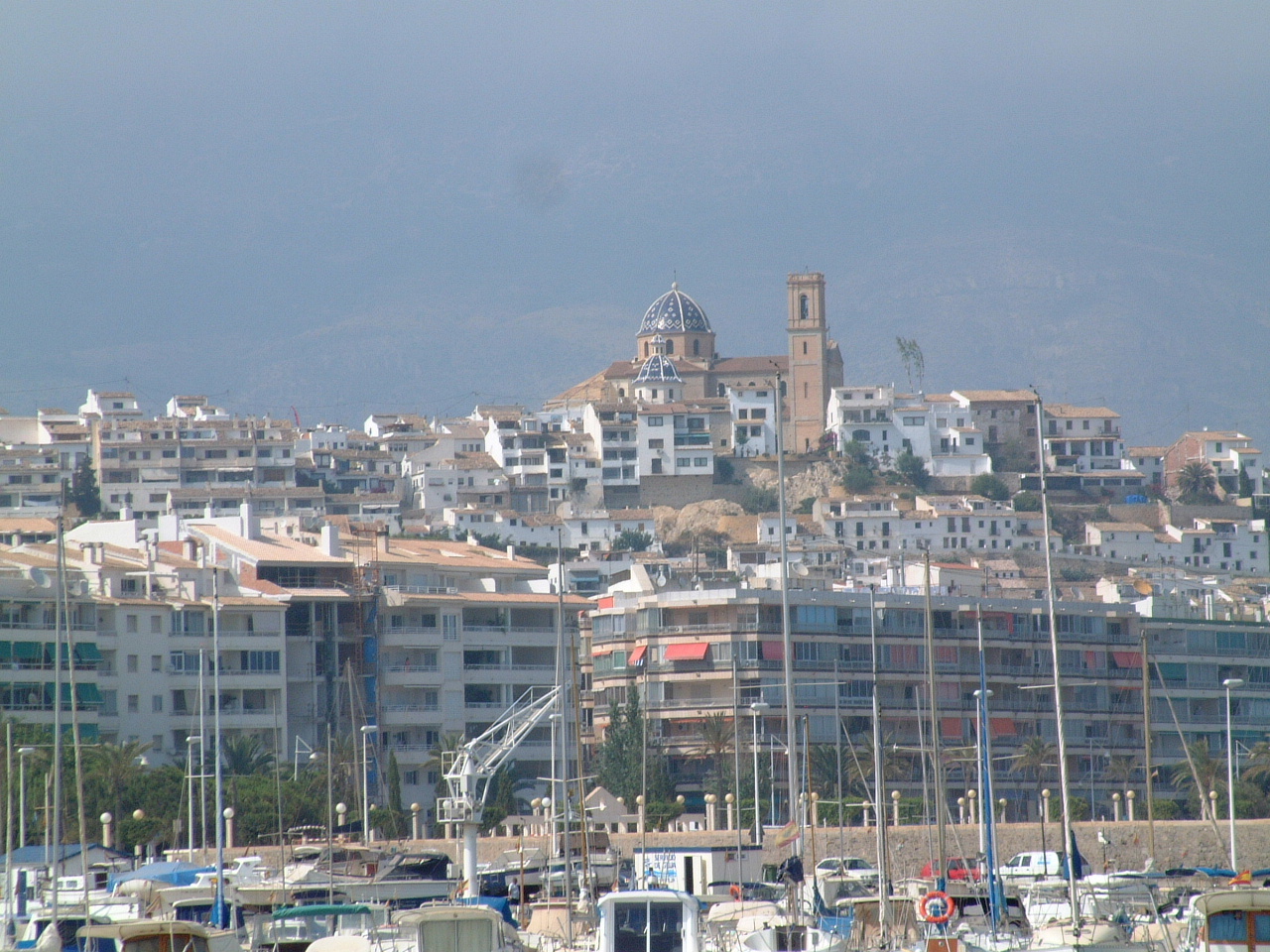 The
cathedral at Altea sits on top of a hill overlooking the town. The blue
dome seems to owe more to the Moorish heritage of this area than the Spanish
catholic heritage. The
cathedral at Altea sits on top of a hill overlooking the town. The blue
dome seems to owe more to the Moorish heritage of this area than the Spanish
catholic heritage. |
| After 5 days in Altea my back felt fine and I departed on an overnight sail to Ibiza. |